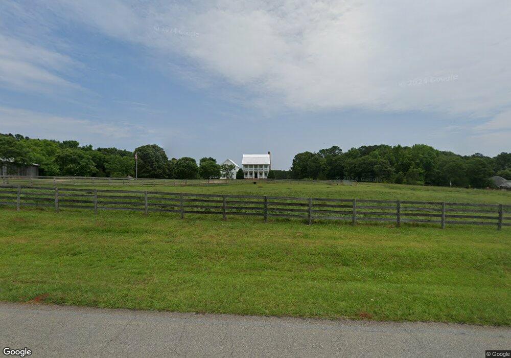
2682 Maynards Mill Rd Forsyth, GA 31029
Estimated Value: $358,000 - $471,308
3
Beds
4
Baths
3,167
Sq Ft
$133/Sq Ft
Est. Value
About This Home
This home is located at 2682 Maynards Mill Rd, Forsyth, GA 31029 and is currently estimated at $422,769, approximately $133 per square foot. 2682 Maynards Mill Rd is a home located in Monroe County with nearby schools including Samuel E. Hubbard Elementary School and Mary Persons High School.
Ownership History
Date
Name
Owned For
Owner Type
Purchase Details
Closed on
May 25, 2012
Sold by
Mason Thomas Gresham
Bought by
Munna Rana K and Egloff Joseph R
Current Estimated Value
Home Financials for this Owner
Home Financials are based on the most recent Mortgage that was taken out on this home.
Original Mortgage
$177,750
Outstanding Balance
$122,160
Interest Rate
3.88%
Mortgage Type
New Conventional
Estimated Equity
$300,609
Purchase Details
Closed on
Apr 22, 2009
Sold by
Mason Thomas Gresham
Bought by
Munna Rana K
Purchase Details
Closed on
Nov 17, 1998
Sold by
Thompson D C
Bought by
Mason Thomas Gresham
Purchase Details
Closed on
Jun 21, 1993
Sold by
Thompson D C
Bought by
Mason Thomas Gresham
Create a Home Valuation Report for This Property
The Home Valuation Report is an in-depth analysis detailing your home's value as well as a comparison with similar homes in the area
Purchase History
| Date | Buyer | Sale Price | Title Company |
|---|---|---|---|
| Munna Rana K | $197,500 | -- | |
| Munna Rana K | $140,619 | -- | |
| Mason Thomas G | -- | -- | |
| Mason Thomas Gresham | -- | -- | |
| Mason Thomas Gresham | -- | -- | |
| Mason Thomas Gresham | $59,100 | -- |
Source: Public Records
Mortgage History
| Date | Status | Borrower | Loan Amount |
|---|---|---|---|
| Open | Munna Rana K | $177,750 |
Source: Public Records
Tax History
| Year | Tax Paid | Tax Assessment Tax Assessment Total Assessment is a certain percentage of the fair market value that is determined by local assessors to be the total taxable value of land and additions on the property. | Land | Improvement |
|---|---|---|---|---|
| 2025 | $3,100 | $110,120 | $19,280 | $90,840 |
| 2024 | $3,100 | $110,120 | $19,280 | $90,840 |
| 2023 | $2,975 | $95,640 | $19,280 | $76,360 |
| 2022 | $2,589 | $95,640 | $19,280 | $76,360 |
| 2021 | $2,681 | $95,640 | $19,280 | $76,360 |
| 2020 | $2,748 | $95,640 | $19,280 | $76,360 |
| 2019 | $2,770 | $95,640 | $19,280 | $76,360 |
| 2018 | $2,778 | $95,640 | $19,280 | $76,360 |
| 2017 | $2,780 | $95,640 | $19,280 | $76,360 |
| 2016 | $2,643 | $95,640 | $19,280 | $76,360 |
| 2015 | $2,506 | $95,640 | $19,280 | $76,360 |
| 2014 | $2,417 | $95,640 | $19,280 | $76,360 |
Source: Public Records
Map
Nearby Homes
- 158 Charles Johnson Rd
- LOT 14-A-1 Creekside Ln
- Lot 15-A-2 Creekside Ln
- LOT 13 Creekside Ln
- 0 Old Zebulon Rd Unit 26510556
- 0 Old Zebulon Rd Unit 10697483
- Lot 15-A-1 Creekside Ln
- 14 Creekside Ct
- 14 Creekside Ct
- 4866 Hwy 42 S
- Lot 26-A-2 Creekside Trail
- 3319 Highway 42 S
- Lot 27-A-1 Creekside Trail
- 271 Presidents Way
- 0 Montpelier Springs Rd Unit 13 M162038
- 0 Montpelier Springs Rd Unit 10 M162036
- 4866 Georgia 42
- 119 Bagley Rd
- 0 Abercrombie Rd Unit 10713105
- 251 Russellville Rd
- 3284 Maynards Mill Rd
- 1079 Maynards Mill Rd
- 1079 Maynards Mill Rd Unit Parcel 1
- 828 Maynards Mill Rd
- - Maynards Mill Rd
- 2700 Maynards Mill Rd
- 2772 Maynards Mill Rd
- 2569 Maynards Mill Rd
- 2820 Maynards Mill Rd
- 2703 Maynards Mill Rd
- 0 Rogers Church Rd Unit LOT 1 7019624
- 0 Rogers Church Rd Unit 1 7286649
- 0 Rogers Church Rd Unit 10487552
- 0 Rogers Church Rd Unit 4/5 7555175
- 0 Rogers Church Rd Unit 8926840
- 1321 Charles Johnson Rd
- 1205 Charles Johnson Rd
- 1309 Charles Johnson Rd Unit 1
- 1309 Charles Johnson Rd
- 2962 Maynards Mill Rd
Your Personal Tour Guide
Ask me questions while you tour the home.