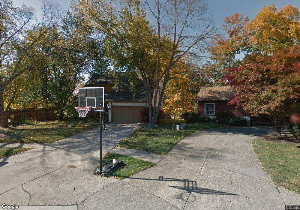
2682 Shady Ridge Dr Columbus, OH 43231
Northern Woods NeighborhoodEstimated Value: $378,860 - $428,000
4
Beds
3
Baths
1,610
Sq Ft
$256/Sq Ft
Est. Value
About This Home
This home is located at 2682 Shady Ridge Dr, Columbus, OH 43231 and is currently estimated at $412,465, approximately $256 per square foot. 2682 Shady Ridge Dr is a home located in Franklin County with nearby schools including Cherrington Elementary School, Genoa Middle School, and Westerville South High School.
Ownership History
Date
Name
Owned For
Owner Type
Purchase Details
Closed on
Dec 5, 2003
Sold by
Zumstein James E and Zumstein Tammy K
Bought by
Zumstein James E and Zumstein Tammy K
Current Estimated Value
Purchase Details
Closed on
Jun 27, 2002
Sold by
Peirano Craig A
Bought by
Benton Shannon K and Benton Clayton H
Purchase Details
Closed on
Nov 20, 1991
Bought by
Peirano Craig A
Create a Home Valuation Report for This Property
The Home Valuation Report is an in-depth analysis detailing your home's value as well as a comparison with similar homes in the area
Home Values in the Area
Average Home Value in this Area
Purchase History
| Date | Buyer | Sale Price | Title Company |
|---|---|---|---|
| Zumstein James E | -- | -- | |
| Benton Shannon K | $182,000 | -- | |
| Peirano Craig A | -- | -- |
Source: Public Records
Tax History Compared to Growth
Tax History
| Year | Tax Paid | Tax Assessment Tax Assessment Total Assessment is a certain percentage of the fair market value that is determined by local assessors to be the total taxable value of land and additions on the property. | Land | Improvement |
|---|---|---|---|---|
| 2024 | $5,601 | $112,390 | $32,200 | $80,190 |
| 2023 | $5,466 | $112,385 | $32,200 | $80,185 |
| 2022 | $5,133 | $80,570 | $15,330 | $65,240 |
| 2021 | $5,129 | $79,730 | $15,330 | $64,400 |
| 2020 | $5,254 | $81,940 | $15,330 | $66,610 |
| 2019 | $4,403 | $65,520 | $12,250 | $53,270 |
| 2018 | $4,304 | $65,520 | $12,250 | $53,270 |
| 2017 | $4,316 | $65,520 | $12,250 | $53,270 |
| 2016 | $4,324 | $59,890 | $12,810 | $47,080 |
| 2015 | $4,334 | $59,890 | $12,810 | $47,080 |
| 2014 | $4,337 | $59,890 | $12,810 | $47,080 |
| 2013 | $4,548 | $63,035 | $13,475 | $49,560 |
Source: Public Records
Map
Nearby Homes
- 465 W Schrock Rd
- 2659 Christine Blvd Unit D
- 0 Cooper Rd
- 2713 Woodland Village Dr Unit 6
- 2525 Oakstone Dr
- 6658 Walbridge St
- 2110 Nobleshire Rd
- 2817 Bella Via Ave
- 6760 Maple Canyon Ave
- 2120 Willowick Dr Unit B
- 2095 Willowick Dr Unit C
- 206 Charring Cross Dr S Unit 2206
- 1985 Willow Glen Ln Unit B
- 502 Foxtrail Cir E Unit 502
- 6125 Pelican Pointe Unit 304
- 2623 Blendon Woods Blvd
- 2292 Laurelwood Dr Unit 2292L
- 2197 Bayfield Dr
- 1923 Noble Run Way Unit 42
- 3048 Highcliff Ct
- 2690 Shady Ridge Dr
- 2698 Shady Ridge Dr
- 2695 Cooper Ridge Rd
- 2706 Shady Ridge Dr
- 2703 Cooper Ridge Rd
- 2710 Cooper Ridge Rd
- 2714 Shady Ridge Dr
- 2709 Shady Ridge Dr
- 2711 Cooper Ridge Rd
- 2718 Cooper Ridge Rd
- 2722 Shady Ridge Dr
- 2717 Shady Ridge Dr
- 2726 Cooper Ridge Rd
- 6651 Dunraven Ct
- 2719 Cooper Ridge Rd
- 2725 Shady Ridge Dr
- 2730 Shady Ridge Dr
- 2704 Lauffer Ravines Dr
- 2704 Lauffer Ravines Dr
- 6658 Dunraven Ct