Estimated Value: $141,000 - $478,000
4
Beds
2
Baths
2,704
Sq Ft
$108/Sq Ft
Est. Value
About This Home
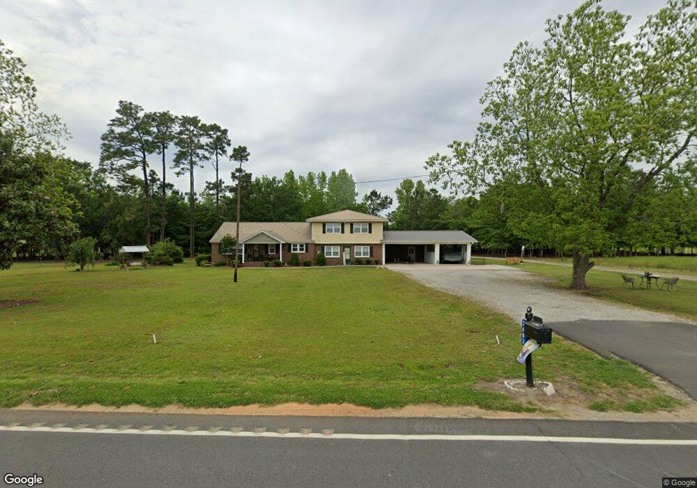
This home is located at 2683 Garner Rd, Aynor, SC 29511 and is currently estimated at $293,029, approximately $108 per square foot. 2683 Garner Rd is a home with nearby schools including Midland Elementary School, Aynor Middle School, and Aynor High School.
Ownership History
Date
Name
Owned For
Owner Type
Purchase Details
Closed on
Nov 6, 2015
Sold by
Bell Robert P
Bought by
Davis Kenneth A and Davis Laura J
Current Estimated Value
Home Financials for this Owner
Home Financials are based on the most recent Mortgage that was taken out on this home.
Original Mortgage
$150,000
Outstanding Balance
$116,303
Interest Rate
3.78%
Estimated Equity
$176,726
Purchase Details
Closed on
Apr 5, 2002
Sold by
Bell Robert P
Bought by
Bell Robert P and Bell Irene B
Create a Home Valuation Report for This Property
The Home Valuation Report is an in-depth analysis detailing your home's value as well as a comparison with similar homes in the area
Home Values in the Area
Average Home Value in this Area
Purchase History
| Date | Buyer | Sale Price | Title Company |
|---|---|---|---|
| Davis Kenneth A | $73,000 | -- | |
| Bell Robert P | -- | -- |
Source: Public Records
Mortgage History
| Date | Status | Borrower | Loan Amount |
|---|---|---|---|
| Open | Davis Kenneth A | $150,000 | |
| Closed | Davis Kenneth A | $150,000 |
Source: Public Records
Tax History
| Year | Tax Paid | Tax Assessment Tax Assessment Total Assessment is a certain percentage of the fair market value that is determined by local assessors to be the total taxable value of land and additions on the property. | Land | Improvement |
|---|---|---|---|---|
| 2025 | $434 | $0 | $0 | $0 |
| 2024 | $434 | $6,178 | $2,400 | $3,778 |
| 2023 | $434 | $3,258 | $613 | $2,645 |
| 2021 | $398 | $4,684 | $800 | $3,884 |
| 2020 | $328 | $4,684 | $800 | $3,884 |
| 2019 | $328 | $4,684 | $800 | $3,884 |
| 2018 | $0 | $2,833 | $533 | $2,300 |
| 2017 | $283 | $2,833 | $533 | $2,300 |
| 2016 | $0 | $2,833 | $533 | $2,300 |
| 2015 | -- | $3,962 | $534 | $3,428 |
| 2014 | $191 | $3,962 | $534 | $3,428 |
Source: Public Records
Map
Nearby Homes
- TBD W Highway 501
- 129 Covey Rise Dr
- 121 Covey Rise Dr
- 109 Covey Rise Dr
- 113 Covey Rise Dr
- 501 Silver Pidgeon St
- 500 Silver Pidgeon St
- 505 Silver Pidgeon St
- 508 Silver Pidgeon St
- 404 Citori Dr
- 513 Silver Pidgeon St
- 512 Silver Pidgeon St
- 517 Silver Pidgeon St
- 539 Silver Pidgeon St
- 349 Sporting Dr
- 547 Silver Pidgeon St
- 551 Silver Pidgeon St
- 346 Sporting Dr
- 534 Silver Pidgeon St
- 342 Sporting Dr
- 2682 Garner Rd
- 2736 Garner Rd
- 2738 Garner Rd
- 2640 Garner Rd
- 2698 Valley Forge Rd
- 2780 Valley Forge Rd
- 3013 Glenn Rd
- 2676 Valley Forge Rd
- 2793 Valley Forge Rd
- 3225 Albert Gasque Rd
- Lot 3B Valley Forge Rd
- Lot B Valley Forge Rd
- Lot A Valley Forge Rd
- 2613 Valley Forge Rd
- 2592 Valley Forge Rd
- 6005 Double r Cir
- 3281 Albert Gasque Rd
- 2963 Garner Rd
- 3350 Albert Gasque Rd
- 5993 Double r Cir
Your Personal Tour Guide
Ask me questions while you tour the home.