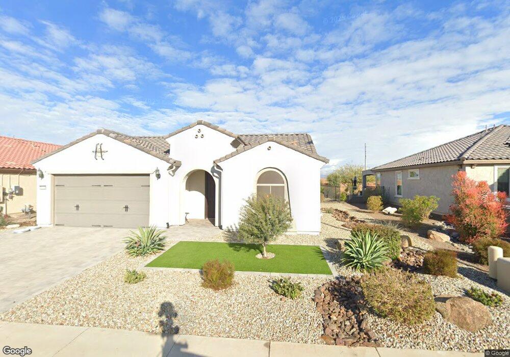
26834 W Firehawk Dr Buckeye, AZ 85396
Sun City Festival NeighborhoodEstimated Value: $446,245 - $495,000
--
Bed
--
Bath
1,909
Sq Ft
$250/Sq Ft
Est. Value
About This Home
This home is located at 26834 W Firehawk Dr, Buckeye, AZ 85396 and is currently estimated at $476,561, approximately $249 per square foot. 26834 W Firehawk Dr is a home with nearby schools including Festival Foothills Elementary School and Wickenburg High School.
Ownership History
Date
Name
Owned For
Owner Type
Purchase Details
Closed on
Aug 10, 2022
Sold by
Loch Franklin R and Loch Kathleen
Bought by
Loch Franklin R and Loch Kathleen
Current Estimated Value
Purchase Details
Closed on
Jan 29, 2021
Sold by
Pulte Home Company Llc
Bought by
Loch Franklin R and Loch Kathleen
Home Financials for this Owner
Home Financials are based on the most recent Mortgage that was taken out on this home.
Original Mortgage
$260,020
Interest Rate
2.67%
Mortgage Type
Purchase Money Mortgage
Create a Home Valuation Report for This Property
The Home Valuation Report is an in-depth analysis detailing your home's value as well as a comparison with similar homes in the area
Home Values in the Area
Average Home Value in this Area
Purchase History
| Date | Buyer | Sale Price | Title Company |
|---|---|---|---|
| Loch Franklin R | -- | None Listed On Document | |
| Loch Franklin R | $371,458 | Pgp Title Inc |
Source: Public Records
Mortgage History
| Date | Status | Borrower | Loan Amount |
|---|---|---|---|
| Previous Owner | Loch Franklin R | $260,020 |
Source: Public Records
Tax History Compared to Growth
Tax History
| Year | Tax Paid | Tax Assessment Tax Assessment Total Assessment is a certain percentage of the fair market value that is determined by local assessors to be the total taxable value of land and additions on the property. | Land | Improvement |
|---|---|---|---|---|
| 2025 | $2,522 | $21,939 | -- | -- |
| 2024 | $2,316 | $20,894 | -- | -- |
| 2023 | $2,316 | $36,220 | $7,240 | $28,980 |
| 2022 | $2,247 | $27,870 | $5,570 | $22,300 |
| 2021 | $840 | $10,815 | $10,815 | $0 |
| 2020 | $821 | $8,385 | $8,385 | $0 |
| 2019 | $848 | $6,900 | $6,900 | $0 |
| 2017 | $231 | $168 | $168 | $0 |
Source: Public Records
Map
Nearby Homes
- 26810 W Melinda Ln
- 26971 W Adam Ave
- 27057 W Melinda Ln
- 21290 N 270th Ave
- 21298 N 270th Dr
- 26667 W Covey Ln
- 26616 W Quail Ave
- 26647 W Covey Ln
- 26638 W Zachary Dr
- 21293 N 266th Ave
- 21370 N 271st Dr
- 26568 W Cat Balue Dr
- 26563 W Cat Balue Dr
- 21277 N 272nd Ave
- 21278 N 272nd Ave
- 26534 W Abraham Ln
- 21279 N 272nd Dr
- 21307 N 265th Dr
- 21288 N 272nd Dr
- 20642 N 268th Dr
- 26840 W Firehawk Dr
- 26828 W Firehawk Dr
- 26820 W Firehawk Dr
- 26837 W Firehawk Dr
- 26823 W Firehawk Dr
- 26819 W Firehawk Dr
- 21642 N 268th Dr
- 26808 W Firehawk Dr
- 26811 W Firehawk Dr
- 21628 N 268th Dr
- 26846 W Melinda Ln
- 26842 W Melinda Ln
- 26832 W Melinda Ln
- 26826 W Melinda Ln
- 26802 W Firehawk Dr
- 21614 N 268th Dr
- 26795 W Firehawk Dr
- 21583 N 269th Ave
- 26794 W Firehawk Dr
- 21600 N 268th Dr