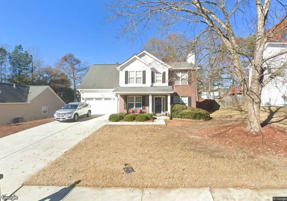
2685 Fort Apachee Trail Dacula, GA 30019
Estimated Value: $362,000 - $389,000
4
Beds
3
Baths
2,056
Sq Ft
$183/Sq Ft
Est. Value
About This Home
This home is located at 2685 Fort Apachee Trail, Dacula, GA 30019 and is currently estimated at $376,020, approximately $182 per square foot. 2685 Fort Apachee Trail is a home located in Gwinnett County with nearby schools including Fort Daniel Elementary School, Frank N. Osborne Middle School, and Mill Creek High School.
Ownership History
Date
Name
Owned For
Owner Type
Purchase Details
Closed on
Sep 23, 1999
Sold by
Wendwell Constr Inc
Bought by
Burton Alanagh A and Burton Randy
Current Estimated Value
Home Financials for this Owner
Home Financials are based on the most recent Mortgage that was taken out on this home.
Original Mortgage
$119,780
Outstanding Balance
$35,067
Interest Rate
7.89%
Mortgage Type
FHA
Estimated Equity
$340,954
Create a Home Valuation Report for This Property
The Home Valuation Report is an in-depth analysis detailing your home's value as well as a comparison with similar homes in the area
Home Values in the Area
Average Home Value in this Area
Purchase History
| Date | Buyer | Sale Price | Title Company |
|---|---|---|---|
| Burton Alanagh A | $120,200 | -- |
Source: Public Records
Mortgage History
| Date | Status | Borrower | Loan Amount |
|---|---|---|---|
| Open | Burton Alanagh A | $119,780 |
Source: Public Records
Tax History
| Year | Tax Paid | Tax Assessment Tax Assessment Total Assessment is a certain percentage of the fair market value that is determined by local assessors to be the total taxable value of land and additions on the property. | Land | Improvement |
|---|---|---|---|---|
| 2025 | $889 | $158,520 | $36,080 | $122,440 |
| 2024 | $3,845 | $147,880 | $29,600 | $118,280 |
| 2023 | $3,845 | $140,800 | $29,600 | $111,200 |
| 2022 | $3,454 | $127,120 | $24,800 | $102,320 |
| 2021 | $2,898 | $98,080 | $18,640 | $79,440 |
| 2020 | $2,635 | $84,880 | $17,120 | $67,760 |
| 2019 | $2,575 | $84,880 | $17,120 | $67,760 |
| 2018 | $2,171 | $66,230 | $13,260 | $52,970 |
| 2016 | $2,259 | $69,160 | $12,400 | $56,760 |
| 2015 | $2,054 | $59,080 | $10,400 | $48,680 |
| 2014 | -- | $56,360 | $10,400 | $45,960 |
Source: Public Records
Map
Nearby Homes
- 2461 Lance Ridge Way
- 2159 Shin Ct
- 2752 Scouts Ct
- 2170 Peachford Ln
- 0 Hog Mountain Church Road and Auburn Rd
- 2305 Braselton Hwy
- 2152 Paces Vale Place
- 2507 Weycroft Cir Unit 4
- 2674 Rocky Knoll Ct
- 1573 Vinings Ct
- 2687 High Creek Run
- 1521 Rocky Knoll Ln
- 2747 High Creek Run
- 2375 Matlin Way
- 1692 Paces Vale Ct
- 2228 Lakeview Bend Way
- 1909 Lakeview Bend Way
- 1965 Holland Park Dr NE
- 1418 Wilkes Ive Dr
- 2085 Kings Valley Dr
- 2675 Fort Apachee Trail
- 2695 Fort Apachee Trail Unit 4
- 2247 Pierce Way
- 2237 Pierce Way
- 2665 Fort Apachee Trail
- 2705 Fort Apachee Trail
- 2257 Pierce Way
- 2680 Fort Apachee Trail
- 2690 Fort Apachee Trail Unit 66
- 2690 Fort Apachee Trail
- 2227 Pierce Way
- 2670 Fort Apachee Trail
- 2700 Fort Apachee Trail
- 2267 Pierce Way Unit 2
- 2715 Fort Apachee Trail Unit 4
- 2217 Pierce Way Unit 1
- 2660 Fort Apachee Trail
- 2710 Fort Apachee Trail
- 2710 Fort Apachee Trail Unit 4
- 2277 Pierce Way NE
Your Personal Tour Guide
Ask me questions while you tour the home.