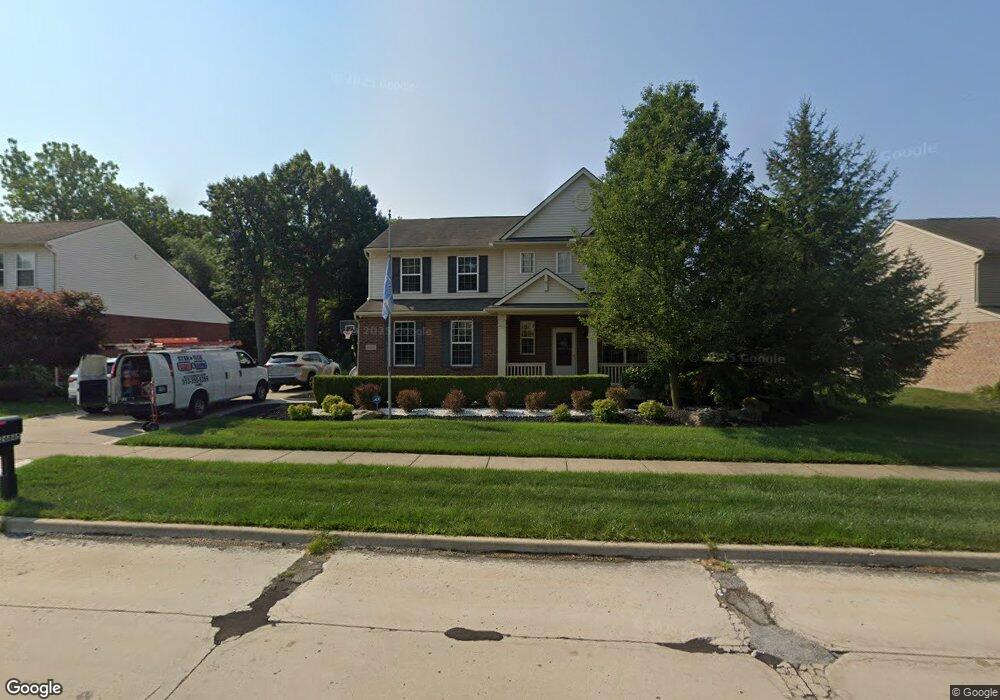
26865 Parkside Dr Unit 100 Taylor, MI 48180
Estimated Value: $340,000 - $392,000
4
Beds
3
Baths
2,089
Sq Ft
$172/Sq Ft
Est. Value
About This Home
This home is located at 26865 Parkside Dr Unit 100, Taylor, MI 48180 and is currently estimated at $359,452, approximately $172 per square foot. 26865 Parkside Dr Unit 100 is a home located in Wayne County with nearby schools including Holland Elementary School, Hoover Middle School, and Taylor High School.
Ownership History
Date
Name
Owned For
Owner Type
Purchase Details
Closed on
Jan 8, 2021
Sold by
Soofi Mohamed
Bought by
Soofi Mohamed and Soofi Ekram
Current Estimated Value
Purchase Details
Closed on
Jan 21, 2010
Sold by
Randazzo Catherine
Bought by
Soofi Mohamed F
Purchase Details
Closed on
Sep 5, 2008
Sold by
Centex Homes
Bought by
Randazzo Catherine
Purchase Details
Closed on
Aug 29, 2008
Sold by
Selective Delaware Llc
Bought by
Centex Homes
Create a Home Valuation Report for This Property
The Home Valuation Report is an in-depth analysis detailing your home's value as well as a comparison with similar homes in the area
Home Values in the Area
Average Home Value in this Area
Purchase History
| Date | Buyer | Sale Price | Title Company |
|---|---|---|---|
| Soofi Mohamed | -- | None Available | |
| Soofi Mohamed F | $189,000 | Visionary Title Agency Llc | |
| Randazzo Catherine | -- | Commerce Title | |
| Centex Homes | -- | Commerce Title |
Source: Public Records
Tax History Compared to Growth
Tax History
| Year | Tax Paid | Tax Assessment Tax Assessment Total Assessment is a certain percentage of the fair market value that is determined by local assessors to be the total taxable value of land and additions on the property. | Land | Improvement |
|---|---|---|---|---|
| 2025 | $3,874 | $162,700 | $0 | $0 |
| 2024 | $3,874 | $161,800 | $0 | $0 |
| 2023 | $4,667 | $152,700 | $0 | $0 |
| 2022 | $3,697 | $131,600 | $0 | $0 |
| 2021 | $4,241 | $122,600 | $0 | $0 |
| 2020 | $4,201 | $109,200 | $0 | $0 |
| 2019 | $452,774 | $91,000 | $0 | $0 |
| 2018 | $3,175 | $117,800 | $0 | $0 |
| 2017 | $1,833 | $100,100 | $0 | $0 |
| 2016 | $3,985 | $97,400 | $0 | $0 |
| 2015 | $7,173 | $82,500 | $0 | $0 |
| 2013 | $7,140 | $74,700 | $0 | $0 |
| 2012 | $3,160 | $72,100 | $16,000 | $56,100 |
Source: Public Records
Map
Nearby Homes
- 11190 Inkster Rd
- 11098 Partridge Dr Unit 12
- 11098 Partridge Dr
- Bayberry Plan at Cypress Garden
- Bannister Plan at Cypress Garden
- Cypress Plan at Cypress Garden
- Evanston IV Plan at Cypress Garden
- Cedar III Plan at Cypress Garden
- Aspen Plan at Cypress Garden
- Evanston III Plan at Cypress Garden
- Cedar IV Plan at Cypress Garden
- 11737 Partridge Dr Unit 70
- 11825 Partridge Dr Unit 74
- 11847 Partridge Dr Unit 75
- 11715 Partridge Dr Unit 69
- 11693 Partridge Dr Unit 38
- 11693 Partridge Dr
- 12000 Inkster Rd
- 25873 Cove Creek Dr Unit 7
- 0 Goddard Unit 20251010304
- 26875 Parkside Dr
- 26855 Parkside Dr Unit 99
- 26860 Parkside Dr
- 26850 Parkside Dr
- 26870 Parkside Dr Unit 1
- 26845 Parkside Dr
- 26840 Parkside Dr
- 26835 Parkside Dr
- 26830 Parkside Dr Unit 5
- 26795 Parkside Dr
- 26800 Parkside Dr
- 26745 Parkside Dr Unit 95
- 26770 Parkside Dr Unit 7
- 72 Golfcrest
- 11152 Golfcrest Dr
- 11194 Golfcrest Dr Unit 93
- 26740 Parkside Dr
- 11031 Golfcrest Dr Unit 33
- 11073 Golfcrest Dr Unit Bldg-Unit
- 11073 Golfcrest Dr