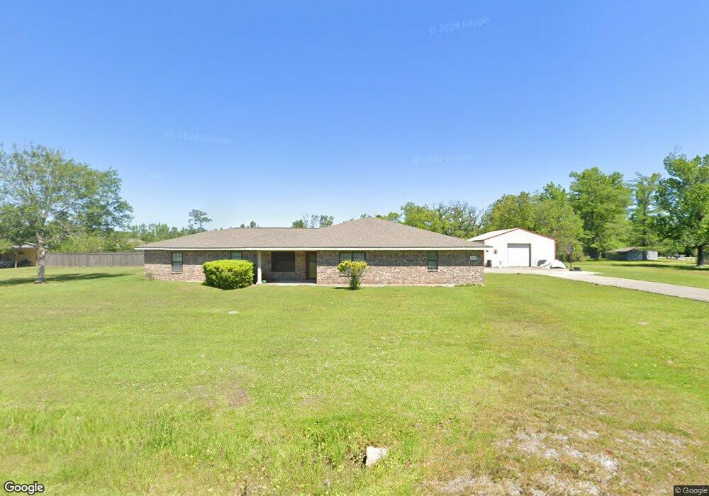
2687 Miller Dr Sulphur, LA 70665
Estimated Value: $224,000 - $327,000
4
Beds
3
Baths
2,682
Sq Ft
$103/Sq Ft
Est. Value
About This Home
This home is located at 2687 Miller Dr, Sulphur, LA 70665 and is currently estimated at $274,978, approximately $102 per square foot. 2687 Miller Dr is a home located in Calcasieu Parish with nearby schools including Vincent Settlement Elementary School, W.W. Lewis Middle School, and Sulphur High School.
Ownership History
Date
Name
Owned For
Owner Type
Purchase Details
Closed on
Jan 11, 2013
Sold by
Bordelon Anthony James and Bordelon Michella Dawn
Bought by
Nabours Keysha Raye
Current Estimated Value
Home Financials for this Owner
Home Financials are based on the most recent Mortgage that was taken out on this home.
Original Mortgage
$193,626
Outstanding Balance
$134,503
Interest Rate
3.35%
Mortgage Type
FHA
Estimated Equity
$140,475
Create a Home Valuation Report for This Property
The Home Valuation Report is an in-depth analysis detailing your home's value as well as a comparison with similar homes in the area
Home Values in the Area
Average Home Value in this Area
Purchase History
| Date | Buyer | Sale Price | Title Company |
|---|---|---|---|
| Nabours Keysha Raye | $197,000 | None Available |
Source: Public Records
Mortgage History
| Date | Status | Borrower | Loan Amount |
|---|---|---|---|
| Open | Nabours Keysha Raye | $193,626 |
Source: Public Records
Tax History Compared to Growth
Tax History
| Year | Tax Paid | Tax Assessment Tax Assessment Total Assessment is a certain percentage of the fair market value that is determined by local assessors to be the total taxable value of land and additions on the property. | Land | Improvement |
|---|---|---|---|---|
| 2024 | $1,335 | $19,390 | $1,780 | $17,610 |
| 2023 | $1,335 | $19,390 | $1,780 | $17,610 |
| 2022 | $1,307 | $19,390 | $1,780 | $17,610 |
| 2021 | $1,329 | $19,390 | $1,780 | $17,610 |
| 2020 | $1,927 | $17,560 | $1,710 | $15,850 |
| 2019 | $2,160 | $19,260 | $1,650 | $17,610 |
| 2018 | $1,336 | $19,260 | $1,650 | $17,610 |
| 2017 | $2,241 | $19,260 | $1,650 | $17,610 |
| 2016 | $2,361 | $19,260 | $1,650 | $17,610 |
| 2015 | $2,361 | $19,260 | $1,650 | $17,610 |
Source: Public Records
Map
Nearby Homes
- 2802 Dosite Broussard Rd
- 2606 Mary Dr
- 2732 Sandra Dr
- 0 La Paix Dr Unit 189210
- 0 La Paix Dr Unit SWL25003189
- 0 Bon Vie Dr Unit SWL25001370
- 0 Bon Vie Dr Unit 189226
- 0 Bon Vie Dr Unit SWL25001371
- 0 Bon Vie Dr Unit SWL25001373
- 0 Bon Vie Dr Unit SWL25001372
- 0 Bon Vie Dr Unit SWL25001374
- 2300 Bonvie Dr
- 2212 Bon Vie Dr
- 0 Bon Ton Dr Unit SWL25001676
- 5221 E Iona Dr
- 0 Madewood St Unit SWL21010711
- 0 Madewood St Unit SWL21010704
- 0 Madewood St Unit SWL21010691
- 0 Myrtle Hill St Unit SWL21010697
- 0 Madewood St Unit SWL21010708
- 2687 Miller Dr
- 2641 Miller Dr
- 2715 Miller Dr
- 0 Miller Dr Unit 76997
- 0 Miller Dr Unit 81001
- 0 Miller Dr Unit 88057
- 0 Miller Dr Unit 86844
- 0 Miller Dr Unit 88068
- 0 Miller Dr Unit 92519
- 0 Miller Dr Unit 103236
- 0 Miller Dr Unit SWL23007603
- 2377 Miller Dr
- 0 Miller Dr
- 2656 Miller Dr
- 2714 Dosite Broussard Rd
- 2714 Miller Dr
- 2621 Miller Dr
- 0 Dosite Broussard Rd
- 2747 Miller Dr
- 2620 Miller Dr