Estimated Value: $315,000 - $427,000
--
Bed
--
Bath
1,736
Sq Ft
$207/Sq Ft
Est. Value
About This Home
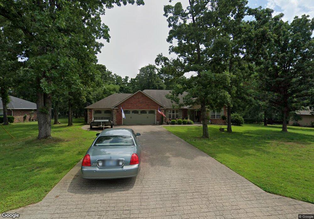
This home is located at 2687 Taylor St, Grove, OK 74344 and is currently estimated at $359,332, approximately $206 per square foot. 2687 Taylor St is a home located in Delaware County with nearby schools including Grove Lower Elementary School, Grove Upper Elementary School, and Grove Middle School.
Ownership History
Date
Name
Owned For
Owner Type
Purchase Details
Closed on
Mar 18, 2022
Sold by
Drake Max C and Drake Peggy A
Bought by
Max C Drake And Peggy A Drake Revocable Trust
Current Estimated Value
Purchase Details
Closed on
May 10, 2007
Sold by
Manning Herb and Manning Lindsey
Bought by
Drake Max C and Drake Peggy A
Home Financials for this Owner
Home Financials are based on the most recent Mortgage that was taken out on this home.
Original Mortgage
$50,000
Interest Rate
6.13%
Mortgage Type
New Conventional
Create a Home Valuation Report for This Property
The Home Valuation Report is an in-depth analysis detailing your home's value as well as a comparison with similar homes in the area
Home Values in the Area
Average Home Value in this Area
Purchase History
| Date | Buyer | Sale Price | Title Company |
|---|---|---|---|
| Max C Drake And Peggy A Drake Revocable Trust | -- | None Listed On Document | |
| Drake Max C | $163,000 | -- |
Source: Public Records
Mortgage History
| Date | Status | Borrower | Loan Amount |
|---|---|---|---|
| Previous Owner | Drake Max C | $50,000 |
Source: Public Records
Tax History Compared to Growth
Tax History
| Year | Tax Paid | Tax Assessment Tax Assessment Total Assessment is a certain percentage of the fair market value that is determined by local assessors to be the total taxable value of land and additions on the property. | Land | Improvement |
|---|---|---|---|---|
| 2025 | $1,726 | $22,988 | $2,105 | $20,883 |
| 2024 | $1,726 | $22,318 | $2,044 | $20,274 |
| 2023 | $1,726 | $21,668 | $2,002 | $19,666 |
| 2022 | $1,673 | $21,668 | $1,994 | $19,674 |
| 2021 | $1,618 | $21,037 | $1,993 | $19,044 |
| 2020 | $1,595 | $20,424 | $2,001 | $18,423 |
| 2019 | $1,552 | $19,252 | $1,970 | $17,282 |
| 2018 | $1,501 | $19,253 | $1,974 | $17,279 |
| 2017 | $1,460 | $18,692 | $1,949 | $16,743 |
| 2016 | $1,414 | $17,619 | $1,898 | $15,721 |
| 2015 | $1,435 | $17,619 | $1,898 | $15,721 |
| 2014 | $1,442 | $17,619 | $1,898 | $15,721 |
Source: Public Records
Map
Nearby Homes
- 2666 Shasten St
- 2243 Lower Waterfall Rd
- 0 Upper Waterfall Dr
- 0 Tbd Melody Point Cir
- 0 E 304 Rd Unit 2518957
- 0 E 304 Rd Unit 25-955
- 1709 Cardiac Cove Rd
- 1029 Village Dr
- 1000 Poplar
- 1407 W 9th St
- 1305 Dubois
- 1515 St Joseph Dr
- 622 Alpine Dr
- 1616 Battle Dr
- 1621 Rockwood Dr
- 29901 S 595 Rd
- 1628 Battle Dr
- 0 Baycrest Ave
- 511 Summit Dr
- 2300 Lookout Ln
- 2685 Taylor St
- 2689 Taylor St
- 2678 Taylor St
- 0 Taylor St
- 2690 Taylor St
- 2691 Taylor St
- 2683 Taylor St
- 2515 Shasten St
- 2688 Taylor St
- 2692 Taylor St
- 2681 Taylor St
- 2605 Shasten St
- 2605 Shasten St
- 2694 Taylor St
- 2684 Taylor St
- 2606 Shasten St
- 2696 Taylor St
- 2695 Taylor St
- 2075 Shasten St
- 2673 Taylor St