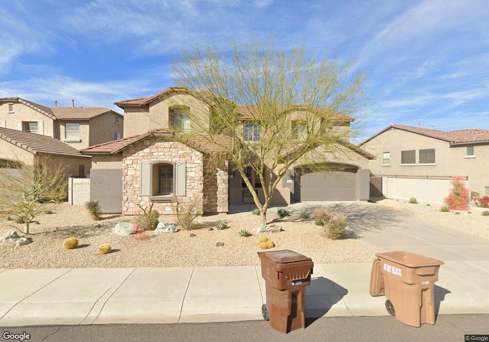
26874 N 87th Dr Peoria, AZ 85383
Estimated Value: $752,991 - $878,000
--
Bed
6
Baths
4,256
Sq Ft
$198/Sq Ft
Est. Value
About This Home
This home is located at 26874 N 87th Dr, Peoria, AZ 85383 and is currently estimated at $840,998, approximately $197 per square foot. 26874 N 87th Dr is a home located in Maricopa County with nearby schools including West Wing Elementary School, Mountain Ridge High School, and BASIS Peoria Primary.
Ownership History
Date
Name
Owned For
Owner Type
Purchase Details
Closed on
Jun 7, 2022
Sold by
Buddy Birmingham
Bought by
Bdb Revocable Living Trust
Current Estimated Value
Purchase Details
Closed on
Aug 10, 2006
Sold by
Pulte Home Corp
Bought by
Birmingham Buddy D
Home Financials for this Owner
Home Financials are based on the most recent Mortgage that was taken out on this home.
Original Mortgage
$493,204
Interest Rate
6.75%
Mortgage Type
New Conventional
Create a Home Valuation Report for This Property
The Home Valuation Report is an in-depth analysis detailing your home's value as well as a comparison with similar homes in the area
Home Values in the Area
Average Home Value in this Area
Purchase History
| Date | Buyer | Sale Price | Title Company |
|---|---|---|---|
| Bdb Revocable Living Trust | -- | None Listed On Document | |
| Birmingham Buddy D | $616,506 | Sun Title Agency Co |
Source: Public Records
Mortgage History
| Date | Status | Borrower | Loan Amount |
|---|---|---|---|
| Previous Owner | Birmingham Buddy D | $493,204 |
Source: Public Records
Tax History Compared to Growth
Tax History
| Year | Tax Paid | Tax Assessment Tax Assessment Total Assessment is a certain percentage of the fair market value that is determined by local assessors to be the total taxable value of land and additions on the property. | Land | Improvement |
|---|---|---|---|---|
| 2025 | $4,069 | $48,107 | -- | -- |
| 2024 | $3,941 | $45,816 | -- | -- |
| 2023 | $3,941 | $57,850 | $11,570 | $46,280 |
| 2022 | $3,786 | $44,550 | $8,910 | $35,640 |
| 2021 | $3,919 | $42,300 | $8,460 | $33,840 |
| 2020 | $3,848 | $39,650 | $7,930 | $31,720 |
| 2019 | $3,727 | $38,310 | $7,660 | $30,650 |
| 2018 | $3,579 | $38,650 | $7,730 | $30,920 |
| 2017 | $3,443 | $36,930 | $7,380 | $29,550 |
| 2016 | $3,205 | $36,410 | $7,280 | $29,130 |
| 2015 | $2,969 | $36,050 | $7,210 | $28,840 |
Source: Public Records
Map
Nearby Homes
- 26853 N 89th Dr
- 8687 W Bajada Rd
- 26802 N 90th Ave Unit 14
- 26924 N 89th Dr
- 8448 W Maya Dr
- 9058 W Redbird Rd
- 26892 N 84th Ln
- 8657 W Rowel Rd
- 26947 N 84th Ave
- 8666 W Lariat Ln
- 8647 W Lariat Ln
- 9156 W Bajada Rd
- 9161 W Bajada Rd
- 27486 N 89th Dr
- 27490 N Higuera Dr
- 26477 N 84th Ave
- 8374 W Rosewood Ln
- 27344 N 91st Ln
- 7830 W Tether Trail
- 7819 W Tether Trail
- 26862 N 87th Dr
- 26886 N 87th Dr
- 26901 N 87th Ln
- 26889 N 87th Ln
- 26898 N 87th Dr
- 26850 N 87th Dr
- 26913 N 87th Ln
- 26877 N 87th Ln
- 26910 N 87th Dr
- 26885 N 87th Dr Unit 79
- 26869 N 87th Dr Unit 78
- 26869 N 87th Dr
- 26925 N 87th Ln
- 26895 N 87th Dr
- 26838 N 87th Dr
- 26905 N 87th Dr
- 26922 N 87th Dr
- 26937 N 87th Ln
- 26908 N 87th Ln
- 26911 N 87th Dr