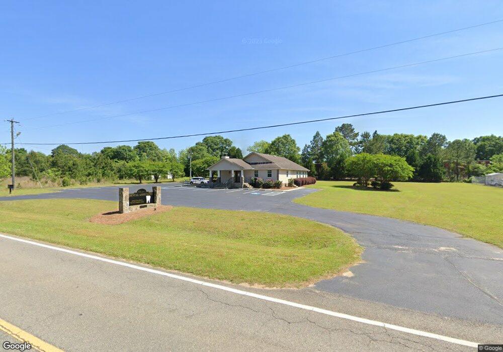
2688 Moore Station Rd Dublin, GA 31021
Estimated Value: $471,264
--
Bed
--
Bath
2,600
Sq Ft
$181/Sq Ft
Est. Value
About This Home
This home is located at 2688 Moore Station Rd, Dublin, GA 31021 and is currently estimated at $471,264, approximately $181 per square foot. 2688 Moore Station Rd is a home located in Laurens County with nearby schools including Northwest Laurens Elementary School, Southwest Laurens Elementary School, and East Laurens Primary School.
Ownership History
Date
Name
Owned For
Owner Type
Purchase Details
Closed on
May 7, 2009
Sold by
Lesko Paul
Bought by
Oconee Family & Cosmetic Dentistry
Current Estimated Value
Home Financials for this Owner
Home Financials are based on the most recent Mortgage that was taken out on this home.
Original Mortgage
$239,827
Interest Rate
4.89%
Mortgage Type
Credit Line Revolving
Purchase Details
Closed on
Mar 31, 2003
Sold by
Astwani Maher
Bought by
Lesko Paul Dr
Purchase Details
Closed on
Oct 1, 1995
Bought by
Astwani Maher
Create a Home Valuation Report for This Property
The Home Valuation Report is an in-depth analysis detailing your home's value as well as a comparison with similar homes in the area
Home Values in the Area
Average Home Value in this Area
Purchase History
| Date | Buyer | Sale Price | Title Company |
|---|---|---|---|
| Oconee Family & Cosmetic Dentistry | $187,500 | -- | |
| Lesko Paul Dr | $225,000 | -- | |
| Astwani Maher | -- | -- |
Source: Public Records
Mortgage History
| Date | Status | Borrower | Loan Amount |
|---|---|---|---|
| Closed | Oconee Family & Cosmetic Dentistry | $239,827 |
Source: Public Records
Tax History Compared to Growth
Tax History
| Year | Tax Paid | Tax Assessment Tax Assessment Total Assessment is a certain percentage of the fair market value that is determined by local assessors to be the total taxable value of land and additions on the property. | Land | Improvement |
|---|---|---|---|---|
| 2024 | $3,140 | $149,166 | $18,000 | $131,166 |
| 2023 | $1,978 | $93,124 | $27,000 | $66,124 |
| 2022 | $1,978 | $93,124 | $27,000 | $66,124 |
| 2021 | $2,030 | $93,124 | $27,000 | $66,124 |
| 2020 | $2,033 | $93,124 | $27,000 | $66,124 |
| 2019 | $2,034 | $93,124 | $27,000 | $66,124 |
| 2018 | $2,036 | $93,124 | $27,000 | $66,124 |
| 2017 | $2,035 | $93,124 | $27,000 | $66,124 |
| 2016 | $2,037 | $93,124 | $27,000 | $66,124 |
| 2015 | $2,038 | $93,124 | $27,000 | $66,124 |
| 2014 | $2,145 | $95,639 | $19,166 | $76,473 |
Source: Public Records
Map
Nearby Homes
- 203 Cherokee Rose Cir
- 106 Garden Ln
- 132 Cottage Loop
- 414 Village Dr
- 0 Fairview Park Dr
- 112 Oak Pointe Cir
- 706 A Industrial Blvd
- 109 Walke Ridge Trail
- 113 Parks Ridge Rd
- lot 4 Walke Ridge Rd
- 203 Westview Dr
- 100 Parks Ridge
- 0 Hillcrest Pkwy Unit 22394
- 0 Hillcrest Pkwy Unit 25660
- 0 Hillcrest Pkwy Unit 22378
- 0 Hillcrest Pkwy Unit 22393
- 0 Hillcrest Pkwy Unit 25638
- 0 Hillcrest Pkwy Unit 22379
- 200 Woodridge Rd
- 1707 Greystone Rd
- 305 Cherokee Rose Cir
- 114 Old Field Ln
- 2706 Moore Station Rd
- 509 Cherokee Rose Cir
- 112 Old Field Ln
- 110 Old Field Ln
- 108 Old Field Ln
- 0 Old Field Ln Unit 8605104
- 0 Old Field Ln Unit 7625809
- 106 Old Field Ln
- 103 Village Dr
- 104 Old Field Ln
- 201 Village Dr
- 0 Village Dr Unit 8095655
- 0 Village Dr Unit 8506747
- 0 Village Dr Unit 7243182
- 0 Village Dr
- 203 Village Dr
- 211 Cherokee Rose Cir
- 205 Village Dr