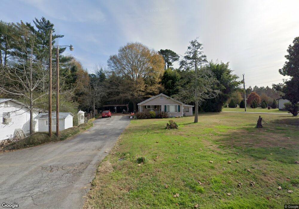
2689 Peavine Rd Rock Spring, GA 30739
Rock Spring NeighborhoodEstimated Value: $89,000 - $213,000
1
Bed
1
Bath
1,026
Sq Ft
$159/Sq Ft
Est. Value
About This Home
This home is located at 2689 Peavine Rd, Rock Spring, GA 30739 and is currently estimated at $163,249, approximately $159 per square foot. 2689 Peavine Rd is a home located in Walker County with nearby schools including Rock Spring Elementary School, Lafayette High School, and Alice M Daley Adventist School.
Ownership History
Date
Name
Owned For
Owner Type
Purchase Details
Closed on
Jun 1, 2023
Sold by
Ellis A Nathaniel
Bought by
Swafford Andrea Renee and Swafford Christopher Shawn
Current Estimated Value
Purchase Details
Closed on
Feb 18, 2010
Sold by
The Bank Of New York Mello
Bought by
Ellis A Nathaniel
Home Financials for this Owner
Home Financials are based on the most recent Mortgage that was taken out on this home.
Original Mortgage
$19,311
Interest Rate
4.97%
Mortgage Type
New Conventional
Purchase Details
Closed on
Nov 3, 2009
Sold by
Whitener Roy
Bought by
The Bank Of New York Mellon
Purchase Details
Closed on
Jun 1, 1999
Sold by
Chastain Samuel A and Chastain Frances
Bought by
Whitener Roy
Purchase Details
Closed on
Jan 1, 1972
Bought by
Chastain Samuel A and Chastain Frances
Create a Home Valuation Report for This Property
The Home Valuation Report is an in-depth analysis detailing your home's value as well as a comparison with similar homes in the area
Home Values in the Area
Average Home Value in this Area
Purchase History
| Date | Buyer | Sale Price | Title Company |
|---|---|---|---|
| Swafford Andrea Renee | $55,000 | -- | |
| Ellis A Nathaniel | $18,000 | -- | |
| The Bank Of New York Mellon | $69,427 | -- | |
| Whitener Roy | -- | -- | |
| Chastain Samuel A | -- | -- |
Source: Public Records
Mortgage History
| Date | Status | Borrower | Loan Amount |
|---|---|---|---|
| Previous Owner | The Bank Of New York Mellon | $19,311 |
Source: Public Records
Tax History Compared to Growth
Tax History
| Year | Tax Paid | Tax Assessment Tax Assessment Total Assessment is a certain percentage of the fair market value that is determined by local assessors to be the total taxable value of land and additions on the property. | Land | Improvement |
|---|---|---|---|---|
| 2024 | $832 | $35,866 | $5,202 | $30,664 |
| 2023 | $831 | $33,183 | $4,129 | $29,054 |
| 2022 | $975 | $37,525 | $3,991 | $33,534 |
| 2021 | $747 | $25,055 | $3,991 | $21,064 |
| 2020 | $654 | $20,662 | $3,991 | $16,671 |
| 2019 | $657 | $20,385 | $3,991 | $16,394 |
| 2018 | $539 | $20,385 | $3,991 | $16,394 |
| 2017 | $629 | $20,385 | $3,991 | $16,394 |
| 2016 | $629 | $20,385 | $3,991 | $16,394 |
| 2015 | $518 | $14,912 | $5,504 | $9,408 |
| 2014 | $441 | $14,912 | $5,504 | $9,408 |
| 2013 | $539 | $14,912 | $5,504 | $9,408 |
Source: Public Records
Map
Nearby Homes
- 59 Honeysuckle Dr
- 195 Honeysuckle Dr
- 1902 Long Hollow Rd
- 36 Pheonix Cir
- 386 Twelve Oaks Dr
- 285 Cooper Rd
- 1476 Arnold Rd
- 375 Cooper Rd
- 5602 Georgia 95
- 00 Georgia 95
- 1121 Arnold Rd
- 1003 Highway N Old 27
- 1370 Old Highway 27
- 788 Long Hollow Rd
- 701 Bicentennial Trail
- 10180 Us Highway 27
- 954 Goodson Cir
- 294 E Long Hollow Rd
- 918 Old Lafayette Rd
- 514 Ginger Lake Dr
- 2692 Peavine Rd
- 2712 Peavine Rd
- 2676 Peavine Rd Unit 1
- 2676 Peavine Rd
- 2732 Peavine Rd
- 2671 Peavine Rd
- 2748 Peavine Rd
- 19 Jordan Cir
- 2707 Peavine Rd
- 2764 Peavine Rd
- 105 Jordan Cir
- 127 Jordan Cir
- 85 Jordan Cir
- 26 Jordan Cir
- 2777 Peavine Rd
- 43 Jordan Cir
- 2776 Peavine Rd
- 147 Jordan Cir
- 46 Jordan Cir
- 167 Jordan Cir