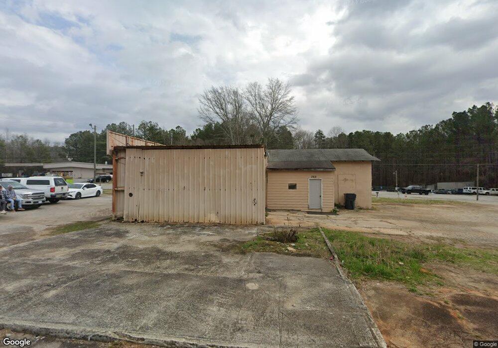
269 Center Point Rd Temple, GA 30179
Estimated Value: $157,000 - $237,000
3
Beds
2
Baths
2,485
Sq Ft
$81/Sq Ft
Est. Value
About This Home
This home is located at 269 Center Point Rd, Temple, GA 30179 and is currently estimated at $202,332, approximately $81 per square foot. 269 Center Point Rd is a home located in Carroll County with nearby schools including Temple Elementary School, Temple Middle School, and Temple High School.
Ownership History
Date
Name
Owned For
Owner Type
Purchase Details
Closed on
Mar 27, 2023
Sold by
Satterfield Hakim Richard
Bought by
Sanchez Guillermo Gomez and Garcia Navorina Pineda
Current Estimated Value
Purchase Details
Closed on
Aug 8, 2016
Sold by
Robert L Estate
Bought by
Satterfield Hakim Richard
Purchase Details
Closed on
Jul 2, 2007
Sold by
Not Provided
Bought by
West Robert L
Purchase Details
Closed on
May 2, 2007
Sold by
Not Provided
Bought by
West Robert L
Purchase Details
Closed on
Sep 6, 1987
Bought by
West Robert L
Create a Home Valuation Report for This Property
The Home Valuation Report is an in-depth analysis detailing your home's value as well as a comparison with similar homes in the area
Home Values in the Area
Average Home Value in this Area
Purchase History
| Date | Buyer | Sale Price | Title Company |
|---|---|---|---|
| Sanchez Guillermo Gomez | $160,000 | -- | |
| Satterfield Hakim Richard | $39,900 | -- | |
| West Robert L | -- | -- | |
| West Robert L | -- | -- | |
| West Robert L | -- | -- | |
| West Robert L | -- | -- |
Source: Public Records
Tax History
| Year | Tax Paid | Tax Assessment Tax Assessment Total Assessment is a certain percentage of the fair market value that is determined by local assessors to be the total taxable value of land and additions on the property. | Land | Improvement |
|---|---|---|---|---|
| 2025 | $1,498 | $56,477 | $9,558 | $46,919 |
| 2024 | $1,503 | $56,116 | $9,558 | $46,558 |
| 2023 | $1,503 | $52,336 | $9,558 | $42,778 |
| 2022 | $1,240 | $40,990 | $6,372 | $34,618 |
| 2021 | $1,087 | $34,970 | $4,720 | $30,250 |
| 2020 | $987 | $31,609 | $4,720 | $26,889 |
| 2019 | $979 | $31,094 | $4,720 | $26,374 |
| 2018 | $923 | $28,491 | $4,720 | $23,771 |
| 2017 | $934 | $28,491 | $4,720 | $23,771 |
| 2016 | $920 | $28,011 | $4,240 | $23,771 |
| 2015 | $1,121 | $32,093 | $6,000 | $26,094 |
| 2014 | $430 | $32,094 | $6,000 | $26,094 |
Source: Public Records
Map
Nearby Homes
- 400 Sapling Ct
- 92 James St
- 95 Carrollton St
- 51 Carrollton St
- 28 Ringer St
- 511 Azalea Way
- 511 Azalea Way Unit 54
- 0 Highway 113 Unit 10586141
- 44 E Johnson St
- 25 Old Bremen Rd
- 215 Lakeview Dr
- 185 Enterprise Dr
- 119 E Johnson St
- 249 Carrollton St
- 358 Daffodil Dr
- 96 Rome St
- 170 Double d Rd
- 221 Rome St
- 140 Creek Crossing Ln
- 587 E Johnson St
- 293 Center Point Rd
- 215 U S 78
- 265 W Highway 78
- 236 W Highway 78
- 311 Center Point Rd
- 0 E Highway 78 Unit 7133798
- 0 E Highway 78 Unit 3146449
- 0 E Highway 78 Unit 8240568
- 0 E Highway 78 Unit 20087725
- 0 E Highway 78 Unit 20025765
- 0 E Highway 78 Unit 8731361
- 0 E Highway 78 Unit 8366975
- 0 E Highway 78 Unit 8406919
- 107 Sourwood Ln
- 197 W Highway 78
- 101 Sourwood Ln Unit 2
- 101 Sourwood Ln
- 113 Sourwood Ln
- 209 W Highway 78
- 120 Matthews St
Your Personal Tour Guide
Ask me questions while you tour the home.