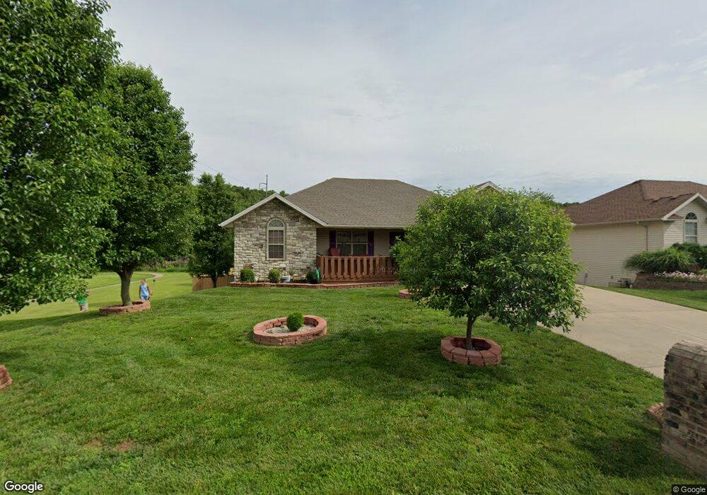
269 E Katie Dr Springfield, MO 65803
Estimated Value: $322,000 - $403,000
4
Beds
3
Baths
2,458
Sq Ft
$144/Sq Ft
Est. Value
About This Home
This home is located at 269 E Katie Dr, Springfield, MO 65803 and is currently estimated at $353,332, approximately $143 per square foot. 269 E Katie Dr is a home located in Greene County with nearby schools including Truman Elementary School, Pleasant View K-8 School, and Hillcrest High School.
Ownership History
Date
Name
Owned For
Owner Type
Purchase Details
Closed on
May 1, 2007
Sold by
Springer Enterprises Inc
Bought by
Patel Vasantbahi J and Patel Kailas
Current Estimated Value
Home Financials for this Owner
Home Financials are based on the most recent Mortgage that was taken out on this home.
Original Mortgage
$160,000
Interest Rate
5.91%
Mortgage Type
New Conventional
Purchase Details
Closed on
Jan 25, 2006
Sold by
Ashcroft Estates Development Llc and Rodelander Jim J
Bought by
Springer Enterprises Inc
Create a Home Valuation Report for This Property
The Home Valuation Report is an in-depth analysis detailing your home's value as well as a comparison with similar homes in the area
Purchase History
| Date | Buyer | Sale Price | Title Company |
|---|---|---|---|
| Patel Vasantbahi J | -- | None Available | |
| Springer Enterprises Inc | -- | None Available |
Source: Public Records
Mortgage History
| Date | Status | Borrower | Loan Amount |
|---|---|---|---|
| Closed | Patel Vasantbahi J | $160,000 |
Source: Public Records
Tax History
| Year | Tax Paid | Tax Assessment Tax Assessment Total Assessment is a certain percentage of the fair market value that is determined by local assessors to be the total taxable value of land and additions on the property. | Land | Improvement |
|---|---|---|---|---|
| 2025 | $2,228 | $46,780 | $5,700 | $41,080 |
| 2024 | $2,228 | $38,480 | $3,420 | $35,060 |
| 2023 | $2,216 | $38,480 | $3,420 | $35,060 |
| 2022 | $1,999 | $34,010 | $3,420 | $30,590 |
| 2021 | $1,912 | $34,010 | $3,420 | $30,590 |
| 2020 | $1,814 | $30,630 | $3,420 | $27,210 |
| 2019 | $1,763 | $30,630 | $3,420 | $27,210 |
| 2018 | $1,593 | $27,550 | $3,420 | $24,130 |
| 2017 | $1,579 | $27,060 | $3,420 | $23,640 |
| 2016 | $1,548 | $27,060 | $3,420 | $23,640 |
| 2015 | $1,537 | $27,060 | $3,420 | $23,640 |
| 2014 | $1,530 | $26,790 | $3,420 | $23,370 |
Source: Public Records
Map
Nearby Homes
- 4482 N Toby Ave
- 4497 N Toby Ave
- 4449 N Toby Ave
- 4473 N Toby Ave
- 347 Dry River Ct
- 419 Dry River Ct
- 4377 N Toby Ave
- 4461 N Katrina Ave
- 262 W Libby Dr
- 4642 N Farm Road 159
- 4230 N Farm Road 159
- 3764 N Huntington Ave
- 440 E Farm Road 84
- 555 E Farm Road 84
- 3969 N Springlawn Ave
- 3957 N Springlawn Ave
- 3857 N Sheedy Ave
- 3740 N Oak Point Ave
- 1270 E Ogorman Ct
- 671 W Bridgewood Ct
- 281 E Katie Dr
- 293 E Katie Dr
- 245 E Katie Dr
- 4487 Gladys Ave
- 311 Dry River Ct
- 4494 N Toby Ave
- 305 E Katie Dr
- 4521 N Toby Ave
- 4475 Gladys Ave
- 329 Dry River Ct
- 317 E Katie Dr
- 4486 Gladys Ave
- 4509 N Toby Ave
- 4463 Gladys Ave
- 4474 Gladys Ave
- 365 Dry River Ct
- 355 E Katie Dr
- 4485 N Toby Ave
- 4451 Gladys Ave
- 437 Dry River Ct
Your Personal Tour Guide
Ask me questions while you tour the home.