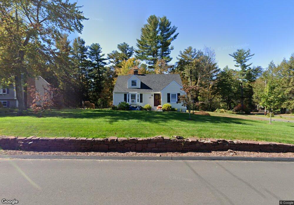
269 Firetown Rd Simsbury, CT 06070
Estimated Value: $365,626 - $416,000
2
Beds
1
Bath
1,493
Sq Ft
$259/Sq Ft
Est. Value
About This Home
This home is located at 269 Firetown Rd, Simsbury, CT 06070 and is currently estimated at $386,657, approximately $258 per square foot. 269 Firetown Rd is a home located in Hartford County with nearby schools including Squadron Line School, Henry James Memorial School, and Simsbury High School.
Ownership History
Date
Name
Owned For
Owner Type
Purchase Details
Closed on
Sep 15, 2022
Sold by
Delaney Terri Lee
Bought by
Urquhart Terri Lee and Urquhart Charles S
Current Estimated Value
Purchase Details
Closed on
Dec 18, 2006
Sold by
Raulinaitis Scott L and Raulinaitis Paula M
Bought by
Delaney Terri-Lee
Home Financials for this Owner
Home Financials are based on the most recent Mortgage that was taken out on this home.
Original Mortgage
$160,000
Interest Rate
6%
Purchase Details
Closed on
Aug 31, 2001
Sold by
Interrante Leonard J and Interrante Carol C
Bought by
Raulinaitis Scott L and Raulinaitis Paula M
Purchase Details
Closed on
Feb 10, 1994
Sold by
Brooks John and Brooks Diana
Bought by
Interrante Leonard and Interrante Carol
Create a Home Valuation Report for This Property
The Home Valuation Report is an in-depth analysis detailing your home's value as well as a comparison with similar homes in the area
Home Values in the Area
Average Home Value in this Area
Purchase History
| Date | Buyer | Sale Price | Title Company |
|---|---|---|---|
| Urquhart Terri Lee | -- | None Available | |
| Delaney Terri-Lee | $246,000 | -- | |
| Raulinaitis Scott L | $189,088 | -- | |
| Interrante Leonard | $137,000 | -- |
Source: Public Records
Mortgage History
| Date | Status | Borrower | Loan Amount |
|---|---|---|---|
| Previous Owner | Interrante Leonard | $274,550 | |
| Previous Owner | Interrante Leonard | $160,000 | |
| Previous Owner | Interrante Leonard | $170,000 |
Source: Public Records
Tax History
| Year | Tax Paid | Tax Assessment Tax Assessment Total Assessment is a certain percentage of the fair market value that is determined by local assessors to be the total taxable value of land and additions on the property. | Land | Improvement |
|---|---|---|---|---|
| 2025 | $6,236 | $182,560 | $63,070 | $119,490 |
| 2024 | $6,081 | $182,560 | $63,070 | $119,490 |
| 2023 | $5,809 | $182,560 | $63,070 | $119,490 |
| 2022 | $5,504 | $142,480 | $75,500 | $66,980 |
| 2021 | $5,504 | $142,480 | $75,500 | $66,980 |
| 2020 | $5,285 | $142,480 | $75,500 | $66,980 |
| 2019 | $5,317 | $142,480 | $75,500 | $66,980 |
| 2018 | $5,356 | $142,480 | $75,500 | $66,980 |
| 2017 | $5,247 | $135,380 | $75,500 | $59,880 |
| 2016 | $5,025 | $135,380 | $75,500 | $59,880 |
| 2015 | $5,025 | $135,380 | $75,500 | $59,880 |
| 2014 | $5,028 | $135,380 | $75,500 | $59,880 |
Source: Public Records
Map
Nearby Homes
- 7 Grimes Brook Place
- 60 Barry Ln
- 90 Seminary Rd
- 9 Barry Ln
- 36 Clifdon Dr
- 28 Great Pond Rd
- 31 Oxford Ct
- 7 School House Ln
- 79 Cambridge Ct
- 6 Heritage Ln
- 59 Cambridge Ct
- 9 Carriage Dr Unit 9
- 42 Holcomb St
- 40 Firetown Rd Unit 22
- 42 Library Ln Unit 42
- 5 Shady Ln
- 1 West St Unit 219
- 324 Old Farms Rd
- 15 Winhart Dr
- 12 The Glade
- 267 Firetown Rd
- 270 Firetown Rd
- 70 Chriswell Dr
- 272 Firetown Rd
- 14 Chriswell Dr
- 16 Chriswell Dr
- 275 Firetown Rd
- 266 Firetown Rd
- 279 Firetown Rd
- 2 Timber Ridge Dr
- 261 Firetown Rd
- 280 Firetown Rd
- 1 Timber Ridge Dr
- 281 Firetown Rd
- 69 Chriswell Dr
- 73 Chriswell Dr
- 284 Firetown Rd
- 257 Firetown Rd
- 11 Chriswell Dr
Your Personal Tour Guide
Ask me questions while you tour the home.