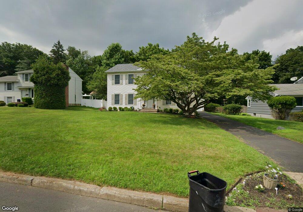
269 Orchard Dr Mahwah, NJ 07430
Estimated Value: $842,000 - $1,152,000
--
Bed
--
Bath
2,436
Sq Ft
$397/Sq Ft
Est. Value
About This Home
This home is located at 269 Orchard Dr, Mahwah, NJ 07430 and is currently estimated at $967,805, approximately $397 per square foot. 269 Orchard Dr is a home located in Bergen County with nearby schools including Mahwah High School.
Ownership History
Date
Name
Owned For
Owner Type
Purchase Details
Closed on
Jan 4, 2006
Sold by
Mihok Duane
Bought by
Bangera Satish and Bangera Savita
Current Estimated Value
Home Financials for this Owner
Home Financials are based on the most recent Mortgage that was taken out on this home.
Original Mortgage
$631,920
Outstanding Balance
$356,447
Interest Rate
6.33%
Estimated Equity
$611,358
Purchase Details
Closed on
Jan 31, 2002
Sold by
Estate Of Francis J Buckwith
Bought by
Mihok Duane and Mihok Maria
Home Financials for this Owner
Home Financials are based on the most recent Mortgage that was taken out on this home.
Original Mortgage
$274,000
Interest Rate
7.08%
Create a Home Valuation Report for This Property
The Home Valuation Report is an in-depth analysis detailing your home's value as well as a comparison with similar homes in the area
Home Values in the Area
Average Home Value in this Area
Purchase History
| Date | Buyer | Sale Price | Title Company |
|---|---|---|---|
| Bangera Satish | $789,900 | -- | |
| Mihok Duane | $342,500 | -- |
Source: Public Records
Mortgage History
| Date | Status | Borrower | Loan Amount |
|---|---|---|---|
| Open | Bangera Satish | $631,920 | |
| Previous Owner | Mihok Duane | $274,000 |
Source: Public Records
Tax History Compared to Growth
Tax History
| Year | Tax Paid | Tax Assessment Tax Assessment Total Assessment is a certain percentage of the fair market value that is determined by local assessors to be the total taxable value of land and additions on the property. | Land | Improvement |
|---|---|---|---|---|
| 2025 | $10,753 | $521,000 | $296,900 | $224,100 |
| 2024 | $10,613 | $521,000 | $296,900 | $224,100 |
| 2023 | $10,274 | $521,000 | $296,900 | $224,100 |
| 2022 | $10,274 | $521,000 | $296,900 | $224,100 |
| 2021 | $10,165 | $521,000 | $296,900 | $224,100 |
| 2020 | $9,920 | $521,000 | $296,900 | $224,100 |
| 2019 | $9,592 | $521,000 | $296,900 | $224,100 |
| 2018 | $9,456 | $521,000 | $296,900 | $224,100 |
| 2017 | $9,305 | $521,000 | $296,900 | $224,100 |
| 2016 | $9,102 | $521,000 | $296,900 | $224,100 |
| 2015 | $8,977 | $521,000 | $296,900 | $224,100 |
| 2014 | $8,826 | $521,000 | $296,900 | $224,100 |
Source: Public Records
Map
Nearby Homes
- 66 Thunderhead Place
- 2 Reid Ct
- 12 Alcott Rd
- 1415 York St
- 12 Sagamore Ave
- 163 Rutherford Rd
- 15 Augur Rd
- 1248 Garrison Ct Unit E1
- 1114 Hyde Park Ct Unit 1114
- 15 Stockbridge Ave
- 2256 Margaret Ct Unit 21A
- 235 Parkside Dr Unit 235
- 1194 Richmond Rd Unit A2
- 19 Yorkshire Dr
- 199 Parkside Dr
- 37 Hillside Ave
- 155 Parkside Dr Unit 155
- 208 Parkside Dr
- 252 Parkside Dr Unit 252
- 4 Stockbridge Ave