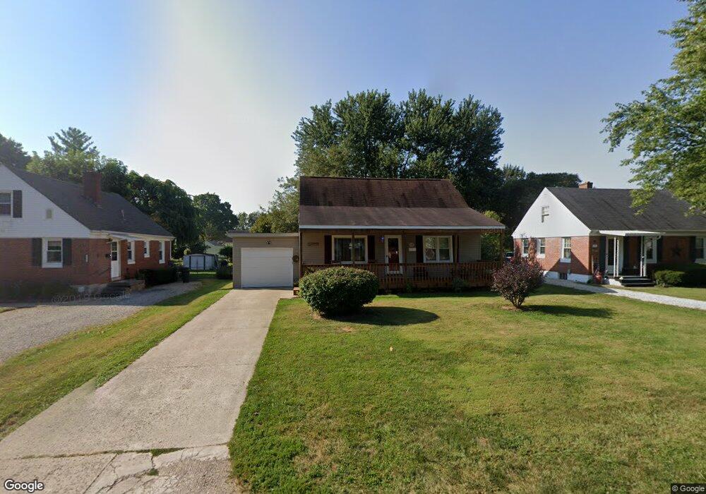
269 Pierson Blvd Newark, OH 43055
Estimated Value: $221,000 - $236,000
4
Beds
1
Bath
1,132
Sq Ft
$203/Sq Ft
Est. Value
About This Home
This home is located at 269 Pierson Blvd, Newark, OH 43055 and is currently estimated at $229,312, approximately $202 per square foot. 269 Pierson Blvd is a home located in Licking County with nearby schools including John Clem Elementary School, Liberty Middle School, and Newark High School.
Ownership History
Date
Name
Owned For
Owner Type
Purchase Details
Closed on
Sep 24, 2011
Sold by
Gochenouer David S
Bought by
Gochenouer Mary K
Current Estimated Value
Purchase Details
Closed on
Nov 1, 1999
Sold by
Est Phyllis E Chappelear
Bought by
Gochenouer Mary K and Gochenouer David S
Home Financials for this Owner
Home Financials are based on the most recent Mortgage that was taken out on this home.
Original Mortgage
$74,949
Interest Rate
7.87%
Mortgage Type
FHA
Create a Home Valuation Report for This Property
The Home Valuation Report is an in-depth analysis detailing your home's value as well as a comparison with similar homes in the area
Home Values in the Area
Average Home Value in this Area
Purchase History
| Date | Buyer | Sale Price | Title Company |
|---|---|---|---|
| Gochenouer Mary K | -- | None Available | |
| Gochenouer Mary K | $75,000 | -- |
Source: Public Records
Mortgage History
| Date | Status | Borrower | Loan Amount |
|---|---|---|---|
| Previous Owner | Gochenouer Mary K | $74,949 |
Source: Public Records
Tax History Compared to Growth
Tax History
| Year | Tax Paid | Tax Assessment Tax Assessment Total Assessment is a certain percentage of the fair market value that is determined by local assessors to be the total taxable value of land and additions on the property. | Land | Improvement |
|---|---|---|---|---|
| 2024 | $2,065 | $57,760 | $15,580 | $42,180 |
| 2023 | $2,062 | $57,760 | $15,580 | $42,180 |
| 2022 | $1,522 | $37,910 | $8,890 | $29,020 |
| 2021 | $1,596 | $37,910 | $8,890 | $29,020 |
| 2020 | $1,632 | $37,910 | $8,890 | $29,020 |
| 2019 | $1,396 | $31,220 | $8,890 | $22,330 |
| 2018 | $1,397 | $0 | $0 | $0 |
| 2017 | $1,333 | $0 | $0 | $0 |
| 2016 | $1,300 | $0 | $0 | $0 |
| 2015 | $1,329 | $0 | $0 | $0 |
| 2014 | $1,702 | $0 | $0 | $0 |
| 2013 | $1,274 | $0 | $0 | $0 |
Source: Public Records
Map
Nearby Homes
- 227 N Quentin Rd
- 370 Meadowbrook Dr
- 988 Mount Vernon Rd
- 440 Reverie Place
- 403 Meadowbrook Dr
- 473 Meadowbrook Dr
- 27 E Channel St
- 74 Cherry St
- 11 Waterworks Rd
- 1049 Sunrise Dr
- 52 Charles St
- 584 Moull St Unit A
- 542 Mount Vernon Rd
- 259 Goosepond Rd Unit C
- 261 Goosepond Rd Unit D
- 544 Hudson Ave
- 425 N 11th St
- 267 Goosepond Rd Unit A
- 188 Meadow Dr
- 184 Meadow Dr
- 263 Pierson Blvd
- 275 Pierson Blvd
- 257 Pierson Blvd
- 281 Pierson Blvd
- 270 Stare Rd
- 251 Pierson Blvd
- 287 Pierson Blvd
- 264 Stare Rd
- 276 Stare Rd
- 258 Stare Rd
- 282 Stare Rd
- 270 Pierson Blvd
- 276 Pierson Blvd
- 264 Pierson Blvd
- 293 Pierson Blvd
- 260 Pierson Blvd
- 245 Pierson Blvd
- 282 Pierson Blvd
- 248 Stare Rd
- 288 Stare Rd