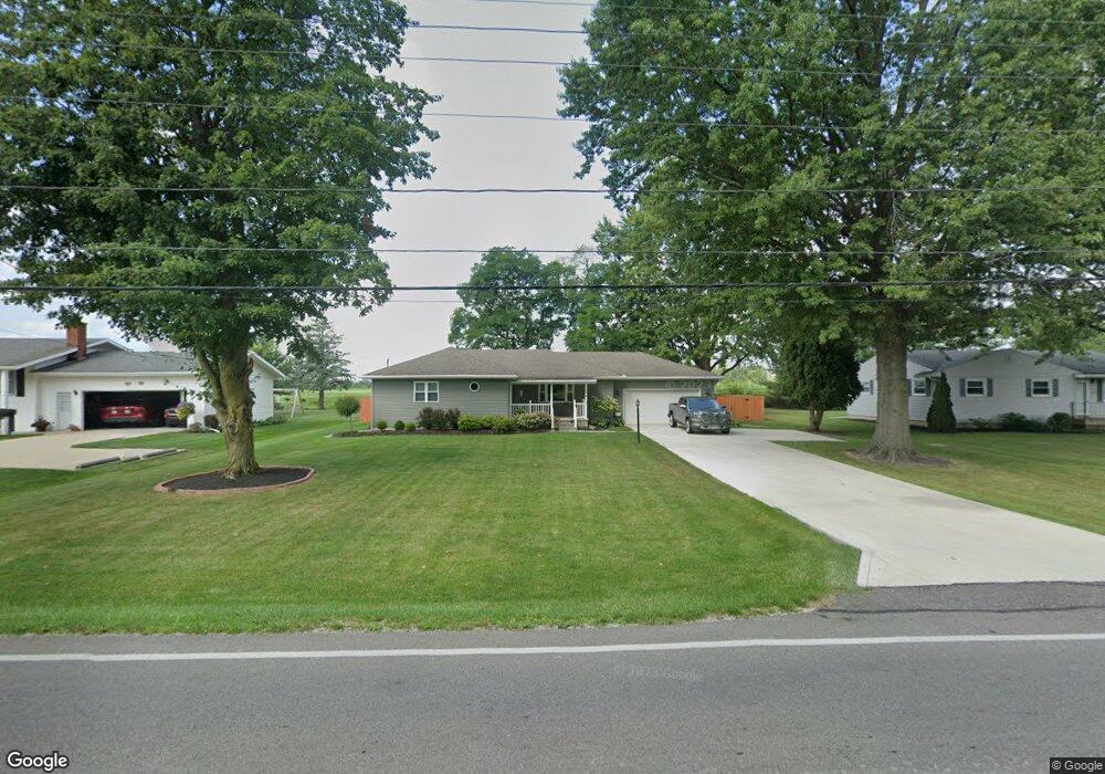
269 Pole Lane Rd Marion, OH 43302
Estimated Value: $153,000 - $256,000
3
Beds
2
Baths
1,432
Sq Ft
$143/Sq Ft
Est. Value
About This Home
This home is located at 269 Pole Lane Rd, Marion, OH 43302 and is currently estimated at $204,953, approximately $143 per square foot. 269 Pole Lane Rd is a home located in Marion County with nearby schools including River Valley High School, Marion Preparatory Academy, and Rushmore Academy.
Ownership History
Date
Name
Owned For
Owner Type
Purchase Details
Closed on
Jan 28, 2022
Sold by
Jacobs Jeffrey A
Bought by
Ward Connie S
Current Estimated Value
Purchase Details
Closed on
Oct 31, 2008
Sold by
Garver Hazel and Osterholt Hollis E
Bought by
Jacobs Jeffrey A
Home Financials for this Owner
Home Financials are based on the most recent Mortgage that was taken out on this home.
Original Mortgage
$122,833
Interest Rate
6.11%
Mortgage Type
FHA
Create a Home Valuation Report for This Property
The Home Valuation Report is an in-depth analysis detailing your home's value as well as a comparison with similar homes in the area
Home Values in the Area
Average Home Value in this Area
Purchase History
| Date | Buyer | Sale Price | Title Company |
|---|---|---|---|
| Ward Connie S | -- | Rieger Thaddeus | |
| Ward Connie S | -- | Rieger Thaddeus | |
| Jacobs Jeffrey A | $123,500 | Chicago Title |
Source: Public Records
Mortgage History
| Date | Status | Borrower | Loan Amount |
|---|---|---|---|
| Previous Owner | Jacobs Jeffrey A | $122,833 |
Source: Public Records
Tax History Compared to Growth
Tax History
| Year | Tax Paid | Tax Assessment Tax Assessment Total Assessment is a certain percentage of the fair market value that is determined by local assessors to be the total taxable value of land and additions on the property. | Land | Improvement |
|---|---|---|---|---|
| 2024 | $1,501 | $46,650 | $8,330 | $38,320 |
| 2023 | $1,501 | $46,650 | $8,330 | $38,320 |
| 2022 | $1,943 | $46,650 | $8,330 | $38,320 |
| 2021 | $1,791 | $38,660 | $7,250 | $31,410 |
| 2020 | $1,735 | $38,660 | $7,250 | $31,410 |
| 2019 | $1,732 | $38,660 | $7,250 | $31,410 |
| 2018 | $1,348 | $33,870 | $6,290 | $27,580 |
| 2017 | $1,362 | $33,870 | $6,290 | $27,580 |
| 2016 | $1,361 | $33,870 | $6,290 | $27,580 |
| 2015 | $1,352 | $33,070 | $5,990 | $27,080 |
| 2014 | $1,353 | $33,070 | $5,990 | $27,080 |
| 2012 | $1,366 | $32,330 | $4,800 | $27,530 |
Source: Public Records
Map
Nearby Homes
- 386 Pole Lane Rd
- 627 Augusta Dr
- 485 New Park Dr
- 645 Augusta Dr
- 402 Carolyn Dr
- 499 Carolyn Dr
- 534 Meadow Ln
- 565 Mayfield Dr
- 653 Exeter Way
- 655 Exeter Way
- 680 Eton St
- 736 Eton St
- 1667 Marion Edison Rd
- 145 Sara Ave
- 1242 Skeawood Dr
- 144 Spencer St
- 1050 Hathaway Ln
- 0 Richland Rd
- 1195 Indiana Ave
- 0 Denning Ave
- 275 Pole Lane Rd
- 259 Pole Lane Rd
- 303 Pole Lane Rd
- 249 Pole Lane Rd
- 262 Pole Lane Rd
- 276 Pole Lane Rd
- 256 Pole Lane Rd
- 241 Pole Lane Rd
- 313 Pole Lane Rd
- 300 Pole Lane Rd
- 244 Pole Lane Rd
- 233 Pole Lane Rd
- 310 Pole Lane Rd
- 230 Pole Lane Rd
- 331 Pole Lane Rd
- 328 Pole Lane Rd
- 221 Pole Lane Rd
- 220 Pole Lane Rd
- 343 Pole Lane Rd
- 199 Pole Lane Rd