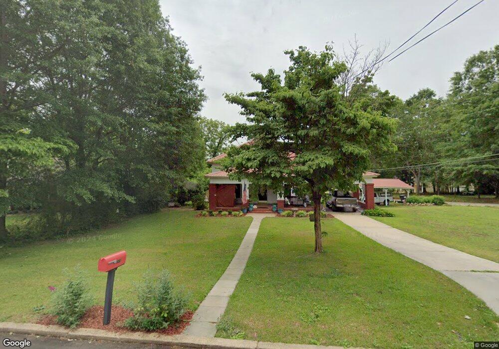
269 Pylant St Senoia, GA 30276
Estimated Value: $362,000 - $469,000
3
Beds
2
Baths
1,832
Sq Ft
$227/Sq Ft
Est. Value
About This Home
This home is located at 269 Pylant St, Senoia, GA 30276 and is currently estimated at $415,583, approximately $226 per square foot. 269 Pylant St is a home located in Coweta County with nearby schools including Eastside Elementary School, East Coweta Middle School, and East Coweta High School.
Ownership History
Date
Name
Owned For
Owner Type
Purchase Details
Closed on
Jul 12, 2021
Sold by
Sullivan Kathleen J
Bought by
Vanpelt Stacey and Vanpelt Van Pelt
Current Estimated Value
Purchase Details
Closed on
Jun 27, 1994
Sold by
Williams Wb
Bought by
Sullivan Kathleen J
Home Financials for this Owner
Home Financials are based on the most recent Mortgage that was taken out on this home.
Original Mortgage
$78,350
Interest Rate
8.51%
Mortgage Type
Purchase Money Mortgage
Create a Home Valuation Report for This Property
The Home Valuation Report is an in-depth analysis detailing your home's value as well as a comparison with similar homes in the area
Home Values in the Area
Average Home Value in this Area
Purchase History
| Date | Buyer | Sale Price | Title Company |
|---|---|---|---|
| Vanpelt Stacey | $175,000 | -- | |
| Sullivan Kathleen J | $82,500 | -- |
Source: Public Records
Mortgage History
| Date | Status | Borrower | Loan Amount |
|---|---|---|---|
| Previous Owner | Sullivan Kathleen J | $78,350 |
Source: Public Records
Tax History Compared to Growth
Tax History
| Year | Tax Paid | Tax Assessment Tax Assessment Total Assessment is a certain percentage of the fair market value that is determined by local assessors to be the total taxable value of land and additions on the property. | Land | Improvement |
|---|---|---|---|---|
| 2024 | $1,253 | $107,236 | $30,000 | $77,236 |
| 2023 | $1,253 | $103,481 | $30,000 | $73,481 |
| 2022 | $1,158 | $93,903 | $30,000 | $63,903 |
| 2021 | $1,490 | $95,957 | $41,040 | $54,917 |
| 2020 | $1,528 | $95,957 | $41,040 | $54,917 |
| 2019 | $772 | $51,626 | $21,099 | $30,527 |
| 2018 | $782 | $51,626 | $21,099 | $30,527 |
| 2017 | $1,007 | $51,626 | $21,098 | $30,528 |
| 2016 | $1,006 | $51,626 | $21,099 | $30,527 |
| 2015 | $980 | $51,626 | $21,099 | $30,527 |
| 2014 | $634 | $41,251 | $10,724 | $30,527 |
Source: Public Records
Map
Nearby Homes
- 71 Lower Creek Trail
- 103 Morgan St
- 126 Morgan St
- 124 Morgan St
- 0 Quick Dr Unit 10555827
- 271 Bridge St
- 0 Johnson St Unit 10612656
- 351 Seavy St
- 146 Middle St
- 44 Standing Rock Rd
- 1978 Luther Bailey Rd
- 260 Willow Dell Dr
- 220 Johnson St
- 46 Horseshoe Bend Way
- 90 Howard Rd
- 35 Millwalk Dr
- 375 Luther Bailey Rd
- 0 Coweta St Unit 10555038
- 374 Luther Bailey Rd
- 316 Hammerstone Ct Unit 19
- 279 Pylant St
- 255 Pylant St
- 270 Pylant St
- 291 Pylant St
- 19 Morgan St
- 258 Pylant St
- 31 Morgan St
- 31 Morgan St Unit 2
- 32 Morgan St
- 239 Pylant St
- 41 Morgan St
- 244 Pylant St
- 305 Pylant St
- 55 Lower Creek Trail
- 304 Pylant St
- 37 Lower Creek Trail Unit 36
- 37 Lower Creek Trail
- 63 Lower Creek Trail
- 93 Lower Creek Trail Unit 59