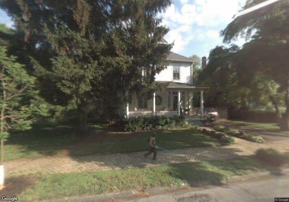
269 W 2nd St Moorestown, NJ 08057
Estimated Value: $523,766 - $805,000
Studio
--
Bath
2,572
Sq Ft
$271/Sq Ft
Est. Value
About This Home
This home is located at 269 W 2nd St, Moorestown, NJ 08057 and is currently estimated at $696,942, approximately $270 per square foot. 269 W 2nd St is a home located in Burlington County with nearby schools including George C. Baker Elementary School, Moorestown Upper Elementary School, and William Allen Middle School.
Ownership History
Date
Name
Owned For
Owner Type
Purchase Details
Closed on
Jun 28, 1999
Sold by
Athanas Steven P and Athanas Nancy M
Bought by
Fauvell Kevin D and Fauvell Kira L
Current Estimated Value
Home Financials for this Owner
Home Financials are based on the most recent Mortgage that was taken out on this home.
Original Mortgage
$172,000
Outstanding Balance
$48,369
Interest Rate
7.61%
Estimated Equity
$648,573
Purchase Details
Closed on
Jun 16, 1998
Sold by
Pike John E and Pike Carol A
Bought by
Athanas Steven P and Athanas Nancy M
Home Financials for this Owner
Home Financials are based on the most recent Mortgage that was taken out on this home.
Original Mortgage
$188,700
Interest Rate
6.99%
Create a Home Valuation Report for This Property
The Home Valuation Report is an in-depth analysis detailing your home's value as well as a comparison with similar homes in the area
Home Values in the Area
Average Home Value in this Area
Purchase History
| Date | Buyer | Sale Price | Title Company |
|---|---|---|---|
| Fauvell Kevin D | $215,000 | Congress Title Corp | |
| Athanas Steven P | $185,000 | Congress Title Corp |
Source: Public Records
Mortgage History
| Date | Status | Borrower | Loan Amount |
|---|---|---|---|
| Open | Fauvell Kevin D | $172,000 | |
| Previous Owner | Athanas Steven P | $188,700 |
Source: Public Records
Tax History
| Year | Tax Paid | Tax Assessment Tax Assessment Total Assessment is a certain percentage of the fair market value that is determined by local assessors to be the total taxable value of land and additions on the property. | Land | Improvement |
|---|---|---|---|---|
| 2025 | $8,329 | $293,600 | $122,500 | $171,100 |
| 2024 | $8,077 | $293,600 | $122,500 | $171,100 |
| 2023 | $8,077 | $293,600 | $122,500 | $171,100 |
| 2022 | $7,995 | $293,600 | $122,500 | $171,100 |
| 2021 | $7,889 | $293,600 | $122,500 | $171,100 |
| 2020 | $7,839 | $293,600 | $122,500 | $171,100 |
| 2019 | $7,701 | $293,600 | $122,500 | $171,100 |
| 2018 | $7,493 | $293,600 | $122,500 | $171,100 |
| 2017 | $7,557 | $293,600 | $122,500 | $171,100 |
| 2016 | $7,531 | $293,600 | $122,500 | $171,100 |
| 2015 | $7,440 | $293,600 | $122,500 | $171,100 |
| 2014 | $7,064 | $293,600 | $122,500 | $171,100 |
Source: Public Records
Map
Nearby Homes
- 15 W Close Unit 15
- 307 Fairview Ave
- 129 S Church St
- 10 E Close Unit 10EAST
- 401 W 3rd St
- 8 S Close Unit 8
- 444 Shady Ln
- 317 S Washington Ave
- 543 Bethel Ave
- 66 E 3rd St
- 9 Haines Dr
- 80 E 3rd St
- 601 Stratford Dr
- 705 Iron Post Rd
- 11 W Spruce Ave
- 500 Chester Ave
- 133 Plum St Unit 6
- 127 Schooley St
- 140 E Central Ave
- 205 E Central Ave
Your Personal Tour Guide
Ask me questions while you tour the home.