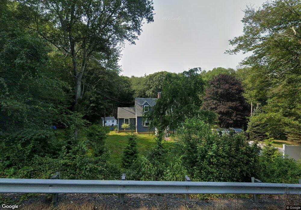
269 W Main St Niantic, CT 06357
Estimated Value: $255,000 - $495,000
3
Beds
2
Baths
1,200
Sq Ft
$304/Sq Ft
Est. Value
About This Home
This home is located at 269 W Main St, Niantic, CT 06357 and is currently estimated at $365,358, approximately $304 per square foot. 269 W Main St is a home located in New London County with nearby schools including East Lyme Middle School, East Lyme High School, and The Light House Voc-Ed Center.
Ownership History
Date
Name
Owned For
Owner Type
Purchase Details
Closed on
Sep 3, 2021
Sold by
Littlefield John A
Bought by
Macdonald Michael
Current Estimated Value
Home Financials for this Owner
Home Financials are based on the most recent Mortgage that was taken out on this home.
Original Mortgage
$124,800
Outstanding Balance
$113,559
Interest Rate
2.8%
Mortgage Type
Purchase Money Mortgage
Estimated Equity
$251,799
Purchase Details
Closed on
May 30, 2002
Sold by
Dousis Nicholas L
Bought by
Mitchell T Llc
Create a Home Valuation Report for This Property
The Home Valuation Report is an in-depth analysis detailing your home's value as well as a comparison with similar homes in the area
Home Values in the Area
Average Home Value in this Area
Purchase History
| Date | Buyer | Sale Price | Title Company |
|---|---|---|---|
| Macdonald Michael | $156,000 | None Available | |
| Mitchell T Llc | $223,000 | -- |
Source: Public Records
Mortgage History
| Date | Status | Borrower | Loan Amount |
|---|---|---|---|
| Open | Macdonald Michael | $124,800 | |
| Previous Owner | Mitchell T Llc | $172,000 | |
| Previous Owner | Mitchell T Llc | $165,960 | |
| Previous Owner | Mitchell T Llc | $110,626 |
Source: Public Records
Tax History Compared to Growth
Tax History
| Year | Tax Paid | Tax Assessment Tax Assessment Total Assessment is a certain percentage of the fair market value that is determined by local assessors to be the total taxable value of land and additions on the property. | Land | Improvement |
|---|---|---|---|---|
| 2025 | $4,784 | $170,800 | $66,640 | $104,160 |
| 2024 | $4,501 | $170,800 | $66,640 | $104,160 |
| 2023 | $3,805 | $152,950 | $66,640 | $86,310 |
| 2022 | $3,646 | $152,950 | $66,640 | $86,310 |
| 2021 | $3,880 | $136,080 | $76,930 | $59,150 |
| 2020 | $3,859 | $136,080 | $76,930 | $59,150 |
| 2019 | $3,836 | $136,080 | $76,930 | $59,150 |
| 2018 | $3,722 | $136,080 | $76,930 | $59,150 |
| 2017 | $3,560 | $136,080 | $76,930 | $59,150 |
| 2016 | $3,190 | $125,790 | $66,640 | $59,150 |
| 2015 | $3,108 | $125,790 | $66,640 | $59,150 |
| 2014 | $3,023 | $125,790 | $66,640 | $59,150 |
Source: Public Records
Map
Nearby Homes
- 15 Freedom Way Unit 92
- 14 Colton Rd
- 4 Jean Dr
- 2 Riverdale Landing
- 22 Riverdale Landing
- 188 4 Mile River Rd
- 40 Spinnaker Dr
- 18 Twin Valley Rd
- 3 Twin Valley Rd
- 16 Twin Valley Rd
- Waramaug Plan at Riverside Reserve
- Highland Plan at Riverside Reserve
- Hayward Plan at Riverside Reserve
- Ashford Plan at Riverside Reserve
- Lillinonah Plan at Riverside Reserve
- 55 Corey Ln
- 78 Corey Ln Unit 9
- 23 Over Brook Rd
- 15 Short Hills Rd
- 57 Spring Rock Rd
- 266 W Main St
- 0 W Main St Unit 170036474
- 0 W Main and Rathbun Unit N353523
- 0 W Main and Rathbun Unit N10230411
- 00 W Main St
- 6 Liberty Way
- 275 W Main St
- 5 Liberty Way
- 7 Liberty Way
- 5 Freedom Way Unit C3 & C4
- 10 Liberty Way
- 22 Liberty Way
- 18 & 20 Liberty Way
- 11 Liberty Way
- 15 Liberty Way
- 15 Liberty Way Unit A
- 15 Liberty Way
- 255 W Main St
- 1 Chadwick Place
- 253 W Main St