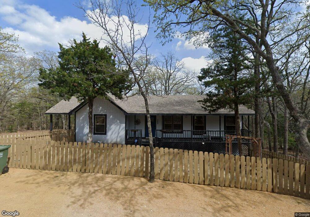
269 Westminister Dr Pottsboro, TX 75076
Estimated Value: $249,538 - $449,000
--
Bed
--
Bath
1,063
Sq Ft
$354/Sq Ft
Est. Value
About This Home
This home is located at 269 Westminister Dr, Pottsboro, TX 75076 and is currently estimated at $375,885, approximately $353 per square foot. 269 Westminister Dr is a home with nearby schools including Pottsboro Elementary School, Pottsboro Middle School, and Pottsboro High School.
Ownership History
Date
Name
Owned For
Owner Type
Purchase Details
Closed on
May 24, 2012
Sold by
Hutson Keith and Hutson Angela
Bought by
Anselmo Paul and Anselmo Laurie
Current Estimated Value
Home Financials for this Owner
Home Financials are based on the most recent Mortgage that was taken out on this home.
Original Mortgage
$60,000
Outstanding Balance
$35,699
Interest Rate
4.25%
Mortgage Type
Adjustable Rate Mortgage/ARM
Estimated Equity
$340,186
Purchase Details
Closed on
Apr 30, 2010
Sold by
Lavender Johnny and Lavender Belinda
Bought by
Hutson Keith and Hutson Angela
Home Financials for this Owner
Home Financials are based on the most recent Mortgage that was taken out on this home.
Original Mortgage
$36,000
Interest Rate
4.91%
Mortgage Type
Purchase Money Mortgage
Create a Home Valuation Report for This Property
The Home Valuation Report is an in-depth analysis detailing your home's value as well as a comparison with similar homes in the area
Home Values in the Area
Average Home Value in this Area
Purchase History
| Date | Buyer | Sale Price | Title Company |
|---|---|---|---|
| Anselmo Paul | -- | Red River Title Co | |
| Hutson Keith | -- | Red River Title Co |
Source: Public Records
Mortgage History
| Date | Status | Borrower | Loan Amount |
|---|---|---|---|
| Open | Anselmo Paul | $60,000 | |
| Previous Owner | Hutson Keith | $36,000 |
Source: Public Records
Tax History Compared to Growth
Tax History
| Year | Tax Paid | Tax Assessment Tax Assessment Total Assessment is a certain percentage of the fair market value that is determined by local assessors to be the total taxable value of land and additions on the property. | Land | Improvement |
|---|---|---|---|---|
| 2025 | $3,401 | $279,016 | $104,600 | $174,416 |
| 2024 | $3,401 | $245,470 | $70,800 | $174,670 |
| 2023 | $2,915 | $210,046 | $35,600 | $174,446 |
| 2022 | $3,357 | $213,277 | $25,289 | $187,988 |
| 2021 | $2,313 | $142,217 | $15,185 | $127,032 |
| 2020 | $2,067 | $122,457 | $16,104 | $106,353 |
| 2019 | $2,199 | $124,317 | $18,859 | $105,458 |
| 2018 | $1,932 | $107,837 | $13,348 | $94,489 |
| 2017 | $1,781 | $98,139 | $13,348 | $84,791 |
| 2016 | $1,783 | $98,210 | $13,348 | $84,862 |
| 2015 | $1,570 | $85,004 | $13,348 | $71,656 |
| 2014 | $1,537 | $82,518 | $13,348 | $69,170 |
Source: Public Records
Map
Nearby Homes
- 33 Queens Dr
- 219 Ray Rd
- 83 Mayfield Ln
- 11 Mayfield Ln
- 491 Black Forest Dr
- 16 Wales Dr
- 545 Black Forest Dr
- 226 Cambridge Dr
- 191 Black Forest Dr
- 142 Wales Dr
- 207 Wales Dr
- 81 Windsor Dr
- 344 Castle Dr
- 34 Cambridge Dr
- 258 Lou-Sand Hill Rd
- 116 Oak Hills Dr
- 766 Lakepoint Loop
- 588 Lakepoint Loop
- 120 Eagleview Cir
- 110 Eagleview Cir
- 281 Westminister Dr
- 251 Westminister Dr
- 258 Westminister Dr
- 298 Westminister Dr
- 90 Eton Dr
- 315 Westminister Dr
- 120 Eton Dr
- 3 Westminister Dr
- 3 Eton Dr
- 205 Westminister Dr
- 341 Westminister Dr
- 150 Eton Dr
- 110 Queens Dr
- 139 Eton Dr
- 204 Westminister Dr
- 86 Queens Dr
- 388 Westminister Dr
- 130 Queens Dr
- 155 Westminister Dr
- 373 Westminister Dr