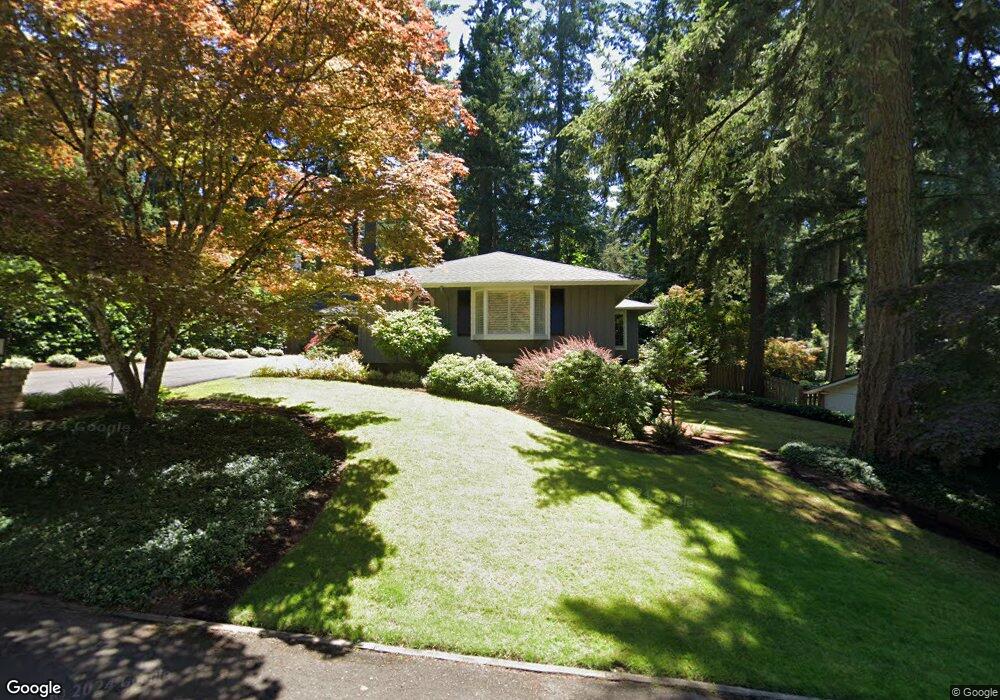
2690 Dellwood Dr Lake Oswego, OR 97034
Palisades NeighborhoodEstimated Value: $1,127,497 - $1,387,000
3
Beds
3
Baths
3,424
Sq Ft
$374/Sq Ft
Est. Value
About This Home
This home is located at 2690 Dellwood Dr, Lake Oswego, OR 97034 and is currently estimated at $1,280,624, approximately $374 per square foot. 2690 Dellwood Dr is a home located in Clackamas County with nearby schools including Westridge Elementary School, Lakeridge Middle School, and Lakeridge High School.
Ownership History
Date
Name
Owned For
Owner Type
Purchase Details
Closed on
May 23, 2022
Sold by
Marto Janice L and Marto Paul F
Bought by
Paul F Marto And Janice L Marto Revocable Liv
Current Estimated Value
Purchase Details
Closed on
Jul 22, 1998
Sold by
Elliott Steven N and Elliott Carolyn A
Bought by
Marto Paul F and Marto Janice L
Home Financials for this Owner
Home Financials are based on the most recent Mortgage that was taken out on this home.
Original Mortgage
$322,950
Interest Rate
7.01%
Create a Home Valuation Report for This Property
The Home Valuation Report is an in-depth analysis detailing your home's value as well as a comparison with similar homes in the area
Home Values in the Area
Average Home Value in this Area
Purchase History
| Date | Buyer | Sale Price | Title Company |
|---|---|---|---|
| Paul F Marto And Janice L Marto Revocable Liv | -- | Teitelman Andrew E | |
| Marto Paul F | $403,700 | Fidelity National Title Co |
Source: Public Records
Mortgage History
| Date | Status | Borrower | Loan Amount |
|---|---|---|---|
| Previous Owner | Marto Paul F | $322,950 |
Source: Public Records
Tax History Compared to Growth
Tax History
| Year | Tax Paid | Tax Assessment Tax Assessment Total Assessment is a certain percentage of the fair market value that is determined by local assessors to be the total taxable value of land and additions on the property. | Land | Improvement |
|---|---|---|---|---|
| 2025 | $8,452 | $440,115 | -- | -- |
| 2024 | $8,227 | $427,297 | -- | -- |
| 2023 | $8,227 | $414,852 | $0 | $0 |
| 2022 | $7,748 | $402,769 | $0 | $0 |
| 2021 | $7,156 | $391,038 | $0 | $0 |
| 2020 | $6,976 | $379,649 | $0 | $0 |
| 2019 | $6,805 | $368,592 | $0 | $0 |
| 2018 | $6,471 | $357,856 | $0 | $0 |
| 2017 | $6,244 | $347,433 | $0 | $0 |
| 2016 | $5,685 | $337,314 | $0 | $0 |
| 2015 | $5,492 | $327,489 | $0 | $0 |
| 2014 | $5,421 | $317,950 | $0 | $0 |
Source: Public Records
Map
Nearby Homes
- 17360 Alpine Way
- 2627 Park Rd
- 17035 Westview Dr
- 17677 Westview Dr
- 16878 Canyon Dr
- 17901 Hillside Dr
- 17447 Blue Heron Rd
- 2255 Glen Haven Rd
- 17210 Cedar Rd
- 2306 Mayors Ln
- 1951 Greentree Rd
- 0 S Shore Blvd
- 1931 Park Forest Ct
- 16636 Maple Cir
- 17367 Canal Cir
- 1847 Woodland Terrace
- 17958 Saint Clair Dr
- 1700 Woodland Terrace
- 17595 Kelok Rd
- 3548 Lakeview Blvd
- 2650 Dellwood Dr
- 2760 Dellwood Dr
- 17341 Canyon Dr
- 17331 Canyon Dr
- 2780 Dellwood Dr
- 2600 Dellwood Dr
- 2697 Dellwood Dr
- 17351 Canyon Dr
- 2657 Dellwood Dr
- 2765 Dellwood Dr
- 2655 Dellwood Dr
- 17321 Canyon Dr
- 2601 Dellwood Dr
- 2779 Dellwood Dr
- 17361 Canyon Dr
- 17350 Canyon Dr
- 2825 Dellwood Dr
- 17311 Canyon Dr
- 2550 Dellwood Dr
- 2810 Dellwood Dr