Estimated Value: $252,139 - $365,000
3
Beds
1
Bath
1
Sq Ft
$296,535/Sq Ft
Est. Value
About This Home
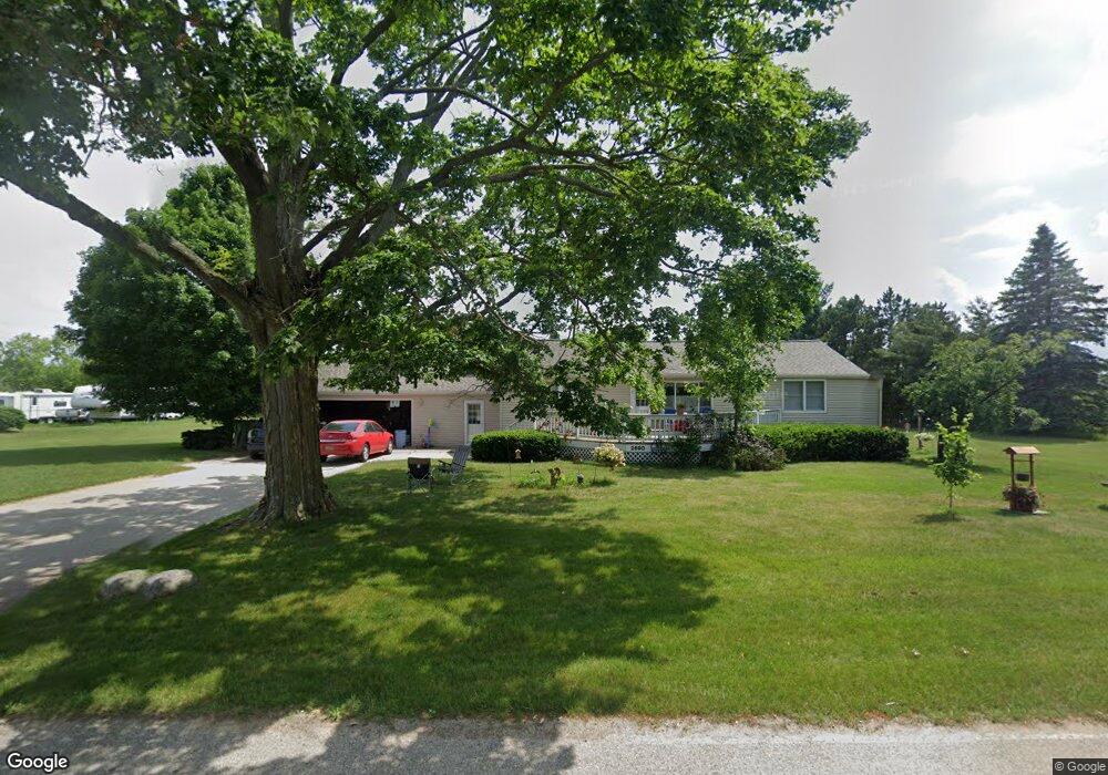
This home is located at 2690 E 132nd St, Grant, MI 49327 and is currently estimated at $296,535, approximately $296,535 per square foot. 2690 E 132nd St is a home located in Newaygo County with nearby schools including Grant Primary Center, Grant Elementary School, and Grant Middle School.
Create a Home Valuation Report for This Property
The Home Valuation Report is an in-depth analysis detailing your home's value as well as a comparison with similar homes in the area
Tax History
| Year | Tax Paid | Tax Assessment Tax Assessment Total Assessment is a certain percentage of the fair market value that is determined by local assessors to be the total taxable value of land and additions on the property. | Land | Improvement |
|---|---|---|---|---|
| 2025 | $460 | $107,400 | $0 | $0 |
| 2024 | $4 | $100,400 | $0 | $0 |
| 2023 | $430 | $85,600 | $0 | $0 |
| 2022 | $1,004 | $79,000 | $0 | $0 |
| 2021 | $1,035 | $73,500 | $0 | $0 |
| 2020 | $1,004 | $65,600 | $0 | $0 |
| 2019 | $978 | $59,300 | $0 | $0 |
| 2018 | $1,012 | $50,000 | $0 | $0 |
| 2017 | $1,039 | $46,900 | $0 | $0 |
| 2016 | $995 | $46,300 | $0 | $0 |
| 2015 | -- | $45,800 | $0 | $0 |
| 2014 | -- | $42,300 | $0 | $0 |
Source: Public Records
Map
Nearby Homes
- 9680 S Thornapple Ave
- 12449 S Catalpa Ave
- 2580 22 Mile Rd NW
- 953 E 136th St
- 3500 Northkent Pine Dr
- 12712 S Elder Ave
- Lot 19 S Elder Ave
- 13806 S Locust Ave
- 5405 E 120th St
- 151 & 153 Clark St
- 140 E Commerce St
- 17090 Kenowa Ave
- 10201 Mason Dr
- 15680 Tyrone Ave
- 2195 20 Mile Rd NW
- 11298 S Gordon Ave
- 1773 N Newaygo Rd
- 17474 Connor Cir
- 2244 19 Mile Rd
- 6477 E 128th St
- 2665 E 132nd St
- 2633 E 132nd St
- 2576 E 132nd St
- 2575 E 132nd St
- 2700 E 132nd St
- 2535 E 132nd St
- 13330 Marsh Way
- 2506 E 132nd St
- 2511 E 132nd St
- 0 Marsh Way Unit 71015040524
- 0 Marsh Way Unit 71017050328
- 0 Marsh Way Unit 71015040517
- 0 Marsh Way Unit 71015040651
- 0 Marsh Way Unit 71015040640
- 0 Marsh Way Unit M15040524
- 0 Marsh Way Unit M15040517
- 0 Marsh Way Unit 71017050317
- 0 Marsh Way Unit 17050328
- 0 Marsh Way Unit 15040651
- 0 Marsh Way Unit 15040640
Your Personal Tour Guide
Ask me questions while you tour the home.