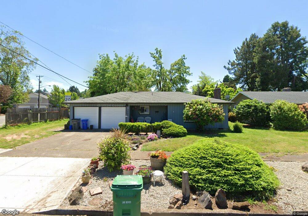
2690 Forrester Way Eugene, OR 97401
Cal Young NeighborhoodEstimated Value: $415,000 - $526,000
3
Beds
2
Baths
1,366
Sq Ft
$344/Sq Ft
Est. Value
About This Home
This home is located at 2690 Forrester Way, Eugene, OR 97401 and is currently estimated at $470,434, approximately $344 per square foot. 2690 Forrester Way is a home located in Lane County with nearby schools including Willagillespie Elementary School, Monroe Middle School, and Sheldon High School.
Ownership History
Date
Name
Owned For
Owner Type
Purchase Details
Closed on
Feb 23, 2024
Sold by
Philip N Mitchell Living Trust and Mitchell Philip N
Bought by
Philip N Mitchell Living Trust and Mitchell
Current Estimated Value
Home Financials for this Owner
Home Financials are based on the most recent Mortgage that was taken out on this home.
Original Mortgage
$622,500
Outstanding Balance
$450,332
Interest Rate
0.2%
Mortgage Type
Reverse Mortgage Home Equity Conversion Mortgage
Estimated Equity
$20,102
Purchase Details
Closed on
Jan 25, 2019
Sold by
Mitchell Philip N
Bought by
Mitchell Philip N and The Philip N Mitchell Living Trust
Create a Home Valuation Report for This Property
The Home Valuation Report is an in-depth analysis detailing your home's value as well as a comparison with similar homes in the area
Home Values in the Area
Average Home Value in this Area
Purchase History
| Date | Buyer | Sale Price | Title Company |
|---|---|---|---|
| Philip N Mitchell Living Trust | -- | None Listed On Document | |
| Mitchell Philip N | -- | None Available |
Source: Public Records
Mortgage History
| Date | Status | Borrower | Loan Amount |
|---|---|---|---|
| Open | Philip N Mitchell Living Trust | $622,500 | |
| Closed | Philip N Mitchell Living Trust | $622,500 |
Source: Public Records
Tax History Compared to Growth
Tax History
| Year | Tax Paid | Tax Assessment Tax Assessment Total Assessment is a certain percentage of the fair market value that is determined by local assessors to be the total taxable value of land and additions on the property. | Land | Improvement |
|---|---|---|---|---|
| 2025 | $4,429 | $227,326 | -- | -- |
| 2024 | $4,374 | $220,705 | -- | -- |
| 2023 | $4,374 | $214,277 | $0 | $0 |
| 2022 | $4,098 | $208,036 | $0 | $0 |
| 2021 | $3,849 | $201,977 | $0 | $0 |
| 2020 | $3,862 | $196,095 | $0 | $0 |
| 2019 | $3,730 | $190,384 | $0 | $0 |
| 2018 | $3,511 | $179,455 | $0 | $0 |
| 2017 | $3,354 | $179,455 | $0 | $0 |
| 2016 | $3,196 | $174,228 | $0 | $0 |
| 2015 | $3,084 | $169,153 | $0 | $0 |
| 2014 | $3,018 | $164,226 | $0 | $0 |
Source: Public Records
Map
Nearby Homes
- 2653 Sharon Way
- 2568 Sharon Way
- 950 Coburg Rd
- 2355 Pioneer Pike
- 820 Lariat Dr
- 2925 Van Ave
- 2250 Turnberry Ct
- 1097 Leigh St
- 347 Rustic Place Unit 1
- 3080 Harlow Rd
- 529 Antelope Way
- 2107 Bedford Way
- 1395 Bogart Ln
- 341 Ransom Ct
- 0 Sprig Ln Unit Lot 3
- 0 Sprig Ln Unit Lot 3 766109892
- 0 Sprig Ln Unit Lot 6 156455067
- 1960 Valhalla St
- 2150 Greenview St
- 250 Regal Ct
- 2680 Forrester Way
- 1030 Coburg Rd
- 2668 Forrester Way
- 2691 Forrester Way
- 1073 Coburg Rd Unit 2
- 1073 Coburg Rd
- 2689 Forrester Way
- 2708 Mallory Ln
- 2651 Tandy Turn
- 2714 Mallory Ln
- 1091 Coburg Rd
- 2671 Forrester Way
- 2640 Forrester Way
- 2725 Mallory Ln
- 2722 Mallory Ln
- 1008 Coburg Rd
- 2690 Sharon Way
- 2728 Mallory Ln
- 2643 Forrester Way
- 1023 Coburg Rd