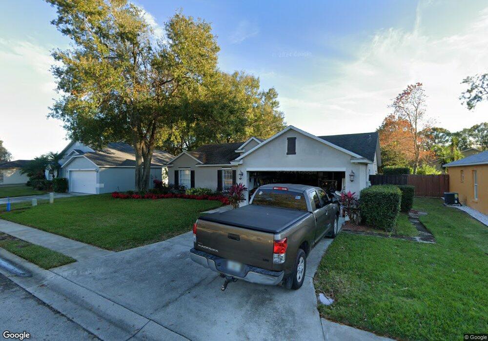
2690 Sundance Cir Mulberry, FL 33860
Willow Oak NeighborhoodEstimated Value: $284,000 - $295,000
3
Beds
2
Baths
1,498
Sq Ft
$192/Sq Ft
Est. Value
About This Home
This home is located at 2690 Sundance Cir, Mulberry, FL 33860 and is currently estimated at $288,019, approximately $192 per square foot. 2690 Sundance Cir is a home located in Polk County with nearby schools including Bennett Elementary School, Kruse Elementary School, and Olander Elementary School.
Ownership History
Date
Name
Owned For
Owner Type
Purchase Details
Closed on
May 7, 1997
Sold by
Sun State Development Corp
Bought by
Broussard Brian A and Broussard Kimberly A
Current Estimated Value
Home Financials for this Owner
Home Financials are based on the most recent Mortgage that was taken out on this home.
Original Mortgage
$87,567
Interest Rate
7.98%
Mortgage Type
VA
Create a Home Valuation Report for This Property
The Home Valuation Report is an in-depth analysis detailing your home's value as well as a comparison with similar homes in the area
Home Values in the Area
Average Home Value in this Area
Purchase History
| Date | Buyer | Sale Price | Title Company |
|---|---|---|---|
| Broussard Brian A | $14,500 | -- |
Source: Public Records
Mortgage History
| Date | Status | Borrower | Loan Amount |
|---|---|---|---|
| Open | Broussard Brian A | $87,000 | |
| Closed | Broussard Brian A | $87,567 |
Source: Public Records
Tax History Compared to Growth
Tax History
| Year | Tax Paid | Tax Assessment Tax Assessment Total Assessment is a certain percentage of the fair market value that is determined by local assessors to be the total taxable value of land and additions on the property. | Land | Improvement |
|---|---|---|---|---|
| 2025 | $1,439 | $93,918 | -- | -- |
| 2024 | $1,301 | $91,271 | -- | -- |
| 2023 | $1,301 | $88,613 | $0 | $0 |
| 2022 | $1,201 | $86,032 | $0 | $0 |
| 2021 | $1,160 | $83,526 | $0 | $0 |
| 2020 | $1,128 | $82,373 | $0 | $0 |
| 2018 | $1,074 | $79,020 | $0 | $0 |
| 2017 | $1,046 | $77,395 | $0 | $0 |
| 2016 | $988 | $75,803 | $0 | $0 |
| 2015 | $562 | $75,276 | $0 | $0 |
| 2014 | $940 | $74,679 | $0 | $0 |
Source: Public Records
Map
Nearby Homes
- 0 Shepherd Rd
- 2578 Sundance Cir
- 2228 Blackwood Dr
- 4248 Moon Shadow Loop
- 4368 Moon Shadow Loop
- 2510 Brownwood Dr
- 3206 Ogden Dr
- 2404 Brownwood Dr
- 6954 Glenbrook Dr
- 4210 Old Colony Rd
- 4240 Old Colony Rd
- 3042 Grand Preserve Blvd
- 6819 Glenbrook Dr
- 5187 Black Birch Trail
- 6425 Torrington Cir
- 3305 Peacock Ln
- 3075 Flamingo Ln
- 5075 Misty Lake Dr
- 4044 the Fenway
- 4102 Stonehenge Rd
- 2686 Sundance Cir
- 2694 Sundance Cir
- 2708 Sundance Place
- 2704 Sundance Place
- 2712 Sundance Place
- 2698 Sundance Cir
- 2668 Sundance Cir
- 2685 Sundance Cir
- 2689 Sundance Cir
- 2681 Sundance Cir
- 2716 Sundance Place
- 2664 Sundance Place
- 2693 Sundance Cir
- 2702 Sundance Cir
- 2677 Sundance Cir
- 2697 Sundance Cir
- 2720 Sundance Place
- 2709 Sundance Place
- 2705 Sundance Place
- 2706 Sundance Cir