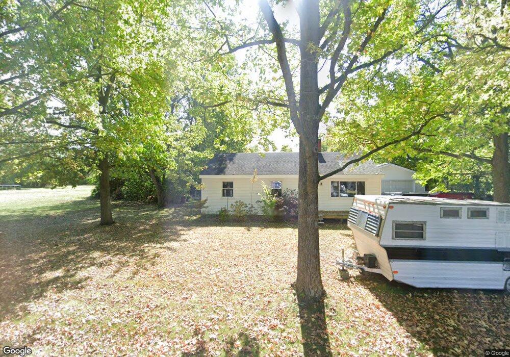
2691 Hustead Rd Springfield, OH 45502
Estimated Value: $185,000 - $217,000
3
Beds
1
Bath
1,296
Sq Ft
$160/Sq Ft
Est. Value
About This Home
This home is located at 2691 Hustead Rd, Springfield, OH 45502 and is currently estimated at $206,937, approximately $159 per square foot. 2691 Hustead Rd is a home located in Clark County with nearby schools including Greenon Elementary School, Greenon Jr. High School, and Greenon High School.
Ownership History
Date
Name
Owned For
Owner Type
Purchase Details
Closed on
Jul 6, 2006
Sold by
Sauer Spariosu Marcia and Spariosu John
Bought by
Taylor Richard A and Richlen Coltrane W
Current Estimated Value
Purchase Details
Closed on
Mar 5, 2003
Sold by
Lowe Norman R
Bought by
Sauer-Spariosu Marcia
Purchase Details
Closed on
Jan 31, 2002
Sold by
Kincaid Virginia E
Bought by
Lowe Norman R and Lowe Ladonna K
Create a Home Valuation Report for This Property
The Home Valuation Report is an in-depth analysis detailing your home's value as well as a comparison with similar homes in the area
Purchase History
| Date | Buyer | Sale Price | Title Company |
|---|---|---|---|
| Taylor Richard A | -- | None Available | |
| Sauer-Spariosu Marcia | $92,900 | -- | |
| Lowe Norman R | $61,000 | -- |
Source: Public Records
Tax History
| Year | Tax Paid | Tax Assessment Tax Assessment Total Assessment is a certain percentage of the fair market value that is determined by local assessors to be the total taxable value of land and additions on the property. | Land | Improvement |
|---|---|---|---|---|
| 2025 | $4,321 | $65,630 | $13,500 | $52,130 |
| 2024 | $2,684 | $52,070 | $12,170 | $39,900 |
| 2023 | $4,158 | $52,070 | $12,170 | $39,900 |
| 2022 | $2,725 | $52,070 | $12,170 | $39,900 |
| 2021 | $2,354 | $39,860 | $8,820 | $31,040 |
| 2020 | $2,360 | $39,860 | $8,820 | $31,040 |
| 2019 | $2,392 | $39,860 | $8,820 | $31,040 |
| 2018 | $2,083 | $33,970 | $8,090 | $25,880 |
| 2017 | $2,087 | $33,964 | $8,085 | $25,879 |
| 2016 | $1,819 | $33,964 | $8,085 | $25,879 |
| 2015 | $1,707 | $30,720 | $7,350 | $23,370 |
| 2014 | $1,710 | $30,720 | $7,350 | $23,370 |
| 2013 | $1,431 | $29,218 | $7,350 | $21,868 |
Source: Public Records
Map
Nearby Homes
- 2531 W Jackson Rd
- Tract 3 W Jackson Rd
- Tract 2 W Jackson Rd
- 5152 S Tecumseh Rd
- 1448 W Sparrow Rd
- 3864 Quailhollow Ct
- 0 Xenia Ave Unit 934833
- 0 Xenia Ave Unit 1038888
- 414 W Sparrow Rd
- 6155 Springfield Jamestown Rd
- 2170 Fairfield Pike
- 115 W Whiteman St
- 517 Iris Dr
- 524 Iris Dr
- 117 E North College St
- 535 Iris Dr
- 435 Snowdrop Dr
- 420 W Whiteman St
- 140 Kenneth Hamilton Way
- 134 Kenneth Hamilton Way
- 2643 Hustead Rd
- 2727 Hustead Rd
- 2678 Hustead Rd
- 2734 Hustead Rd
- 2644 Hustead Rd
- 2751 Hustead Rd
- 2656 Hustead Rd
- 2591 Hustead Rd
- 2592 Hustead Rd
- 2837 Hustead Rd
- 2537 Hustead Rd
- 2531 Hustead Rd
- 2915 Hustead Rd
- 2586 Hustead Rd
- 6045 Springfield Xenia Rd
- 6149 Springfield Xenia Rd
- 2942 Hustead Rd
- 6035 Springfield Xenia Rd
- 2521 Hustead Rd
- 2939 Hustead Rd
Your Personal Tour Guide
Ask me questions while you tour the home.