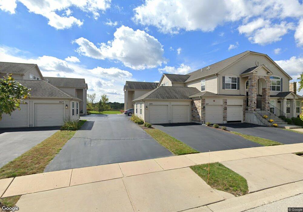
2691 Maple Cir Unit 1 West Dundee, IL 60118
Estimated Value: $295,656 - $343,000
2
Beds
--
Bath
1,805
Sq Ft
$183/Sq Ft
Est. Value
About This Home
This home is located at 2691 Maple Cir Unit 1, West Dundee, IL 60118 and is currently estimated at $329,914, approximately $182 per square foot. 2691 Maple Cir Unit 1 is a home located in Kane County with nearby schools including Dundee Highlands Elementary School, Dundee Middle School, and West Prairie Middle School.
Ownership History
Date
Name
Owned For
Owner Type
Purchase Details
Closed on
Mar 11, 2005
Sold by
Grand Pointe Meadows Llc
Bought by
Green Robert B and Green Joan E
Current Estimated Value
Home Financials for this Owner
Home Financials are based on the most recent Mortgage that was taken out on this home.
Original Mortgage
$207,800
Outstanding Balance
$104,580
Interest Rate
5.5%
Mortgage Type
Purchase Money Mortgage
Estimated Equity
$225,334
Create a Home Valuation Report for This Property
The Home Valuation Report is an in-depth analysis detailing your home's value as well as a comparison with similar homes in the area
Home Values in the Area
Average Home Value in this Area
Purchase History
| Date | Buyer | Sale Price | Title Company |
|---|---|---|---|
| Green Robert B | $262,500 | Ticor Title Insurance Co |
Source: Public Records
Mortgage History
| Date | Status | Borrower | Loan Amount |
|---|---|---|---|
| Open | Green Robert B | $207,800 |
Source: Public Records
Tax History Compared to Growth
Tax History
| Year | Tax Paid | Tax Assessment Tax Assessment Total Assessment is a certain percentage of the fair market value that is determined by local assessors to be the total taxable value of land and additions on the property. | Land | Improvement |
|---|---|---|---|---|
| 2024 | $5,574 | $84,386 | $8,371 | $76,015 |
| 2023 | $5,128 | $75,928 | $7,532 | $68,396 |
| 2022 | $5,168 | $69,666 | $7,532 | $62,134 |
| 2021 | $4,816 | $65,779 | $7,112 | $58,667 |
| 2020 | $4,843 | $64,300 | $6,952 | $57,348 |
| 2019 | $4,652 | $61,041 | $6,600 | $54,441 |
| 2018 | $4,250 | $55,563 | $6,469 | $49,094 |
| 2017 | $4,825 | $60,454 | $6,051 | $54,403 |
| 2016 | $4,893 | $58,534 | $5,859 | $52,675 |
| 2015 | -- | $50,929 | $5,490 | $45,439 |
| 2014 | -- | $49,522 | $5,338 | $44,184 |
| 2013 | -- | $54,933 | $5,501 | $49,432 |
Source: Public Records
Map
Nearby Homes
- 36W461 Binnie Rd
- 36W340 Huntley Rd
- 1601 Higgins Rd
- 36W690 Winding Trail
- 8022 Sierra Woods Ln Unit 8022
- 6850 Huntley Rd
- lot 009 Huntley Rd
- 8304 Sierra Woods Ln Unit 8304
- 2742 Connolly Ln
- 1715 W Main St
- Marianne Plan at Hickory Glen
- Charlotte Plan at Hickory Glen
- 812 Lindsay Ln
- 822 Lindsay Ln
- 814 Lindsay Ln
- 816 Lindsay Ln
- 813 Lindsay Ln
- 825 Lindsay Ln
- 818 Lindsay Ln
- 2857 Bristol Ct
- 2693 Maple Cir Unit 2
- 2697 Maple Cir Unit 4
- 2695 Maple Cir Unit 3
- 2691 Acorn Ct Unit 1
- 2675 Maple Cir Unit 3
- 2671 Maple Cir Unit 1
- 2673 Maple Cir Unit 2
- 2677 Maple Cir Unit 4
- 2677 Maple Cir Unit 2677
- 2628 Maple Cir Unit 4
- 2624 Maple Cir Unit 2
- 2626 Maple Cir Unit 3
- 2685 Acorn Ct Unit 3
- 2622 Maple Cir Unit 1
- 2683 Acorn Ct Unit 2
- 2683 Acorn Ct Unit B
- 2681 Acorn Ct Unit 1
- 2686 Acorn Ct Unit 4
- 2684 Acorn Ct Unit 1
- 2684 Acorn Ct Unit 3