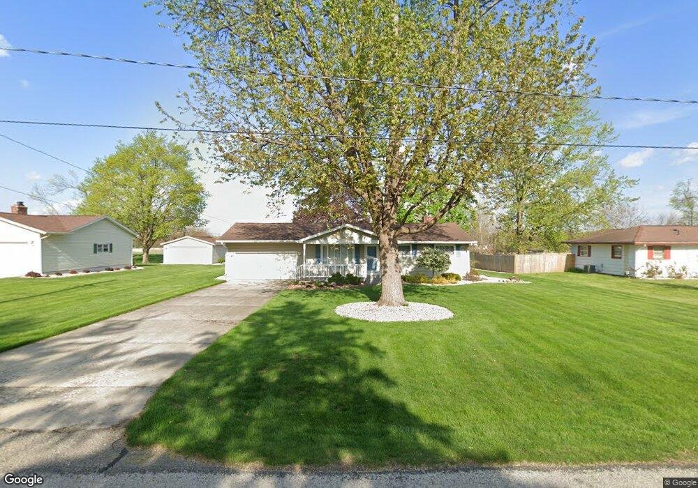
2693 Prairie Dr Adrian, MI 49221
Estimated Value: $207,000 - $226,000
3
Beds
1
Bath
1,210
Sq Ft
$178/Sq Ft
Est. Value
About This Home
This home is located at 2693 Prairie Dr, Adrian, MI 49221 and is currently estimated at $215,138, approximately $177 per square foot. 2693 Prairie Dr is a home located in Lenawee County with nearby schools including Adrian High School, Berean Baptist Academy, and St. Stephen Lutheran School.
Ownership History
Date
Name
Owned For
Owner Type
Purchase Details
Closed on
Jul 6, 2006
Sold by
Emery Charles H
Bought by
Emery Charles H and Emery Gloria J
Current Estimated Value
Home Financials for this Owner
Home Financials are based on the most recent Mortgage that was taken out on this home.
Original Mortgage
$88,000
Interest Rate
6.72%
Mortgage Type
New Conventional
Purchase Details
Closed on
Jun 29, 2006
Sold by
Emery Charles H
Bought by
Emery Charles H and Emery Gloria J
Home Financials for this Owner
Home Financials are based on the most recent Mortgage that was taken out on this home.
Original Mortgage
$88,000
Interest Rate
6.72%
Mortgage Type
New Conventional
Create a Home Valuation Report for This Property
The Home Valuation Report is an in-depth analysis detailing your home's value as well as a comparison with similar homes in the area
Home Values in the Area
Average Home Value in this Area
Purchase History
| Date | Buyer | Sale Price | Title Company |
|---|---|---|---|
| Emery Charles H | -- | None Available | |
| Emery Charles H | -- | None Available |
Source: Public Records
Mortgage History
| Date | Status | Borrower | Loan Amount |
|---|---|---|---|
| Closed | Emery Charles H | $88,000 |
Source: Public Records
Tax History
| Year | Tax Paid | Tax Assessment Tax Assessment Total Assessment is a certain percentage of the fair market value that is determined by local assessors to be the total taxable value of land and additions on the property. | Land | Improvement |
|---|---|---|---|---|
| 2025 | $1,996 | $98,200 | $0 | $0 |
| 2024 | $12 | $89,200 | $0 | $0 |
| 2023 | $1,851 | $76,800 | $0 | $0 |
| 2022 | $1,816 | $70,600 | $0 | $0 |
| 2021 | $1,816 | $68,000 | $0 | $0 |
| 2020 | $1,815 | $69,300 | $0 | $0 |
| 2019 | $157,082 | $58,900 | $0 | $0 |
| 2018 | $1,760 | $58,948 | $0 | $0 |
| 2017 | $1,697 | $58,625 | $0 | $0 |
| 2016 | $1,632 | $55,608 | $0 | $0 |
| 2014 | -- | $51,431 | $0 | $0 |
Source: Public Records
Map
Nearby Homes
- 2673 Airport Rd
- 2303 Lakewood Dr
- 1637 Rivers Edge Ct
- 1639 Rivers Edge Ct
- 1641 Rivers Edge Ct
- 809 Missouri River Dr
- 909 Savannah River Dr
- 2012 Green Acres Dr
- 2029 Green Acres Dr
- 2018 Green Acres Dr
- 2010 Green Acres Dr
- 2008 Green Acres Dr
- 2016 Green Acres Dr
- 2026 Green Acres Dr
- 2004 Green Acres Dr
- 521 Rio Grande Dr
- 2455 W Cadmus Rd
- 301 Hidden River Dr
- 217 Red River Dr
- 1062 Oram Dr
- 2675 Prairie Dr
- 2713 Prairie Dr
- 2694 Prairie Dr
- 2676 Prairie Dr
- 2712 Prairie Dr
- 2657 Prairie Dr
- 2731 Prairie Dr
- 2730 Prairie Dr
- 2641 Prairie Dr
- 2641 Prairie Dr Unit PRAIRIE
- 2642 Prairie Dr
- 2749 Prairie Dr
- 2748 Prairie Dr
- 2797 Eunice Cir
- 2795 Eunice Cir
- 2767 Prairie Dr
- 2793 Eunice Cir
- 2624 Prairie Dr
- 2791 Eunice Cir
- 2801 Eunice Cir
Your Personal Tour Guide
Ask me questions while you tour the home.