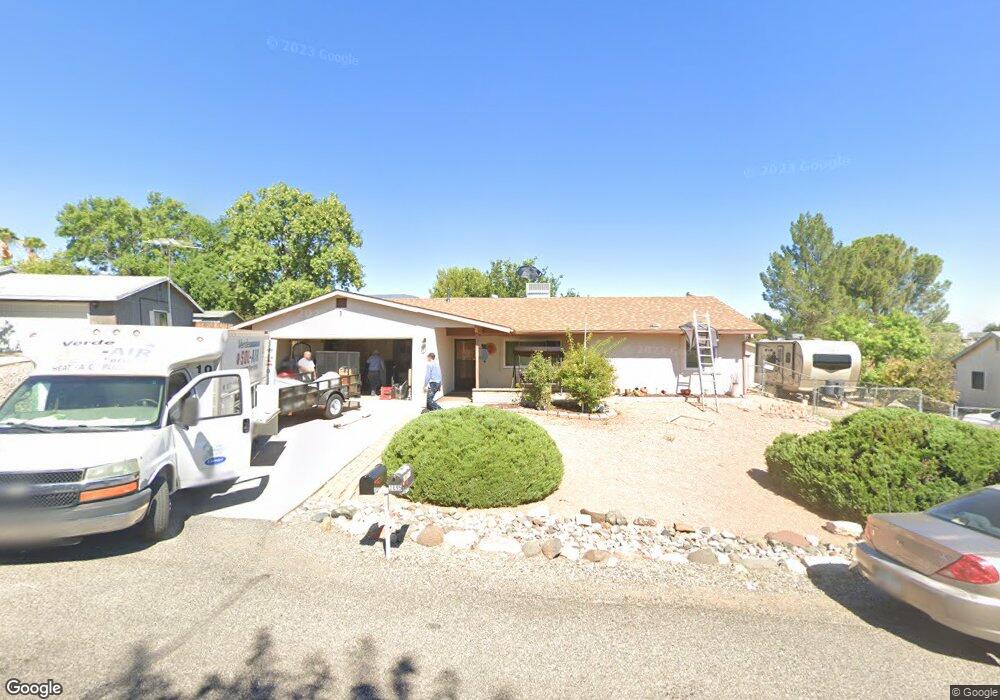
2694 S Mesa Ln Cottonwood, AZ 86326
Estimated Value: $354,000 - $377,000
2
Beds
2
Baths
1,226
Sq Ft
$297/Sq Ft
Est. Value
About This Home
This home is located at 2694 S Mesa Ln, Cottonwood, AZ 86326 and is currently estimated at $364,674, approximately $297 per square foot. 2694 S Mesa Ln is a home located in Yavapai County with nearby schools including Dr Daniel Bright Elementary School, Cottonwood Elementary School, and Cottonwood Community School.
Ownership History
Date
Name
Owned For
Owner Type
Purchase Details
Closed on
May 25, 2016
Sold by
Norton Robert D and Norton Kathleen K
Bought by
Blount Robert F
Current Estimated Value
Home Financials for this Owner
Home Financials are based on the most recent Mortgage that was taken out on this home.
Original Mortgage
$181,491
Outstanding Balance
$144,479
Interest Rate
3.66%
Mortgage Type
New Conventional
Estimated Equity
$220,195
Purchase Details
Closed on
Mar 16, 2004
Sold by
Randall Marian A
Bought by
Norton Robert D and Norton Kathleen K
Home Financials for this Owner
Home Financials are based on the most recent Mortgage that was taken out on this home.
Original Mortgage
$105,600
Interest Rate
5.64%
Mortgage Type
New Conventional
Purchase Details
Closed on
Aug 4, 1995
Sold by
Tartar Raymond W and Tartar Ava L
Bought by
Randall Loy M and Randall Marian A
Create a Home Valuation Report for This Property
The Home Valuation Report is an in-depth analysis detailing your home's value as well as a comparison with similar homes in the area
Home Values in the Area
Average Home Value in this Area
Purchase History
| Date | Buyer | Sale Price | Title Company |
|---|---|---|---|
| Blount Robert F | $176,500 | Lawyers Title Yavapai | |
| Norton Robert D | $132,000 | Yavapai Title Agency | |
| Randall Loy M | $87,000 | Yavapai Coconino Title Agenc |
Source: Public Records
Mortgage History
| Date | Status | Borrower | Loan Amount |
|---|---|---|---|
| Open | Blount Robert F | $181,491 | |
| Previous Owner | Norton Robert D | $105,600 |
Source: Public Records
Tax History Compared to Growth
Tax History
| Year | Tax Paid | Tax Assessment Tax Assessment Total Assessment is a certain percentage of the fair market value that is determined by local assessors to be the total taxable value of land and additions on the property. | Land | Improvement |
|---|---|---|---|---|
| 2026 | $1,340 | $27,389 | -- | -- |
| 2024 | $1,288 | $26,698 | -- | -- |
| 2023 | $1,288 | $21,607 | $0 | $0 |
| 2022 | $1,266 | $17,759 | $2,854 | $14,905 |
| 2021 | $1,322 | $16,826 | $2,985 | $13,841 |
| 2020 | $1,298 | $0 | $0 | $0 |
| 2019 | $1,275 | $0 | $0 | $0 |
| 2018 | $1,223 | $0 | $0 | $0 |
| 2017 | $1,170 | $0 | $0 | $0 |
| 2016 | $1,140 | $0 | $0 | $0 |
| 2015 | $1,128 | $0 | $0 | $0 |
| 2014 | -- | $0 | $0 | $0 |
Source: Public Records
Map
Nearby Homes
- 2713 S Rio Verde Dr
- 2780 S Rio Verde Dr
- 4359 E Butte Dr
- 4249 E Vista Dr
- 2527 S Rio Verde Dr
- 2649 S Village Dr
- 4252 Canyon Trail
- 4253 E Mission Ln
- 1750 Highway 260
- 2362 S Lariat Cir
- 2366 Eastern Dr
- 2320 S Eastern Dr Unit 669
- 2743 Yuma Cir
- 2319 S Eastern Dr Unit 670
- 2306 S Eastern Dr
- 3619 Western Dr
- 2234 S Eastern Dr
- 4000 E Mustang Dr
- 3556 Grand View Dr
- 3568 Hogan Cir