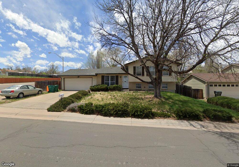
2695 S Norfolk St Aurora, CO 80013
Kingsborough NeighborhoodEstimated Value: $458,050 - $505,000
4
Beds
2
Baths
1,764
Sq Ft
$274/Sq Ft
Est. Value
About This Home
This home is located at 2695 S Norfolk St, Aurora, CO 80013 and is currently estimated at $483,263, approximately $273 per square foot. 2695 S Norfolk St is a home located in Arapahoe County with nearby schools including Yale Elementary School, Columbia Middle School, and Rangeview High School.
Ownership History
Date
Name
Owned For
Owner Type
Purchase Details
Closed on
Mar 20, 2013
Sold by
Duncan Elizabeth L and Estate Of Herman M Duncan
Bought by
Espinosa Peter J
Current Estimated Value
Home Financials for this Owner
Home Financials are based on the most recent Mortgage that was taken out on this home.
Original Mortgage
$171,000
Outstanding Balance
$121,107
Interest Rate
3.62%
Mortgage Type
New Conventional
Estimated Equity
$362,157
Purchase Details
Closed on
Jul 4, 1776
Bought by
Conversion Arapco
Create a Home Valuation Report for This Property
The Home Valuation Report is an in-depth analysis detailing your home's value as well as a comparison with similar homes in the area
Home Values in the Area
Average Home Value in this Area
Purchase History
| Date | Buyer | Sale Price | Title Company |
|---|---|---|---|
| Espinosa Peter J | $180,000 | Land Title Guarantee Company | |
| Conversion Arapco | -- | -- |
Source: Public Records
Mortgage History
| Date | Status | Borrower | Loan Amount |
|---|---|---|---|
| Open | Espinosa Peter J | $171,000 |
Source: Public Records
Tax History Compared to Growth
Tax History
| Year | Tax Paid | Tax Assessment Tax Assessment Total Assessment is a certain percentage of the fair market value that is determined by local assessors to be the total taxable value of land and additions on the property. | Land | Improvement |
|---|---|---|---|---|
| 2024 | $3,041 | $32,716 | -- | -- |
| 2023 | $3,041 | $32,716 | $0 | $0 |
| 2022 | $2,447 | $24,373 | $0 | $0 |
| 2021 | $2,526 | $24,373 | $0 | $0 |
| 2020 | $2,564 | $24,625 | $0 | $0 |
| 2019 | $2,550 | $24,625 | $0 | $0 |
| 2018 | $2,215 | $20,945 | $0 | $0 |
| 2017 | $1,927 | $20,945 | $0 | $0 |
| 2016 | $1,585 | $16,875 | $0 | $0 |
| 2015 | $1,530 | $16,875 | $0 | $0 |
| 2014 | -- | $10,595 | $0 | $0 |
| 2013 | -- | $12,940 | $0 | $0 |
Source: Public Records
Map
Nearby Homes
- 2822 S Mobile St
- 2832 S Mobile St
- 16570 E Lasalle Place
- 2884 S Mobile St
- 16497 E Vassar Ave
- 2497 S Mobile St
- 2615 S Laredo Ct
- 16215 E Brunswick Dr
- 16341 E Bates Dr
- 16879 E Amherst Ave
- 2463 S Memphis Way
- 2493 S Kalispell Cir
- 2515 S Pagosa St
- 16096 E Columbia Place
- 2215 S Buckley Rd Unit 201
- 17307 E Wesley Ave
- 3155 S Norfolk St
- 16026 E Warren Place
- 2318 S Rifle St
- 2490 S Rifle St
- 2693 S Norfolk St
- 2680 S Mobile Way
- 2672 S Mobile Way
- 2685 S Norfolk St
- 16504 E Yale Place
- 2682 S Mobile Way
- 2662 S Mobile Way
- 2683 S Norfolk St
- 16524 E Yale Place
- 16445 E Amherst Ave
- 2660 S Mobile Way
- 16581 E Brown Dr
- 2692 S Mobile Way
- 2673 S Norfolk St
- 16435 E Amherst Ave
- 16465 E Amherst Ave
- 16455 E Amherst Ave
- 16523 E Yale Place
- 16534 E Yale Place
- 16502 E Villanova Place