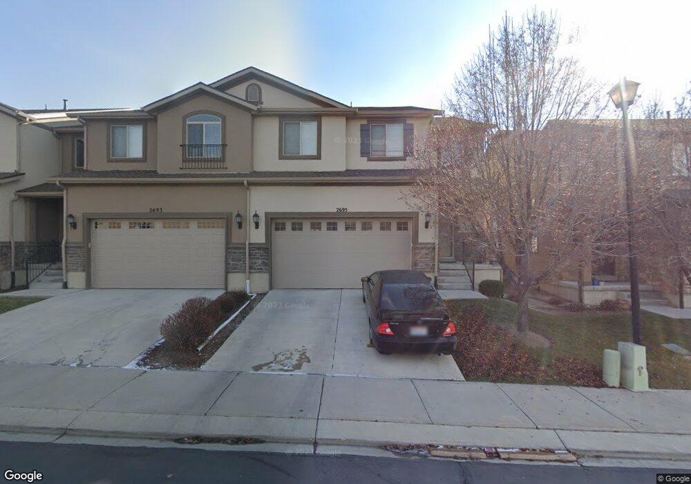
2695 W Maple Dr Lehi, UT 84043
Thanksgiving NeighborhoodEstimated Value: $441,909 - $459,000
3
Beds
2
Baths
1,683
Sq Ft
$266/Sq Ft
Est. Value
About This Home
This home is located at 2695 W Maple Dr, Lehi, UT 84043 and is currently estimated at $447,970, approximately $266 per square foot. 2695 W Maple Dr is a home located in Utah County with nearby schools including Liberty Hills Elementary School, Skyridge High School, and Ascent Academies of Utah - Lehi Campus.
Ownership History
Date
Name
Owned For
Owner Type
Purchase Details
Closed on
Dec 14, 2012
Sold by
D R Horton Inc
Bought by
Giang Jason
Current Estimated Value
Home Financials for this Owner
Home Financials are based on the most recent Mortgage that was taken out on this home.
Original Mortgage
$165,000
Outstanding Balance
$114,210
Interest Rate
3.35%
Mortgage Type
New Conventional
Estimated Equity
$333,760
Purchase Details
Closed on
Nov 21, 2008
Sold by
Castlewood Thanksgiving Point Llc
Bought by
First Utah Bank
Create a Home Valuation Report for This Property
The Home Valuation Report is an in-depth analysis detailing your home's value as well as a comparison with similar homes in the area
Home Values in the Area
Average Home Value in this Area
Purchase History
| Date | Buyer | Sale Price | Title Company |
|---|---|---|---|
| Giang Jason | -- | Provo Land Title Company | |
| Giang Jason | -- | Provo Land Title Co | |
| First Utah Bank | -- | First American Ncs South |
Source: Public Records
Mortgage History
| Date | Status | Borrower | Loan Amount |
|---|---|---|---|
| Open | Giang Jason | $165,000 |
Source: Public Records
Tax History
| Year | Tax Paid | Tax Assessment Tax Assessment Total Assessment is a certain percentage of the fair market value that is determined by local assessors to be the total taxable value of land and additions on the property. | Land | Improvement |
|---|---|---|---|---|
| 2025 | $1,985 | $222,915 | -- | -- |
| 2024 | $1,985 | $232,265 | $0 | $0 |
| 2023 | $1,880 | $238,920 | $0 | $0 |
| 2022 | $1,773 | $218,405 | $0 | $0 |
| 2021 | $1,666 | $310,200 | $83,000 | $227,200 |
| 2020 | $1,636 | $301,200 | $83,000 | $218,200 |
| 2019 | $1,438 | $275,100 | $83,000 | $192,100 |
| 2018 | $1,521 | $275,100 | $83,000 | $192,100 |
| 2017 | $1,470 | $141,405 | $0 | $0 |
| 2016 | $1,356 | $121,000 | $0 | $0 |
| 2015 | $1,357 | $114,950 | $0 | $0 |
| 2014 | $1,241 | $104,500 | $0 | $0 |
Source: Public Records
Map
Nearby Homes
- 2738 W Cottonwood Dr
- 2464 W 2400 N
- 2681 N Elm Dr
- 2238 N 2600 W
- 2242 N 2500 W
- 1454 N Sierra Way
- 2216 N 2500 W
- 2189 N 2600 W
- 2280 N 2350 W
- 2669 N Turnberry Ct
- 1952 N 2600 W
- 3217 W 2450 N
- Huntington Plan at Pioneer Meadows
- Silver Lake Plan at Pioneer Meadows
- Summit Plan at Pioneer Meadows
- Palisade Plan at Pioneer Meadows
- 3288 W 2450 N
- 3301 Cramden Dr
- 1883 N 2280 W
- 1912 W 2250 N
- 2693 W Maple Dr
- 2705 W Maple Dr
- 2691 W Maple Dr
- 2707 W Maple Dr
- 2688 W Cottonwood Dr
- 2692 W Cottonwood Dr
- 2668 W Cottonwood Dr
- 2698 W Cottonwood Dr
- 2663 W Maple Dr
- 2663 W Maple Dr Unit 272
- 2666 W Cottonwood Dr
- 2704 W Cottonwood Dr
- 2731 W Maple Dr
- 2666 Cottonwood Dr
- 2498 N Cypress Way
- 2498 N Cypress Way Unit 247
- 2661 W Maple Dr
- 2661 W Maple Dr Unit 271
- 2708 W Cottonwood Dr
- 2491 N Cypress Way
Your Personal Tour Guide
Ask me questions while you tour the home.