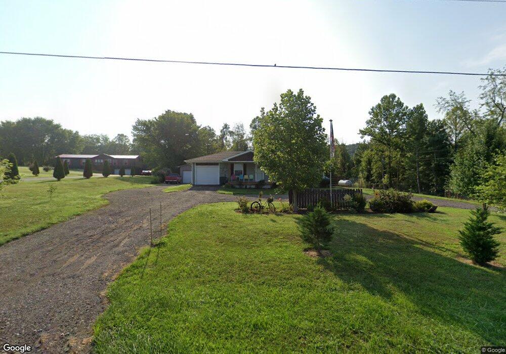
2696 State Route 327 Londonderry, OH 45647
Estimated Value: $177,823 - $237,000
3
Beds
1
Bath
1,040
Sq Ft
$201/Sq Ft
Est. Value
About This Home
This home is located at 2696 State Route 327, Londonderry, OH 45647 and is currently estimated at $208,706, approximately $200 per square foot. 2696 State Route 327 is a home located in Ross County with nearby schools including Southeastern Elementary School, Southeastern Middle School, and Southeastern High School.
Ownership History
Date
Name
Owned For
Owner Type
Purchase Details
Closed on
Jul 24, 2018
Sold by
Slopko John M and Slopko Julie A
Bought by
Valentine Kim
Current Estimated Value
Purchase Details
Closed on
Mar 22, 2018
Sold by
Peters Robert and Us Bank Na
Bought by
Solpko John M and Solpko Julie A
Purchase Details
Closed on
May 11, 2005
Sold by
Mccord Philip D and Mccord Heather L
Bought by
Peters Robert E and Peters Deborah J
Home Financials for this Owner
Home Financials are based on the most recent Mortgage that was taken out on this home.
Original Mortgage
$106,250
Interest Rate
6.32%
Mortgage Type
Adjustable Rate Mortgage/ARM
Create a Home Valuation Report for This Property
The Home Valuation Report is an in-depth analysis detailing your home's value as well as a comparison with similar homes in the area
Home Values in the Area
Average Home Value in this Area
Purchase History
| Date | Buyer | Sale Price | Title Company |
|---|---|---|---|
| Valentine Kim | $121,500 | Northwest Title Box | |
| Solpko John M | $67,000 | None Available | |
| Peters Robert E | $125,000 | None Available |
Source: Public Records
Mortgage History
| Date | Status | Borrower | Loan Amount |
|---|---|---|---|
| Previous Owner | Peters Robert E | $106,250 |
Source: Public Records
Tax History Compared to Growth
Tax History
| Year | Tax Paid | Tax Assessment Tax Assessment Total Assessment is a certain percentage of the fair market value that is determined by local assessors to be the total taxable value of land and additions on the property. | Land | Improvement |
|---|---|---|---|---|
| 2024 | $1,186 | $59,760 | $4,960 | $54,800 |
| 2023 | $1,186 | $45,300 | $4,960 | $40,340 |
| 2022 | $1,547 | $45,300 | $4,960 | $40,340 |
| 2021 | $1,492 | $38,310 | $4,200 | $34,110 |
| 2020 | $1,503 | $38,310 | $4,200 | $34,110 |
| 2019 | $1,504 | $38,310 | $4,200 | $34,110 |
| 2018 | $1,337 | $33,550 | $3,640 | $29,910 |
| 2017 | $1,339 | $33,550 | $3,640 | $29,910 |
| 2016 | $1,306 | $33,550 | $3,640 | $29,910 |
| 2015 | $1,320 | $33,820 | $3,640 | $30,180 |
| 2014 | $1,289 | $33,820 | $3,640 | $30,180 |
| 2013 | $1,295 | $33,820 | $3,640 | $30,180 |
Source: Public Records
Map
Nearby Homes
- 36665 U S 50
- 32120 Fout Rd
- 52753 Ohio 671
- 32905 Graves Rd
- 53430 State Route 671
- 31557 French Rd
- 54038 Old Route 50
- 30129 Steven Branch Rd
- 667 Bronx Corner Rd
- 587 John W Barbee Rd
- 0 Three Locks Rd
- 0 Woodruff Rd
- 26702 E Fork Rd
- 0 State Route 327 Unit 225031635
- 0 Ponetown Rd
- 1587 St Rt 35
- 498 Schrader Rd
- 108 Lane Dr
- 0 Hutt Rd
- 2696 Ohio 327
- 2740 Ohio 327
- 2740 State Route 327
- 2615 State Route 327
- 2800 State Route 327
- 2618 Ohio 327
- 2467 State Route 327
- 2618 State Route 327
- 207 Blue Lick Rd
- 2457 State Route 327
- 2943 State Route 327
- 2415 State Route 327
- 2379 Ohio 327
- 2145 Ohio 327
- 340 Blue Lick Rd
- 340 Blue Lick Rd
- 2273 State Route 327
- 396 Blue Lick Rd
- 2212 State Route 327
- 2253 State Route 327