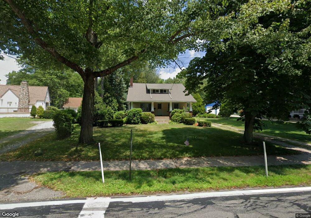
26970 Butternut Ridge Rd North Olmsted, OH 44070
Estimated Value: $268,000 - $302,000
3
Beds
2
Baths
1,710
Sq Ft
$169/Sq Ft
Est. Value
About This Home
This home is located at 26970 Butternut Ridge Rd, North Olmsted, OH 44070 and is currently estimated at $288,429, approximately $168 per square foot. 26970 Butternut Ridge Rd is a home located in Cuyahoga County with nearby schools including Pine Intermediate School, Chestnut Intermediate Elementary School, and North Olmsted Middle School.
Ownership History
Date
Name
Owned For
Owner Type
Purchase Details
Closed on
Aug 31, 2007
Sold by
Pongrass Dolores J
Bought by
Pongrass Dolores J
Current Estimated Value
Purchase Details
Closed on
Apr 3, 1985
Sold by
Pongrass Elmer G and D J
Bought by
Elmer G Pongrass
Purchase Details
Closed on
Jan 1, 1975
Bought by
Pongrass Elmer G and D J
Create a Home Valuation Report for This Property
The Home Valuation Report is an in-depth analysis detailing your home's value as well as a comparison with similar homes in the area
Home Values in the Area
Average Home Value in this Area
Purchase History
| Date | Buyer | Sale Price | Title Company |
|---|---|---|---|
| Pongrass Dolores J | -- | None Available | |
| Elmer G Pongrass | -- | -- | |
| Pongrass Elmer G | -- | -- |
Source: Public Records
Tax History Compared to Growth
Tax History
| Year | Tax Paid | Tax Assessment Tax Assessment Total Assessment is a certain percentage of the fair market value that is determined by local assessors to be the total taxable value of land and additions on the property. | Land | Improvement |
|---|---|---|---|---|
| 2024 | $5,301 | $87,150 | $21,000 | $66,150 |
| 2023 | $4,177 | $60,310 | $16,840 | $43,470 |
| 2022 | $4,189 | $60,310 | $16,840 | $43,470 |
| 2021 | $3,791 | $60,310 | $16,840 | $43,470 |
| 2020 | $3,344 | $49,040 | $13,690 | $35,350 |
| 2019 | $3,255 | $140,100 | $39,100 | $101,000 |
| 2018 | $3,058 | $49,040 | $13,690 | $35,350 |
| 2017 | $2,863 | $40,920 | $12,010 | $28,910 |
| 2016 | $2,838 | $40,920 | $12,010 | $28,910 |
| 2015 | $2,782 | $40,920 | $12,010 | $28,910 |
| 2014 | $2,782 | $40,110 | $11,760 | $28,350 |
Source: Public Records
Map
Nearby Homes
- 26902 Butternut Ridge Rd
- 274 Vista Cir Unit B
- 27693 Butternut Ridge
- 385 Vista Cir
- 31 Vista Cir Unit A
- 8 Golf View Ln
- 5943 Porter Rd
- 26726 Leenders Ln
- 5248 W Park Dr
- 25735 Lorain Rd Unit 218
- 25735 Lorain Rd Unit 121
- 5399 Berkshire Dr
- 4553 Porter Rd
- 4429 Canterbury Rd
- 25118 Carey Ln
- 27504 Cottonwood Trail
- 5032 Devon Dr
- 6096 Sherwood Dr
- 6427 Mackenzie Rd
- VANDERBURGH Plan at Olmsted - Sanctuary of
- 26944 Butternut Ridge Rd
- 26994 Butternut Ridge Rd
- 26926 Butternut Ridge Rd
- 26926 Butternut Ridge 3bac
- 27010 Butternut Ridge Rd
- 27040 Butternut Ridge Rd
- 26971 Butternut Ridge Rd
- 26937 Butternut Ridge Rd
- 26872 Butternut Ridge Rd
- 26995 Butternut Ridge Rd
- 27011 Butternut Ridge Rd
- 26885 Butternut Ridge Rd
- 27060 Butternut Ridge Rd
- 27041 Butternut Ridge Rd
- 26840 Butternut Ridge Rd
- 26863 Butternut Ridge Rd
- 27053 Butternut Ridge Rd
- 5468 Fitch Rd
- 27082 Butternut Ridge Rd
- 5459 Fitch Rd