Estimated Value: $2,343,625 - $2,764,000
4
Beds
5
Baths
3,990
Sq Ft
$635/Sq Ft
Est. Value
About This Home
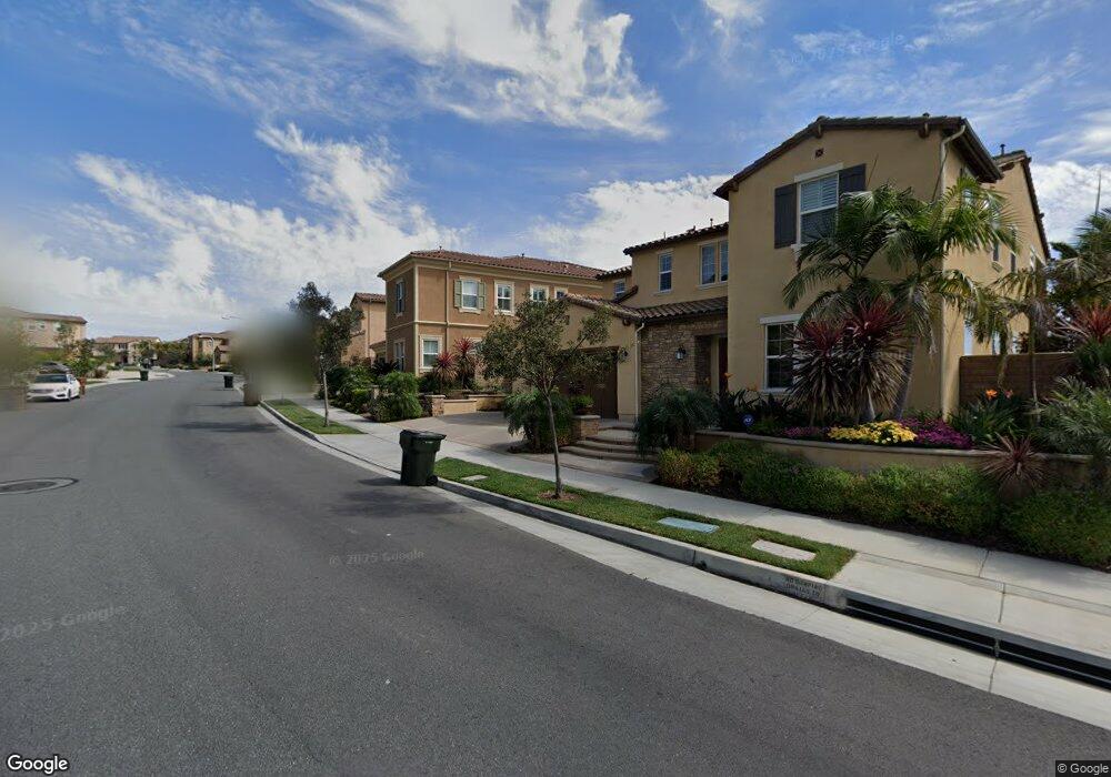
This home is located at 2698 E Ojai Dr, Brea, CA 92821 and is currently estimated at $2,533,906, approximately $635 per square foot. 2698 E Ojai Dr is a home with nearby schools including Olinda Elementary School, Brea Junior High School, and Brea-Olinda High School.
Ownership History
Date
Name
Owned For
Owner Type
Purchase Details
Closed on
Mar 25, 2022
Sold by
Hong Ling Edmund Oy
Bought by
Ling Family Revocable Trust
Current Estimated Value
Purchase Details
Closed on
Apr 23, 2013
Sold by
Shea Tonner Hills Llc
Bought by
Ling Edmund and Ling Erica
Home Financials for this Owner
Home Financials are based on the most recent Mortgage that was taken out on this home.
Original Mortgage
$625,500
Interest Rate
4.51%
Mortgage Type
New Conventional
Create a Home Valuation Report for This Property
The Home Valuation Report is an in-depth analysis detailing your home's value as well as a comparison with similar homes in the area
Home Values in the Area
Average Home Value in this Area
Purchase History
| Date | Buyer | Sale Price | Title Company |
|---|---|---|---|
| Ling Family Revocable Trust | -- | Law Offices Of Bernard Pang | |
| Ling Edmund | $1,296,000 | Fidelity National Title Co |
Source: Public Records
Mortgage History
| Date | Status | Borrower | Loan Amount |
|---|---|---|---|
| Previous Owner | Ling Edmund | $625,500 |
Source: Public Records
Tax History
| Year | Tax Paid | Tax Assessment Tax Assessment Total Assessment is a certain percentage of the fair market value that is determined by local assessors to be the total taxable value of land and additions on the property. | Land | Improvement |
|---|---|---|---|---|
| 2025 | $18,970 | $1,588,479 | $778,848 | $809,631 |
| 2024 | $18,970 | $1,557,333 | $763,577 | $793,756 |
| 2023 | $18,463 | $1,526,798 | $748,605 | $778,193 |
| 2022 | $18,286 | $1,496,861 | $733,926 | $762,935 |
| 2021 | $17,938 | $1,467,511 | $719,535 | $747,976 |
| 2020 | $17,802 | $1,452,464 | $712,157 | $740,307 |
| 2019 | $17,319 | $1,423,985 | $698,193 | $725,792 |
| 2018 | $17,050 | $1,396,064 | $684,503 | $711,561 |
| 2017 | $16,723 | $1,368,691 | $671,082 | $697,609 |
| 2016 | $16,387 | $1,341,854 | $657,923 | $683,931 |
| 2015 | $16,153 | $1,321,699 | $648,041 | $673,658 |
| 2014 | $15,693 | $1,295,809 | $635,347 | $660,462 |
Source: Public Records
Map
Nearby Homes
- 520 N Bardsdale Place
- 2761 E Stearns St
- 2583 Sandpebble Ln
- 3112 E Piru Ln
- 198 Sunflower St
- 3174 E Piru Ln
- 3200 E Santa fe Rd
- 2257 Shadetree Cir
- 2418 Rainbow Ln
- 2304 Carrotwood Dr
- 136 Donnybrook Rd
- 341 Adalina Ln
- 2440 Sanabria Ln
- 404 Condor Ave
- 1975 Heather Cir
- 570 Olive Ave
- 220 Buena Vida Dr Unit 308
- 409 Mallorca Ln
- 3408 Urbana Ln
- 3378 Merida Ln
- 2710 E Ojai Dr
- 2686 E Ojai Dr
- 2722 E Ojai Dr
- 2674 E Ojai Dr
- 2697 E Ojai Dr
- 2705 E Ojai Dr
- 2683 E Ojai Dr
- 2719 E Ojai Dr
- 2734 E Ojai Dr
- 2662 E Ojai Dr
- 2669 E Ojai Dr
- 2746 E Ojai Dr
- 2640 E Ojai Dr
- 2641 E Ojai Dr
- 2758 E Ojai Dr
- 2628 E Ojai Dr
- 2799 E Ojai Dr
- 2625 E Ojai Dr
- 2722 E Temblor Ranch Dr
- 2708 E Temblor Ranch Dr
Your Personal Tour Guide
Ask me questions while you tour the home.