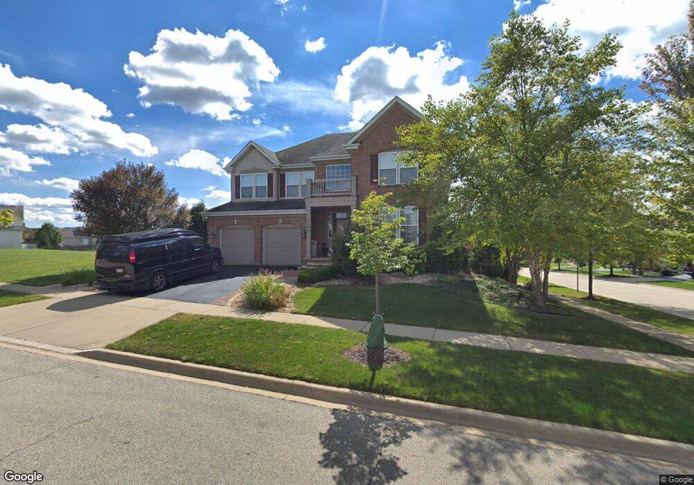
2699 Spruce Dr Unit 2 West Dundee, IL 60118
Estimated Value: $555,440 - $619,000
4
Beds
--
Bath
3,320
Sq Ft
$175/Sq Ft
Est. Value
About This Home
This home is located at 2699 Spruce Dr Unit 2, West Dundee, IL 60118 and is currently estimated at $581,610, approximately $175 per square foot. 2699 Spruce Dr Unit 2 is a home located in Kane County with nearby schools including Dundee Highlands Elementary School, Dundee Middle School, and West Prairie Middle School.
Ownership History
Date
Name
Owned For
Owner Type
Purchase Details
Closed on
Jan 26, 2005
Sold by
Grand Pointe Meadows Llc
Bought by
Beauchamp Bradley G and Beauchamp Melissa R
Current Estimated Value
Home Financials for this Owner
Home Financials are based on the most recent Mortgage that was taken out on this home.
Original Mortgage
$327,500
Outstanding Balance
$166,682
Interest Rate
5.77%
Mortgage Type
Purchase Money Mortgage
Estimated Equity
$414,928
Create a Home Valuation Report for This Property
The Home Valuation Report is an in-depth analysis detailing your home's value as well as a comparison with similar homes in the area
Home Values in the Area
Average Home Value in this Area
Purchase History
| Date | Buyer | Sale Price | Title Company |
|---|---|---|---|
| Beauchamp Bradley G | $409,500 | Ticor Title Insurance Co |
Source: Public Records
Mortgage History
| Date | Status | Borrower | Loan Amount |
|---|---|---|---|
| Open | Beauchamp Bradley G | $327,500 | |
| Closed | Beauchamp Bradley G | $40,950 |
Source: Public Records
Tax History Compared to Growth
Tax History
| Year | Tax Paid | Tax Assessment Tax Assessment Total Assessment is a certain percentage of the fair market value that is determined by local assessors to be the total taxable value of land and additions on the property. | Land | Improvement |
|---|---|---|---|---|
| 2024 | $12,823 | $165,322 | $25,730 | $139,592 |
| 2023 | $12,045 | $148,751 | $23,151 | $125,600 |
| 2022 | $11,423 | $135,664 | $23,151 | $112,513 |
| 2021 | $11,032 | $128,094 | $21,859 | $106,235 |
| 2020 | $10,832 | $125,215 | $21,368 | $103,847 |
| 2019 | $11,182 | $126,288 | $20,285 | $106,003 |
| 2018 | $12,161 | $133,513 | $19,883 | $113,630 |
| 2017 | $11,599 | $124,896 | $18,600 | $106,296 |
| 2016 | $10,437 | $120,929 | $18,009 | $102,920 |
| 2015 | $10,453 | $121,457 | $21,296 | $100,161 |
| 2014 | $10,453 | $118,103 | $20,708 | $97,395 |
| 2013 | $10,453 | $121,718 | $21,342 | $100,376 |
Source: Public Records
Map
Nearby Homes
- 36W461 Binnie Rd
- 36W340 Huntley Rd
- 36W690 Winding Trail
- 8022 Sierra Woods Ln Unit 8022
- 6850 Huntley Rd
- lot 009 Huntley Rd
- 8304 Sierra Woods Ln Unit 8304
- 1601 Higgins Rd
- 3404 Green Pastures Rd
- 2052 Orchard Ln Unit 19C5
- 3314 Blue Ridge Dr
- 3434 Blue Ridge Dr
- 35W543 Miller Rd
- Marianne Plan at Hickory Glen
- Charlotte Plan at Hickory Glen
- 1023 Shagbark Ln
- 1031 Shagbark Ln
- 2742 Connolly Ln
- 812 Lindsay Ln
- 822 Lindsay Ln
- 2691 Ash Dr
- 1434 Walnut Dr
- 1432 Walnut Dr
- 1436 Walnut Dr
- 1430 Walnut Dr
- 1438 Walnut Dr
- 2693 Spruce Dr Unit 1
- 2693 Spruce Dr
- 2685 Ash Dr
- 1428 Walnut Dr
- 1440 Walnut Dr
- 2691 Spruce Dr Unit 2
- 1402 Grand Pointe Blvd
- 1400 Grand Pointe Blvd
- 1442 Walnut Dr
- 2689 Spruce Dr
- 1426 Walnut Dr
- 1404 Grand Pointe Blvd
- 1396 Grand Pointe Blvd
- 1406 Grand Pointe Blvd