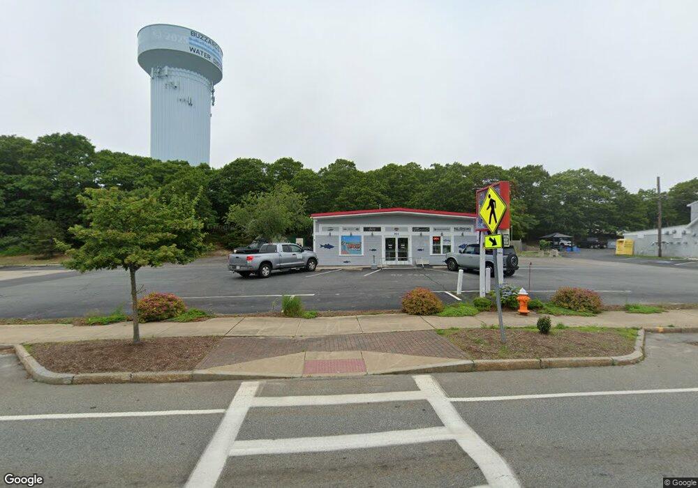
269r Main St Bourne, MA 02532
Buzzards Bay NeighborhoodEstimated Value: $611,205
--
Bed
--
Bath
1,872
Sq Ft
$326/Sq Ft
Est. Value
About This Home
This home is located at 269r Main St, Bourne, MA 02532 and is currently estimated at $611,205, approximately $326 per square foot. 269r Main St is a home located in Barnstable County with nearby schools including Bourne High School and St Margaret Regional School.
Ownership History
Date
Name
Owned For
Owner Type
Purchase Details
Closed on
Dec 7, 2020
Sold by
Gencon Inc
Bought by
Wagner Way Warehouse Hldg
Current Estimated Value
Purchase Details
Closed on
Aug 15, 2019
Sold by
Fantozzi Robert
Bought by
Gencon Inc
Purchase Details
Closed on
Jul 13, 2018
Sold by
269R Main Street Rt and Kinsman
Bought by
Fantozzi Robert
Purchase Details
Closed on
Jan 11, 2011
Sold by
Baird Joseph W and Baird Jerome W
Bought by
269R Main Street Rt and Kinsman
Create a Home Valuation Report for This Property
The Home Valuation Report is an in-depth analysis detailing your home's value as well as a comparison with similar homes in the area
Home Values in the Area
Average Home Value in this Area
Purchase History
| Date | Buyer | Sale Price | Title Company |
|---|---|---|---|
| Wagner Way Warehouse Hldg | -- | None Available | |
| Wagner Way Warehouse Hldg | -- | None Available | |
| Gencon Inc | $350,000 | -- | |
| Gencon Inc | $350,000 | -- | |
| Fantozzi Robert | $320,000 | -- | |
| Fantozzi Robert | $320,000 | -- | |
| 269R Main Street Rt | $120,000 | -- | |
| 269R Main Street Rt | $120,000 | -- |
Source: Public Records
Tax History Compared to Growth
Tax History
| Year | Tax Paid | Tax Assessment Tax Assessment Total Assessment is a certain percentage of the fair market value that is determined by local assessors to be the total taxable value of land and additions on the property. | Land | Improvement |
|---|---|---|---|---|
| 2025 | $2,882 | $369,000 | $283,700 | $85,300 |
| 2024 | $2,818 | $351,400 | $270,200 | $81,200 |
| 2023 | $2,977 | $337,900 | $259,800 | $78,100 |
| 2022 | $3,163 | $313,500 | $244,300 | $69,200 |
| 2021 | $3,274 | $304,000 | $237,200 | $66,800 |
| 2020 | $2,926 | $272,400 | $232,500 | $39,900 |
| 2019 | $2,609 | $248,200 | $228,000 | $20,200 |
| 2018 | $2,516 | $238,700 | $219,200 | $19,500 |
| 2017 | $2,308 | $224,100 | $204,200 | $19,900 |
| 2016 | $2,286 | $225,000 | $204,200 | $20,800 |
| 2015 | $2,266 | $225,000 | $204,200 | $20,800 |
Source: Public Records
Map
Nearby Homes
- 304 Main St
- 17 Maple St
- 38 Old Bridge Rd
- 162 Puritan Rd
- 171 Puritan Rd
- 46 Holt Rd
- 46 Holt Rd Unit A
- 4 Knob Ln
- 151 - 153 Main St
- 41 Lewis Point Rd
- 90-92 Sandwich Rd Unit 9C
- 60 Sandwich Rd
- 90-92 Sandwich Rd Unit 2
- 0 Lewis Point Rd
- 65 Lewis Point Rd
- 73 Lewis Point Rd
- 34 Washington Ave
- 16 Washington Ave
- 44 Cotuit Rd
- 3 Wolf Rd
- 269 Main St
- 269 Main St
- 271 Main St Unit B
- 271 Main St Unit B1
- 271 Main St Unit front
- 271 Main St Unit 2
- 271 Main St Unit 5
- 271 Main St Unit 1
- 271 Main St
- 271 Main St Unit 3
- 271 Main St Unit 4
- 271 Main St Unit B
- 275 Main St
- 52 Cypress St
- 267 Main St
- 283 Main St
- 97 Maple St
- 12 Wagner Way
- 277 Main St
- 277 Main St