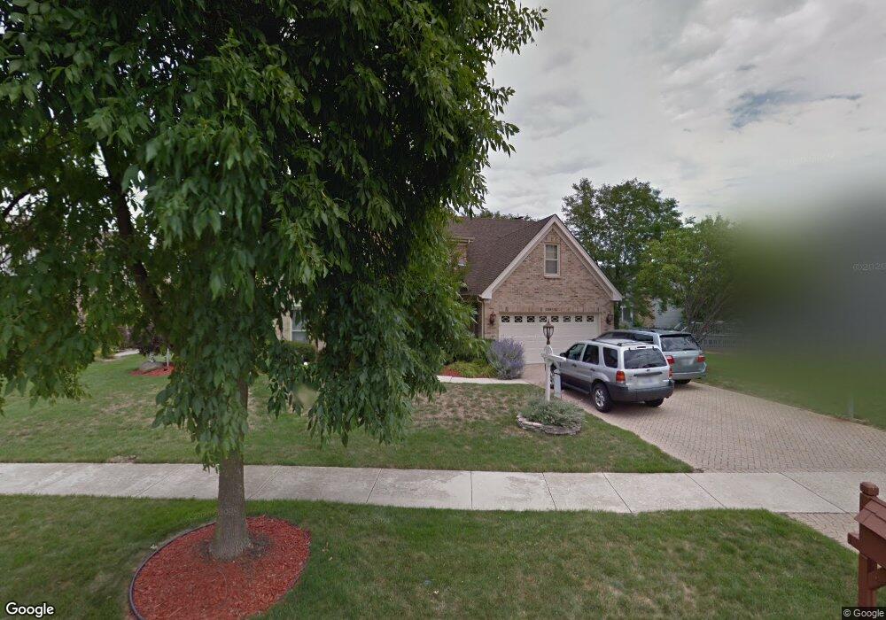
26W130 Pheasant Ct Carol Stream, IL 60188
Estimated Value: $726,232 - $777,000
--
Bed
1
Bath
3,140
Sq Ft
$241/Sq Ft
Est. Value
About This Home
This home is located at 26W130 Pheasant Ct, Carol Stream, IL 60188 and is currently estimated at $755,558, approximately $240 per square foot. 26W130 Pheasant Ct is a home located in DuPage County with nearby schools including Pleasant Hill Elementary School, Monroe Middle School, and Wheaton North High School.
Ownership History
Date
Name
Owned For
Owner Type
Purchase Details
Closed on
Sep 2, 2025
Sold by
Stroner Frederick M and Stroner Jennifer T
Bought by
Stroner Family Revocable Trust and Stroner
Current Estimated Value
Purchase Details
Closed on
Mar 15, 2002
Sold by
Kaskela Paul H and Kaskela Valerie
Bought by
Stroner Frederick M and Stroner Jennifer T
Home Financials for this Owner
Home Financials are based on the most recent Mortgage that was taken out on this home.
Original Mortgage
$249,500
Interest Rate
6.82%
Purchase Details
Closed on
Jul 14, 2000
Sold by
Schuler George J and Schuler Opal L
Bought by
Kaskela Paul H and Kaskela Valerie
Home Financials for this Owner
Home Financials are based on the most recent Mortgage that was taken out on this home.
Original Mortgage
$252,700
Interest Rate
8.31%
Create a Home Valuation Report for This Property
The Home Valuation Report is an in-depth analysis detailing your home's value as well as a comparison with similar homes in the area
Home Values in the Area
Average Home Value in this Area
Purchase History
| Date | Buyer | Sale Price | Title Company |
|---|---|---|---|
| Stroner Family Revocable Trust | -- | None Listed On Document | |
| Stroner Frederick M | $440,000 | -- | |
| Kaskela Paul H | $390,000 | -- |
Source: Public Records
Mortgage History
| Date | Status | Borrower | Loan Amount |
|---|---|---|---|
| Previous Owner | Stroner Frederick M | $249,500 | |
| Previous Owner | Kaskela Paul H | $252,700 |
Source: Public Records
Tax History Compared to Growth
Tax History
| Year | Tax Paid | Tax Assessment Tax Assessment Total Assessment is a certain percentage of the fair market value that is determined by local assessors to be the total taxable value of land and additions on the property. | Land | Improvement |
|---|---|---|---|---|
| 2024 | $12,858 | $211,544 | $51,756 | $159,788 |
| 2023 | $12,329 | $194,720 | $47,640 | $147,080 |
| 2022 | $12,004 | $184,020 | $45,020 | $139,000 |
| 2021 | $11,347 | $179,650 | $43,950 | $135,700 |
| 2020 | $11,174 | $177,980 | $43,540 | $134,440 |
| 2019 | $10,921 | $173,280 | $42,390 | $130,890 |
| 2018 | $11,599 | $181,800 | $39,950 | $141,850 |
| 2017 | $11,390 | $175,100 | $38,480 | $136,620 |
| 2016 | $11,223 | $168,100 | $36,940 | $131,160 |
| 2015 | $11,131 | $160,370 | $35,240 | $125,130 |
| 2014 | $10,549 | $149,840 | $37,120 | $112,720 |
| 2013 | $10,197 | $150,290 | $37,230 | $113,060 |
Source: Public Records
Map
Nearby Homes
- 26W185 Meadowview Ct
- 1N100 Harriet St
- 26W181 Grand Ave
- 1N153 Mission Ct
- 26W130 Prestwick Ln
- 0N 634 Knollwood Dr
- 26W199 Klein Creek Dr
- 1N598 Golf View Ln
- 1N599 Golf View Ln
- 1N607 Golf View Ln
- 0N632 Gables Blvd
- 0N642 Alta Ln
- 26W237 Pinehurst Dr
- S045 Pleasant Hill Rd
- 26W036 Klein Creek Dr Unit 36
- 0N337 Herrick Dr
- 0N510 Gary Ave
- 26W453 Pinehurst Dr
- S071 Leonard St
- 27W130 W Street Charles Rd
- 26W140 Pheasant Ct
- 26W120 Pheasant Ct
- 1N054 Falcon Trail
- 1N066 Falcon Trail
- 26W154 Pheasant Ct
- 26W151 Sandpiper Ct
- 26W141 Sandpiper Ct
- 26W125 Pheasant Ct
- 26W145 Pheasant Ct
- 26W161 Sandpiper Ct Unit 1
- 26W160 Pheasant Ct
- 26W131 Sandpiper Ct
- 26W115 Pheasant Ct Unit 1
- 1N051 Falcon Trail
- 1N061 Falcon Trail
- 26W155 Pheasant Ct
- 26W103 Pheasant Ct
- 26W171 Sandpiper Ct
- 26W170 Pheasant Ct
- 1N103 Falcon Trail