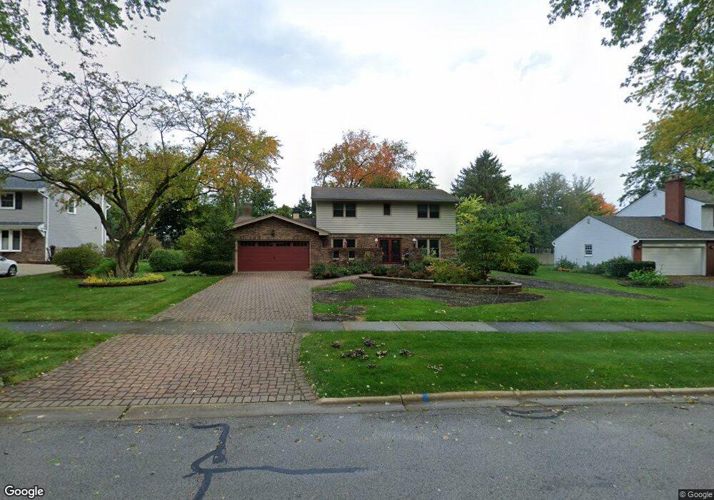
26W344 Menomini Dr Wheaton, IL 60189
Arrowhead NeighborhoodEstimated Value: $576,770 - $676,000
4
Beds
3
Baths
2,172
Sq Ft
$298/Sq Ft
Est. Value
About This Home
This home is located at 26W344 Menomini Dr, Wheaton, IL 60189 and is currently estimated at $646,943, approximately $297 per square foot. 26W344 Menomini Dr is a home located in DuPage County with nearby schools including Wiesbrook Elementary School, Hubble Middle School, and Wheaton Warrenville South High School.
Ownership History
Date
Name
Owned For
Owner Type
Purchase Details
Closed on
Nov 4, 2019
Sold by
Frey Rosemarie Z and Frey Rosemarie C
Bought by
Frey Rosemarie C and Rosemarie C Frey Trust
Current Estimated Value
Purchase Details
Closed on
Sep 29, 1993
Sold by
Frey Carl R
Bought by
Frey Rosemarie Z
Home Financials for this Owner
Home Financials are based on the most recent Mortgage that was taken out on this home.
Original Mortgage
$90,000
Interest Rate
7.05%
Create a Home Valuation Report for This Property
The Home Valuation Report is an in-depth analysis detailing your home's value as well as a comparison with similar homes in the area
Home Values in the Area
Average Home Value in this Area
Purchase History
| Date | Buyer | Sale Price | Title Company |
|---|---|---|---|
| Frey Rosemarie C | -- | Attorney | |
| Frey Rosemarie Z | -- | -- |
Source: Public Records
Mortgage History
| Date | Status | Borrower | Loan Amount |
|---|---|---|---|
| Closed | Frey Rosemarie Z | $90,000 |
Source: Public Records
Tax History Compared to Growth
Tax History
| Year | Tax Paid | Tax Assessment Tax Assessment Total Assessment is a certain percentage of the fair market value that is determined by local assessors to be the total taxable value of land and additions on the property. | Land | Improvement |
|---|---|---|---|---|
| 2024 | $9,103 | $171,945 | $36,134 | $135,811 |
| 2023 | $8,672 | $158,270 | $33,260 | $125,010 |
| 2022 | $8,580 | $149,570 | $31,430 | $118,140 |
| 2021 | $8,302 | $146,020 | $30,680 | $115,340 |
| 2020 | $8,224 | $144,660 | $30,390 | $114,270 |
| 2019 | $8,004 | $140,840 | $29,590 | $111,250 |
| 2018 | $8,030 | $142,020 | $27,880 | $114,140 |
| 2017 | $7,884 | $136,780 | $26,850 | $109,930 |
| 2016 | $7,768 | $131,320 | $25,780 | $105,540 |
| 2015 | $7,694 | $125,280 | $24,590 | $100,690 |
| 2014 | $7,365 | $118,280 | $27,600 | $90,680 |
| 2013 | $7,146 | $118,630 | $27,680 | $90,950 |
Source: Public Records
Map
Nearby Homes
- 26W281 Menomini Dr
- 51 Mitchell Cir
- 1645 Burning Trail Ct
- 212 Hamilton Ln
- 1477 S County Farm Rd Unit 23F
- 1562 Burning Trail
- 1S728 Shaffner Rd
- 1S710 Shaffner Rd
- 27W020 Walz Way
- 1440 Stonebridge Cir Unit J10
- 1601 W Wiesbrook Rd
- 2152 Belleau Woods Dr
- 3S210 Herrick Rd
- 1310 Yorkshire Woods Ct
- 44 Marywood Trail
- 1473 Creekside Dr
- 25W451 Plamondon Rd
- 141 Loretto Ct
- 1040 Creekside Dr Unit 414
- 821 Plamondon Rd
- 26W334 Menomini Dr
- 26W360 Menomini Dr
- 26W374 Menomini Dr
- 26W353 Menomini Dr
- 26W341 Menomini Dr
- 26W320 Menomini Dr
- 26W365 Menomini Dr
- 26W355 Blackhawk Dr
- 26W343 Blackhawk Dr
- 26W402 Menomini Dr
- 26W331 Blackhawk Dr
- 26W310 Menomini Dr
- 26W381 Menomini Dr
- 26W377 Blackhawk Dr
- 26W319 Blackhawk Dr
- 2S452 Menomini Ct
- 539 Blackhawk Dr
- 2S421 Seneca Dr
- 26W280 Menomini Dr
- 26W411 Menomini Dr