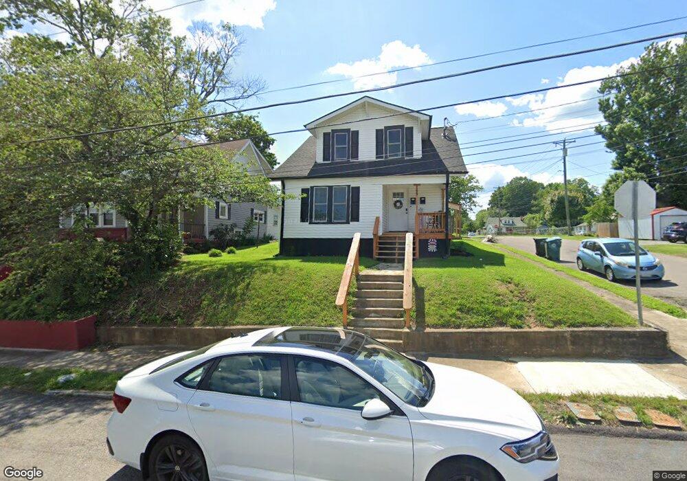
27 18th St Bristol, VA 24201
Estimated Value: $144,935 - $203,000
4
Beds
3
Baths
1,538
Sq Ft
$115/Sq Ft
Est. Value
About This Home
This home is located at 27 18th St, Bristol, VA 24201 and is currently estimated at $176,984, approximately $115 per square foot. 27 18th St is a home located in Bristol City with nearby schools including Virginia High School, Tri-Cities Christian School, and Brookside Academy.
Ownership History
Date
Name
Owned For
Owner Type
Purchase Details
Closed on
Mar 22, 2022
Sold by
Spangler Randy L and Spangler Susan E
Bought by
Shumate Properties Llc
Current Estimated Value
Purchase Details
Closed on
Nov 12, 2019
Sold by
Harlow Tony C and Harlow Evelyn V
Bought by
Harlow Tony C and Harlow Evelyn V
Purchase Details
Closed on
Feb 27, 1987
Sold by
Spangler Randy L and Spangler Susan E
Bought by
Shumate Properties Llc
Create a Home Valuation Report for This Property
The Home Valuation Report is an in-depth analysis detailing your home's value as well as a comparison with similar homes in the area
Home Values in the Area
Average Home Value in this Area
Purchase History
| Date | Buyer | Sale Price | Title Company |
|---|---|---|---|
| Shumate Properties Llc | $45,100 | First American Title | |
| Shumate Properties Llc | $45,100 | First American Title | |
| Shumate Properties Llc | $45,100 | First American Title | |
| Harlow Tony C | -- | None Available | |
| Shumate Properties Llc | $45,100 | First American Title | |
| Shumate Properties Llc | $45,100 | First American Title |
Source: Public Records
Tax History Compared to Growth
Tax History
| Year | Tax Paid | Tax Assessment Tax Assessment Total Assessment is a certain percentage of the fair market value that is determined by local assessors to be the total taxable value of land and additions on the property. | Land | Improvement |
|---|---|---|---|---|
| 2025 | $1,189 | $127,900 | $12,500 | $115,400 |
| 2024 | $804 | $71,800 | $10,000 | $61,800 |
| 2023 | $840 | $71,800 | $10,000 | $61,800 |
| 2022 | $804 | $71,800 | $10,000 | $61,800 |
| 2021 | $804 | $71,800 | $10,000 | $61,800 |
| 2020 | $631 | $53,900 | $10,000 | $43,900 |
| 2019 | $631 | $53,900 | $10,000 | $43,900 |
| 2018 | $315 | $53,900 | $10,000 | $43,900 |
| 2016 | -- | $51,300 | $0 | $0 |
| 2014 | -- | $0 | $0 | $0 |
Source: Public Records
Map
Nearby Homes
- 60 Peters St
- 2000 Euclid Ave
- 1057 Moorland Ave
- 1724 & 1728 Euclid Ave
- 1614 Broad St
- 420 Douglas St
- 2121 2123 Randolph St
- 461 Douglas St
- 728 Randolph St
- 1216 Norway St
- 1227 Shelby St
- 1224 Shelby St
- 000 Hemlock Dr
- 460 Vance St
- 401 Crockett St
- 2228 Bay St
- 2241 Bradley St
- 2412,14,16 Bradley St
- Tbd Clifton Rd
- 311 12th St