
Seller's Agent in 2025
Ray Boutin
RE/MAX
(978) 502-8352
15 in this area
224 Total Sales
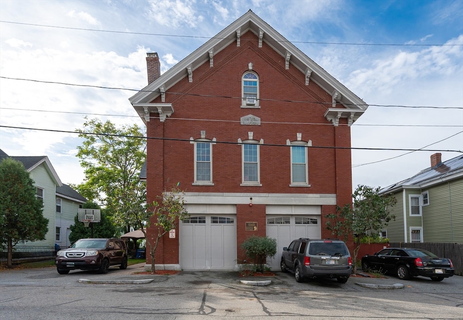
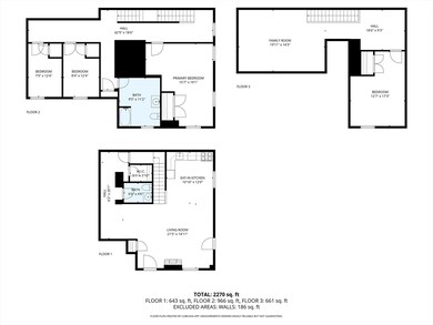
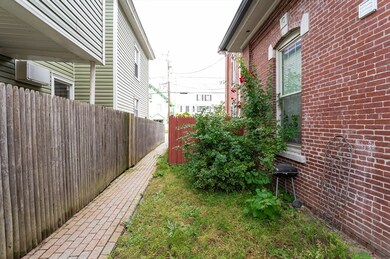
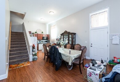
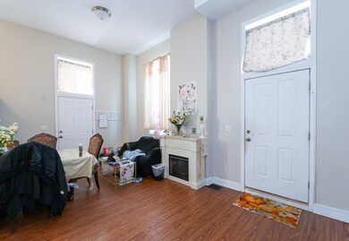
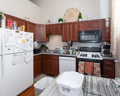
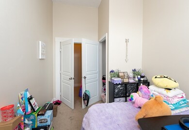
Lead Certs in-hand. Discover 27 Fourth Street, a remarkable former firehouse transformed in 2010 into 3 unique townhouses, each offering its own character & modern amenities. The building’s historic architecture, including soaring 12' ceilings, oversized arched windows, & distinctive brickwork, preserves its original firehouse charm while providing contemporary comfort. Each townhouse features central AC, private basement with laundry area, & independent utilities. The center unit includes an oversized 2 car garage, while the two end units offer private outdoor spaces. The property is also equipped with a fire sprinkler system, enhancing safety and long-term value. This solid, well-maintained structure offers strong rental potential or an opportunity for owner-occupancy with income. Conveniently located near downtown Lowell, public transportation, UMass Lowell, & major commuter routes. A rare chance to own a piece of Lowell history that’s both architecturally unique & income-producing.
| Date | Type | Sale Price | Title Company |
|---|---|---|---|
| Quit Claim Deed | $1,050,000 | -- | |
| Deed | $70,000 | -- | |
| Deed | $70,000 | -- | |
| Deed | $70,000 | -- |
| Date | Status | Loan Amount | Loan Type |
|---|---|---|---|
| Open | $840,000 | New Conventional | |
| Previous Owner | $480,000 | Purchase Money Mortgage |
| Date | Event | Price | List to Sale | Price per Sq Ft |
|---|---|---|---|---|
| 12/18/2025 12/18/25 | Sold | $1,050,000 | +5.0% | $135 / Sq Ft |
| 10/23/2025 10/23/25 | Pending | -- | -- | -- |
| 10/19/2025 10/19/25 | For Sale | $1,000,000 | -- | $129 / Sq Ft |
| Year | Tax Paid | Tax Assessment Tax Assessment Total Assessment is a certain percentage of the fair market value that is determined by local assessors to be the total taxable value of land and additions on the property. | Land | Improvement |
|---|---|---|---|---|
| 2025 | $18,230 | $1,588,000 | $226,700 | $1,361,300 |
| 2024 | $17,093 | $1,435,200 | $188,400 | $1,246,800 |
| 2023 | $16,846 | $1,356,400 | $163,800 | $1,192,600 |
| 2022 | $15,411 | $1,214,400 | $130,300 | $1,084,100 |
| 2021 | $13,280 | $986,600 | $113,300 | $873,300 |
| 2020 | $12,134 | $908,200 | $113,300 | $794,900 |
| 2019 | $11,684 | $832,200 | $97,500 | $734,700 |
| 2018 | $10,610 | $737,300 | $92,900 | $644,400 |
| 2017 | $9,961 | $667,600 | $77,900 | $589,700 |
| 2016 | $9,357 | $617,200 | $81,600 | $535,600 |
| 2015 | $8,847 | $571,500 | $84,100 | $487,400 |
| 2013 | $7,448 | $496,200 | $101,300 | $394,900 |
Seller's Agent in 2025
Ray Boutin
RE/MAX
(978) 502-8352
15 in this area
224 Total Sales
Source: MLS Property Information Network (MLS PIN)
MLS Number: 73445422
APN: LOWE-000197-002410-000027
Disclaimer: Certain information contained herein is derived from information provided by parties other than Homes.com. All information provided is deemed reliable, but is not guaranteed to be accurate and should be independently verified.
![]() The property listing data and information, or the Images, set forth herein were provided to MLS Property Information Network, Inc. from third party sources, including sellers, lessors and public records, and were compiled by MLS Property Information Network, Inc. The property listing data and information, and the Images, are for the personal, non-commercial use of consumers having a good faith interest in purchasing or leasing listed properties of the type displayed to them and may not be used for any purpose other than to identify prospective properties which such consumers may have a good faith interest in purchasing or leasing. MLS Property Information Network, Inc. and its subscribers disclaim any and all representations and warranties as to the accuracy of the property listing data and information, or as to the accuracy of any of the Images, set forth herein.
The property listing data and information, or the Images, set forth herein were provided to MLS Property Information Network, Inc. from third party sources, including sellers, lessors and public records, and were compiled by MLS Property Information Network, Inc. The property listing data and information, and the Images, are for the personal, non-commercial use of consumers having a good faith interest in purchasing or leasing listed properties of the type displayed to them and may not be used for any purpose other than to identify prospective properties which such consumers may have a good faith interest in purchasing or leasing. MLS Property Information Network, Inc. and its subscribers disclaim any and all representations and warranties as to the accuracy of the property listing data and information, or as to the accuracy of any of the Images, set forth herein.
Ask me questions while you tour the home.