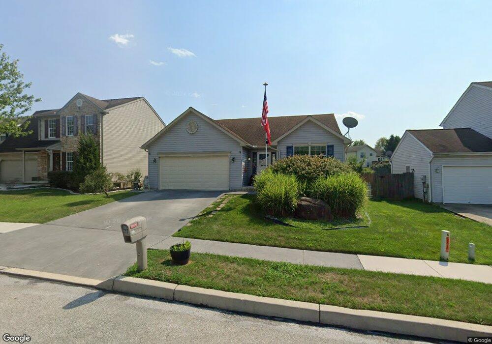
27 Appler Ct Unit 45 Littlestown, PA 17340
Estimated Value: $324,000 - $347,000
3
Beds
2
Baths
1,458
Sq Ft
$227/Sq Ft
Est. Value
About This Home
This home is located at 27 Appler Ct Unit 45, Littlestown, PA 17340 and is currently estimated at $331,526, approximately $227 per square foot. 27 Appler Ct Unit 45 is a home located in Adams County with nearby schools including Rolling Acres El School, Maple Avenue Middle School, and Littlestown Senior High School.
Ownership History
Date
Name
Owned For
Owner Type
Purchase Details
Closed on
Nov 3, 2025
Sold by
Hueglin Daniel
Bought by
Hueglin Family Trust and Hueglin
Current Estimated Value
Purchase Details
Closed on
Sep 16, 2005
Sold by
Stone Ridge Development Corp
Bought by
Hueglin Daniel and Hueglin Josephine E
Home Financials for this Owner
Home Financials are based on the most recent Mortgage that was taken out on this home.
Original Mortgage
$170,000
Interest Rate
5.92%
Mortgage Type
New Conventional
Create a Home Valuation Report for This Property
The Home Valuation Report is an in-depth analysis detailing your home's value as well as a comparison with similar homes in the area
Home Values in the Area
Average Home Value in this Area
Purchase History
| Date | Buyer | Sale Price | Title Company |
|---|---|---|---|
| Hueglin Family Trust | -- | None Listed On Document | |
| Hueglin Daniel | $249,900 | -- |
Source: Public Records
Mortgage History
| Date | Status | Borrower | Loan Amount |
|---|---|---|---|
| Previous Owner | Hueglin Daniel | $170,000 |
Source: Public Records
Tax History Compared to Growth
Tax History
| Year | Tax Paid | Tax Assessment Tax Assessment Total Assessment is a certain percentage of the fair market value that is determined by local assessors to be the total taxable value of land and additions on the property. | Land | Improvement |
|---|---|---|---|---|
| 2025 | $4,574 | $199,000 | $37,300 | $161,700 |
| 2024 | $4,408 | $199,000 | $37,300 | $161,700 |
| 2023 | $4,238 | $199,000 | $37,300 | $161,700 |
| 2022 | $4,212 | $199,000 | $37,300 | $161,700 |
| 2021 | $4,087 | $199,000 | $37,300 | $161,700 |
| 2020 | $4,038 | $199,000 | $37,300 | $161,700 |
| 2019 | $3,917 | $199,000 | $37,300 | $161,700 |
| 2018 | $3,846 | $199,000 | $37,300 | $161,700 |
| 2017 | $3,747 | $199,000 | $37,300 | $161,700 |
| 2016 | -- | $199,000 | $37,300 | $161,700 |
| 2015 | -- | $199,000 | $37,300 | $161,700 |
| 2014 | -- | $199,000 | $37,300 | $161,700 |
Source: Public Records
Map
Nearby Homes
- 140 Apple Grove Ln Unit 425
- 440 N Queen St
- 161 Stoners Cir
- 22 Rita Marie Ave
- 58 Windsor Ct
- 115 Charles St
- 117 Charles St
- 20c Locust Dr
- 0 Locust Dr Unit PAAD2015910
- 162 Newark St
- 61 E King St
- 106 E King St
- 22 Cemetery St
- 241 M St
- 1024 Frederick Pike Unit 6
- 15 Yorktowne Ct Unit 97
- 41 Smith Cir
- 535 Lumber St
- 559 Lumber St
- 567 Lumber St
- 33 Appler Ct Unit 46
- 23 Appler Ct Unit 44
- 163 Colorado Ave Unit 31
- 19 Appler Ct Unit 42
- 165 Colorado Ave Unit 32
- 161 Colorado Ave Unit 30
- 167 Colorado Ave Unit 33
- 30 Appler Ct Unit 54
- 26 Appler Ct Unit 55
- 41 Appler Ct Unit 48
- 34 Appler Ct Unit 53
- 159 Colorado Ave Unit 29
- 22 Appler Ct Unit 56
- 4 Stayman Way Unit 40
- 169 Colorado Ave Unit 34
- 38 Appler Ct Unit 52
- 12 Stayman Way Unit 39
- 18 Appler Ct Unit 57
- 155 Colorado Ave Unit 28
- 20 Stayman Way Unit 38