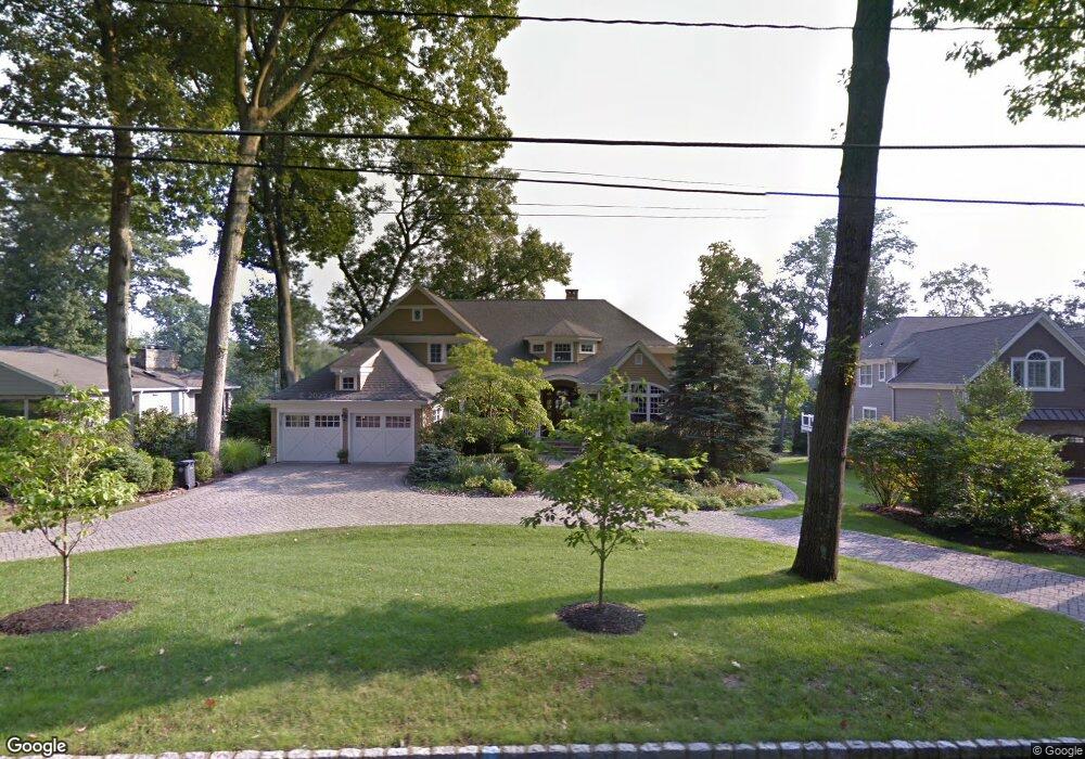
27 Armstrong Rd Morristown, NJ 07960
Estimated Value: $1,763,000 - $2,129,686
4
Beds
5
Baths
4,577
Sq Ft
$421/Sq Ft
Est. Value
About This Home
This home is located at 27 Armstrong Rd, Morristown, NJ 07960 and is currently estimated at $1,929,172, approximately $421 per square foot. 27 Armstrong Rd is a home located in Morris County with nearby schools including Hillcrest School, Thomas Jefferson School, and Alexander Hamilton School.
Ownership History
Date
Name
Owned For
Owner Type
Purchase Details
Closed on
Apr 27, 2000
Sold by
Trullinger Michael C and Trullinger Kathleen
Bought by
Mongey James P and Mongey Mary C
Current Estimated Value
Home Financials for this Owner
Home Financials are based on the most recent Mortgage that was taken out on this home.
Original Mortgage
$400,000
Outstanding Balance
$138,885
Interest Rate
8.21%
Estimated Equity
$1,790,287
Create a Home Valuation Report for This Property
The Home Valuation Report is an in-depth analysis detailing your home's value as well as a comparison with similar homes in the area
Home Values in the Area
Average Home Value in this Area
Purchase History
| Date | Buyer | Sale Price | Title Company |
|---|---|---|---|
| Mongey James P | $400,000 | First American Title Ins Co |
Source: Public Records
Mortgage History
| Date | Status | Borrower | Loan Amount |
|---|---|---|---|
| Open | Mongey James P | $400,000 |
Source: Public Records
Tax History
| Year | Tax Paid | Tax Assessment Tax Assessment Total Assessment is a certain percentage of the fair market value that is determined by local assessors to be the total taxable value of land and additions on the property. | Land | Improvement |
|---|---|---|---|---|
| 2025 | $29,405 | $1,352,700 | $430,800 | $921,900 |
| 2024 | $29,449 | $1,468,800 | $430,800 | $1,038,000 |
Source: Public Records
Map
Nearby Homes
- 69 Sherwood Dr
- 206 Mount Kemble Ave
- 282 Mount Kemble Ave
- 194 James St
- 34 Byron Ave
- 17 Three Gables Rd
- 1 Twin Oaks Ln
- 6 Mountainside Dr
- 34 Sand Hill Rd
- 37 1/2 James St
- 15 Squirrel Run
- 90 Chestnut St
- 19 Ellsworth Ave
- 60 Chestnut St Unit 2
- 58 Chestnut St Unit 1
- 7 Maple Ave Unit 6
- 86 Chestnut St
- 38 Chestnut St Unit 4
- 80 Western Ave
- 320 South St Unit 1D
- 29 Armstrong Rd
- 25 Armstrong Rd
- 53 Spring Brook Rd
- 23 Armstrong Rd
- 28 Armstrong Rd
- 26 Armstrong Rd
- 55 Spring Brook Rd
- 24 Armstrong Rd
- 51 Spring Brook Rd
- 21 Armstrong Rd
- 22 Armstrong Rd
- 43 Spring Brook Rd
- 58 Spring Brook Rd
- 19 Armstrong Rd
- 41 Spring Brook Rd
- 56 Spring Brook Rd
- 57 Spring Brook Rd
- 20 Armstrong Rd
- 39 Spring Brook Rd
- 60 Spring Brook Rd
Your Personal Tour Guide
Ask me questions while you tour the home.