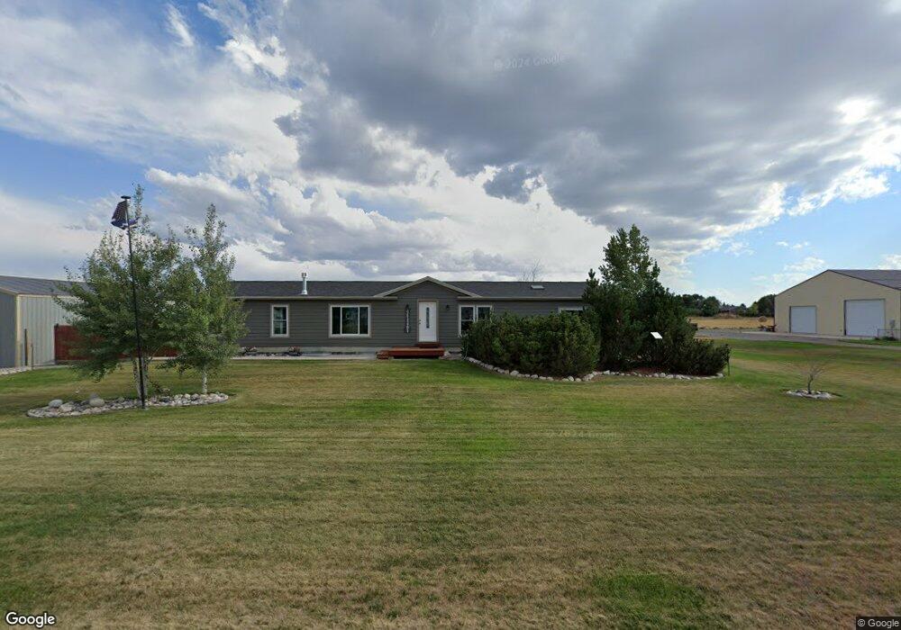
27 Beartooth Way Laurel, MT 59044
Estimated Value: $466,000 - $547,000
3
Beds
2
Baths
3,094
Sq Ft
$164/Sq Ft
Est. Value
About This Home
This home is located at 27 Beartooth Way, Laurel, MT 59044 and is currently estimated at $507,062, approximately $163 per square foot. 27 Beartooth Way is a home located in Carbon County with nearby schools including Fred W. Graff School, West School, and Laurel Middle School.
Ownership History
Date
Name
Owned For
Owner Type
Purchase Details
Closed on
Nov 20, 2020
Sold by
Robert Barta
Bought by
Wintle George David and Keel Theresa Marie
Current Estimated Value
Home Financials for this Owner
Home Financials are based on the most recent Mortgage that was taken out on this home.
Original Mortgage
$279,000
Outstanding Balance
$245,994
Interest Rate
2.8%
Mortgage Type
Construction
Estimated Equity
$261,068
Purchase Details
Closed on
Feb 21, 2020
Sold by
Christopher Neff
Bought by
Barta Robert
Purchase Details
Closed on
Sep 10, 2014
Sold by
Todd Wren and Todd Lizbeth
Bought by
Kraft Rodney J and Turner Cheyenne M
Home Financials for this Owner
Home Financials are based on the most recent Mortgage that was taken out on this home.
Original Mortgage
$181,649
Interest Rate
4.25%
Mortgage Type
FHA
Create a Home Valuation Report for This Property
The Home Valuation Report is an in-depth analysis detailing your home's value as well as a comparison with similar homes in the area
Purchase History
| Date | Buyer | Sale Price | Title Company |
|---|---|---|---|
| Wintle George David | $348,750 | First Montana Title | |
| Barta Robert | -- | First Montana Title | |
| Kraft Rodney J | $183,465 | -- |
Source: Public Records
Mortgage History
| Date | Status | Borrower | Loan Amount |
|---|---|---|---|
| Open | Wintle George David | $279,000 | |
| Previous Owner | Kraft Rodney J | $181,649 |
Source: Public Records
Tax History
| Year | Tax Paid | Tax Assessment Tax Assessment Total Assessment is a certain percentage of the fair market value that is determined by local assessors to be the total taxable value of land and additions on the property. | Land | Improvement |
|---|---|---|---|---|
| 2025 | $1,889 | $469,200 | $0 | $0 |
| 2024 | $2,179 | $339,300 | $0 | $0 |
| 2023 | $2,041 | $339,300 | $0 | $0 |
| 2022 | $1,739 | $288,800 | $0 | $0 |
| 2021 | $1,798 | $288,800 | $0 | $0 |
| 2020 | $1,530 | $244,800 | $0 | $0 |
| 2019 | $1,531 | $244,800 | $0 | $0 |
| 2018 | $1,398 | $210,600 | $0 | $0 |
| 2017 | $1,385 | $210,600 | $0 | $0 |
| 2016 | $1,240 | $187,972 | $0 | $0 |
| 2015 | $1,201 | $187,972 | $0 | $0 |
| 2014 | $987 | $83,369 | $0 | $0 |
Source: Public Records
Map
Nearby Homes
- 615 Clarks River Rd
- 4320 Moser Dome Rd
- 751 Clarks River Rd
- Lot 16 Clarks Point Dr
- 2275 Shay Rd
- 10 Cc Ln
- 9 & 10 Cc Ln
- 51 Wildflower Cir
- TBD S Park City Rd Rd
- TBD Wold Rd
- 2460 Clarks Point Dr
- 409 Maple Ave
- 208 West Ave
- 120 Forrest Ave
- 211 Woodland Ave
- 3801 Spring Creek Rd
- NSN Moser Dome Rd
- 102 8th Ave Unit B
- 2907 Clarks Point Dr
- 310 (and 814 w 4) 8th Ave
- 23 Beartooth Way
- 33 Beartooth Way
- 28 Beartooth Way
- 53 Beartooth View Dr
- 19 Beartooth Way
- 1 Victoria Ct
- 20 Beartooth Way
- 211 Beartooth Way
- 2 Rogers Place
- 6 Rogers Place
- 54 Beartooth View Dr
- 17 Beartooth Way
- 50 Beartooth View Dr
- 9 Victoria Ct
- 5007 Us Highway 310
- 14 Beartooth Way
- 48 Beartooth View Dr
- 5003 Us Highway 310
- 43 Beartooth View Dr
- 18 Riada Dr
Your Personal Tour Guide
Ask me questions while you tour the home.