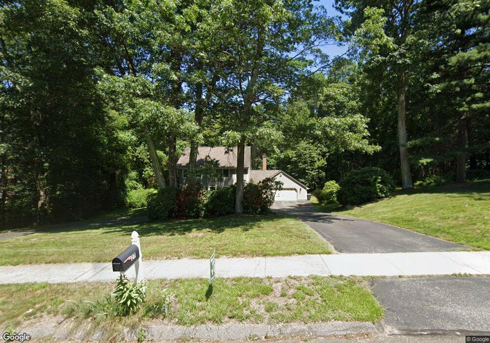
27 Briar Cliff Dr Wilbraham, MA 01095
Estimated Value: $619,096 - $791,000
4
Beds
3
Baths
2,579
Sq Ft
$268/Sq Ft
Est. Value
About This Home
This home is located at 27 Briar Cliff Dr, Wilbraham, MA 01095 and is currently estimated at $691,699, approximately $268 per square foot. 27 Briar Cliff Dr is a home located in Hampden County with nearby schools including Minnechaug Regional High School, Springfield International Charter School, and Wilbraham & Monson Academy.
Ownership History
Date
Name
Owned For
Owner Type
Purchase Details
Closed on
Dec 3, 2004
Sold by
Hakim Faiyaz and Hakim Shaheen
Bought by
Gonzalez Idaelis O
Current Estimated Value
Purchase Details
Closed on
May 27, 1994
Sold by
Kent Pecoy & Sons
Bought by
Hakim Faiyaz and Hakim Shaheen
Purchase Details
Closed on
Nov 30, 1993
Sold by
Viscito Leonard
Bought by
Keny Pecoy & Sons
Create a Home Valuation Report for This Property
The Home Valuation Report is an in-depth analysis detailing your home's value as well as a comparison with similar homes in the area
Home Values in the Area
Average Home Value in this Area
Purchase History
| Date | Buyer | Sale Price | Title Company |
|---|---|---|---|
| Gonzalez Idaelis O | $407,500 | -- | |
| Hakim Faiyaz | $292,448 | -- | |
| Keny Pecoy & Sons | $85,000 | -- |
Source: Public Records
Mortgage History
| Date | Status | Borrower | Loan Amount |
|---|---|---|---|
| Open | Keny Pecoy & Sons | $369,000 | |
| Closed | Keny Pecoy & Sons | $370,500 |
Source: Public Records
Tax History
| Year | Tax Paid | Tax Assessment Tax Assessment Total Assessment is a certain percentage of the fair market value that is determined by local assessors to be the total taxable value of land and additions on the property. | Land | Improvement |
|---|---|---|---|---|
| 2025 | $9,979 | $558,100 | $128,900 | $429,200 |
| 2024 | $9,762 | $527,700 | $128,900 | $398,800 |
| 2023 | $8,868 | $475,600 | $128,900 | $346,700 |
| 2022 | $8,868 | $432,800 | $128,900 | $303,900 |
| 2021 | $9,078 | $395,400 | $138,400 | $257,000 |
| 2020 | $8,849 | $395,400 | $138,400 | $257,000 |
| 2019 | $8,620 | $395,400 | $138,400 | $257,000 |
| 2018 | $8,605 | $380,100 | $138,400 | $241,700 |
| 2017 | $8,362 | $380,100 | $138,400 | $241,700 |
| 2016 | $8,003 | $370,500 | $142,700 | $227,800 |
| 2015 | $7,736 | $370,500 | $142,700 | $227,800 |
Source: Public Records
Map
Nearby Homes
- 6V Melikian Dr
- 15 Cedar Ridge Dr Unit 1
- 86 Sandalwood Dr Unit 15
- 103 Sandalwood Dr Unit site 00
- 48 Castlegate Dr
- 135 Pine Acre Rd
- 28 Old Lane Rd
- 70 Quentin Rd
- 32 Lodge Ln Unit 32
- 147 Parkerview St
- 763 Stony Hill Rd
- 767 Stony Hill Rd
- 2401 Wilbraham Rd
- 19 Marmon Ct
- 367 Nassau Dr Unit 367
- 373 Nassau Dr
- 86 Peekskill Ave
- 55 Parkerview St
- 24 Dumaine St
- 115 Senator St
- 25 Briar Cliff Dr
- 29 Briar Cliff Dr
- 0 Briar Cliff Dr
- 26 Briar Cliff Dr
- 24 Briar Cliff Dr
- 23 Briar Cliff Dr
- 14 Bellows Rd
- 28 Briar Cliff Dr
- 12 Bellows Rd
- 16 Bellows Rd
- 22 Briar Cliff Dr
- 7 Horseshoe Ln
- 9 Horseshoe Ln
- 5 Horseshoe Ln
- 10 Bellows Rd
- 21 Briar Cliff Dr
- 18 Bellows Rd
- 3 Horseshoe Ln
- 20 Briar Cliff Dr
- 20 Tracy Dr
Your Personal Tour Guide
Ask me questions while you tour the home.