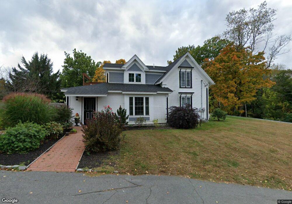
27 Broad St Groveland, MA 01834
Estimated Value: $752,000 - $1,123,000
--
Bed
2
Baths
--
Sq Ft
0.87
Acres
About This Home
This home is located at 27 Broad St, Groveland, MA 01834 and is currently estimated at $992,888. 27 Broad St is a home located in Essex County with nearby schools including Pentucket Regional High School.
Ownership History
Date
Name
Owned For
Owner Type
Purchase Details
Closed on
Oct 17, 2011
Sold by
Stepanian James S and Stepanian Christine K
Bought by
Mccomiskie John R
Current Estimated Value
Home Financials for this Owner
Home Financials are based on the most recent Mortgage that was taken out on this home.
Original Mortgage
$408,000
Outstanding Balance
$280,277
Interest Rate
4.25%
Mortgage Type
Purchase Money Mortgage
Estimated Equity
$712,611
Purchase Details
Closed on
Oct 6, 2008
Sold by
Howland Anne M and Mccomiskie Robert
Bought by
Mccomiskie John R
Home Financials for this Owner
Home Financials are based on the most recent Mortgage that was taken out on this home.
Original Mortgage
$328,050
Interest Rate
6.54%
Mortgage Type
Purchase Money Mortgage
Purchase Details
Closed on
Sep 13, 2006
Sold by
Anne T Mccomiskie T T and Anne Mccomiskie
Bought by
Mccomiskie Robert
Create a Home Valuation Report for This Property
The Home Valuation Report is an in-depth analysis detailing your home's value as well as a comparison with similar homes in the area
Home Values in the Area
Average Home Value in this Area
Purchase History
| Date | Buyer | Sale Price | Title Company |
|---|---|---|---|
| Mccomiskie John R | -- | -- | |
| Mccomiskie John R | $360,000 | -- | |
| Mccomiskie Robert | -- | -- |
Source: Public Records
Mortgage History
| Date | Status | Borrower | Loan Amount |
|---|---|---|---|
| Open | Mccomiskie Robert | $408,000 | |
| Previous Owner | Mccomiskie Robert | $328,050 | |
| Previous Owner | Mccomiskie Robert | $75,000 |
Source: Public Records
Tax History Compared to Growth
Tax History
| Year | Tax Paid | Tax Assessment Tax Assessment Total Assessment is a certain percentage of the fair market value that is determined by local assessors to be the total taxable value of land and additions on the property. | Land | Improvement |
|---|---|---|---|---|
| 2025 | $13,181 | $1,038,700 | $242,900 | $795,800 |
| 2024 | $13,084 | $966,300 | $230,300 | $736,000 |
| 2023 | $11,978 | $912,300 | $209,400 | $702,900 |
| 2022 | $11,829 | $817,500 | $184,200 | $633,300 |
| 2021 | $11,118 | $755,300 | $167,500 | $587,800 |
| 2020 | $10,318 | $734,400 | $154,900 | $579,500 |
| 2019 | $10,038 | $699,500 | $154,900 | $544,600 |
| 2018 | $9,851 | $670,600 | $146,600 | $524,000 |
| 2017 | $9,461 | $644,500 | $146,600 | $497,900 |
| 2016 | $9,083 | $601,900 | $138,200 | $463,700 |
| 2015 | $8,050 | $551,000 | $129,800 | $421,200 |
| 2014 | $7,899 | $524,500 | $129,800 | $394,700 |
Source: Public Records
Map
Nearby Homes
- 3 Marjorie St
- 7 Marjorie St
- 33 Groveland Commons Way
- 8 Wood St
- 22-26 Wood St
- 280 E Broadway
- 18-1/2 Cannon Hill Ave
- 20 Francis Ave
- 0 E Broadway Unit 73335816
- 98 King St
- 28 Coffin Ave
- 19 Orchard Ave Unit F
- 23 Orchard Ave Unit E
- 47 Gardner St
- 144 Old Ferry Rd Unit H
- 100 King St
- 31 Rivercrest Dr
- 6 Highland Ave
- 6 Katie Ln
- 4 Barberry Ln