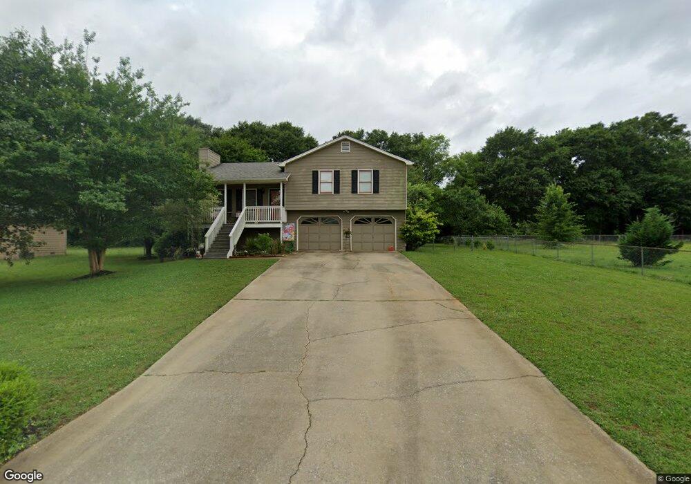
27 Campfire Trail Euharlee, GA 30145
Estimated Value: $254,477 - $286,000
3
Beds
2
Baths
1,122
Sq Ft
$240/Sq Ft
Est. Value
About This Home
This home is located at 27 Campfire Trail, Euharlee, GA 30145 and is currently estimated at $269,369, approximately $240 per square foot. 27 Campfire Trail is a home located in Bartow County with nearby schools including Euharlee Elementary School, Woodland Middle School, and Woodland High School.
Ownership History
Date
Name
Owned For
Owner Type
Purchase Details
Closed on
Aug 29, 2019
Sold by
Ledbetter Hubert
Bought by
Ledbetter Hubert and Ledbetter Keiche Lache
Current Estimated Value
Purchase Details
Closed on
Sep 16, 2011
Sold by
Sarty Ned D
Bought by
Nss Campfire Property
Purchase Details
Closed on
Jul 5, 2011
Sold by
Onewest Bank Fsb
Bought by
Federal National Mtg
Purchase Details
Closed on
May 4, 2006
Sold by
William Thomas C
Bought by
Walls Shane
Home Financials for this Owner
Home Financials are based on the most recent Mortgage that was taken out on this home.
Original Mortgage
$64,800
Interest Rate
6.39%
Mortgage Type
New Conventional
Create a Home Valuation Report for This Property
The Home Valuation Report is an in-depth analysis detailing your home's value as well as a comparison with similar homes in the area
Home Values in the Area
Average Home Value in this Area
Purchase History
| Date | Buyer | Sale Price | Title Company |
|---|---|---|---|
| Ledbetter Hubert | -- | -- | |
| Ledbetter Hubert | $144,000 | -- | |
| Nss Campfire Property | -- | -- | |
| Sarty Ned D | $55,700 | -- | |
| Nss Campfire Property Llc | -- | -- | |
| Sarty Ned D | $55,700 | -- | |
| Federal National Mtg | $66,426 | -- | |
| Onewest Bank Fsb | $66,426 | -- | |
| Walls Shane | $81,000 | -- |
Source: Public Records
Mortgage History
| Date | Status | Borrower | Loan Amount |
|---|---|---|---|
| Previous Owner | Walls Shane | $64,800 |
Source: Public Records
Tax History
| Year | Tax Paid | Tax Assessment Tax Assessment Total Assessment is a certain percentage of the fair market value that is determined by local assessors to be the total taxable value of land and additions on the property. | Land | Improvement |
|---|---|---|---|---|
| 2025 | $2,198 | $84,374 | $18,000 | $66,374 |
| 2024 | $2,198 | $84,374 | $18,000 | $66,374 |
| 2023 | $2,224 | $73,475 | $18,000 | $55,475 |
| 2022 | $2,088 | $73,475 | $18,000 | $55,475 |
| 2021 | $1,637 | $58,986 | $18,000 | $40,986 |
| 2020 | $1,612 | $53,260 | $16,000 | $37,260 |
| 2019 | $1,454 | $47,098 | $16,000 | $31,098 |
| 2018 | $1,379 | $44,280 | $7,200 | $37,080 |
| 2017 | $1,297 | $44,280 | $7,200 | $37,080 |
| 2016 | $1,306 | $44,280 | $7,200 | $37,080 |
| 2015 | $1,037 | $35,080 | $7,200 | $27,880 |
| 2014 | $1,045 | $34,280 | $7,200 | $27,080 |
| 2013 | -- | $28,560 | $7,200 | $21,360 |
Source: Public Records
Map
Nearby Homes
- 17 Lowry Way
- 19 Lowry Way
- 10 Dove Pointe
- 11 Dove Pointe
- 42 River Oaks Dr SW
- 0 Euharlee Rd SW Unit 10518934
- 47 Cliffhanger Pointe SW
- 92 River Walk Pkwy
- 14 Cathedral Heights
- 209 Groveton Ct
- 53 Milam Cir SW
- 1006 Blossom Ln
- 8 Ripplewood Trail
- 1001 Rainier Dr
- 12 Creek Bend Ct SW
- 118 Cherry Glen Way
- 110 Cherry Glen Way
- 132 Cherry Glen Way
- 138 Cherry Glen Way
- 68 Lazy Water Dr SW
- 25 Campfire Trail
- 34 Winchester Dr
- 32 Winchester Dr
- 23 Campfire Trail
- 30 Winchester Dr
- 26 Winchester Dr
- 24 Winchester Dr
- 24 Campfire Trail
- 20 Campfire Trail
- 22 Campfire Trail
- 21 Campfire Trail
- 18 Campfire Trail
- 28 Winchester Dr
- 28 Winchester Dr
- 22 Winchester Dr
- 16 Campfire Trail
- 43 Winchester Dr
- 45 Winchester Dr
- 19 Campfire Trail
- 20 Winchester Dr
Your Personal Tour Guide
Ask me questions while you tour the home.