
Seller's Agent in 2025
Caroline Barrie
Coldwell Banker Realty - Wellesley
(203) 300-2793
1 in this area
5 Total Sales
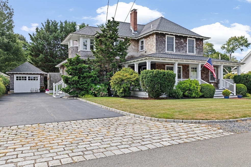
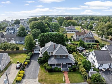
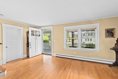
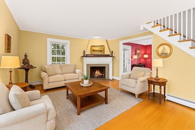
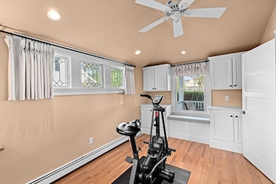
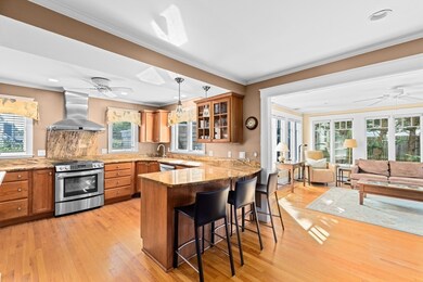
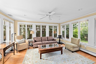
Premier location! Don't miss this impeccably maintained Minot shingle colonial home, perfectly situated between one of Scituate's most beloved beaches & the prestigious Hatherly Country Club. Step through the inviting wraparound farmer's porch, ideal for both entertaining and relaxation, enter into the formal living room. Here, you'll find gleaming hardwood floors, a cozy fireplace & bonus office space that adds functionality & charm. The spacious kitchen is fully equipped with modern stainless steel appliances. It seamlessly connects to the adjacent dining area and flows effortlessly into the spectacular, light-filled family room, creating an open & inviting atmosphere perfect for gatherings & everyday living. Upstairs the large primary suite has excellent closet space & ensuite bathroom. Three additional bedrooms, a full bathroom plus laundry room completes the second floor. Lush manicured gardens plus outdoor shower. This home seamlessly blends comfort & elegance. Welcome home!
Last Agent to Sell the Property
Coldwell Banker Realty - Wellesley Listed on: 09/18/2025
| Date | Type | Sale Price | Title Company |
|---|---|---|---|
| Quit Claim Deed | $1,649,000 | -- | |
| Deed | $690,000 | -- |
| Date | Status | Loan Amount | Loan Type |
|---|---|---|---|
| Open | $700,000 | New Conventional | |
| Previous Owner | $175,000 | No Value Available | |
| Previous Owner | $307,000 | No Value Available | |
| Previous Owner | $690,000 | Purchase Money Mortgage |
| Date | Event | Price | List to Sale | Price per Sq Ft |
|---|---|---|---|---|
| 12/02/2025 12/02/25 | Sold | $1,649,000 | 0.0% | $697 / Sq Ft |
| 09/22/2025 09/22/25 | Pending | -- | -- | -- |
| 09/18/2025 09/18/25 | For Sale | $1,649,000 | -- | $697 / Sq Ft |
| Year | Tax Paid | Tax Assessment Tax Assessment Total Assessment is a certain percentage of the fair market value that is determined by local assessors to be the total taxable value of land and additions on the property. | Land | Improvement |
|---|---|---|---|---|
| 2025 | $13,716 | $1,373,000 | $885,300 | $487,700 |
| 2024 | $14,292 | $1,379,500 | $894,300 | $485,200 |
| 2023 | $12,508 | $1,251,500 | $813,000 | $438,500 |
| 2022 | $12,508 | $991,100 | $622,500 | $368,600 |
| 2021 | $12,152 | $911,600 | $592,900 | $318,700 |
| 2020 | $11,799 | $874,000 | $570,000 | $304,000 |
| 2019 | $11,680 | $850,100 | $558,800 | $291,300 |
| 2018 | $11,414 | $818,200 | $555,700 | $262,500 |
| 2017 | $11,528 | $818,200 | $555,700 | $262,500 |
| 2016 | $11,424 | $807,900 | $555,700 | $252,200 |
| 2015 | $9,775 | $746,200 | $494,000 | $252,200 |
Seller's Agent in 2025
Caroline Barrie
Coldwell Banker Realty - Wellesley
(203) 300-2793
1 in this area
5 Total Sales
Buyer's Agent in 2025
Esther Blacker
William Raveis R.E. & Home Services
(781) 856-6287
31 in this area
41 Total Sales
Source: MLS Property Information Network (MLS PIN)
MLS Number: 73432619
APN: SCIT-000008-000006-000009A
Disclaimer: Certain information contained herein is derived from information provided by parties other than Homes.com. All information provided is deemed reliable, but is not guaranteed to be accurate and should be independently verified.
![]() The property listing data and information, or the Images, set forth herein were provided to MLS Property Information Network, Inc. from third party sources, including sellers, lessors and public records, and were compiled by MLS Property Information Network, Inc. The property listing data and information, and the Images, are for the personal, non-commercial use of consumers having a good faith interest in purchasing or leasing listed properties of the type displayed to them and may not be used for any purpose other than to identify prospective properties which such consumers may have a good faith interest in purchasing or leasing. MLS Property Information Network, Inc. and its subscribers disclaim any and all representations and warranties as to the accuracy of the property listing data and information, or as to the accuracy of any of the Images, set forth herein.
The property listing data and information, or the Images, set forth herein were provided to MLS Property Information Network, Inc. from third party sources, including sellers, lessors and public records, and were compiled by MLS Property Information Network, Inc. The property listing data and information, and the Images, are for the personal, non-commercial use of consumers having a good faith interest in purchasing or leasing listed properties of the type displayed to them and may not be used for any purpose other than to identify prospective properties which such consumers may have a good faith interest in purchasing or leasing. MLS Property Information Network, Inc. and its subscribers disclaim any and all representations and warranties as to the accuracy of the property listing data and information, or as to the accuracy of any of the Images, set forth herein.
Ask me questions while you tour the home.