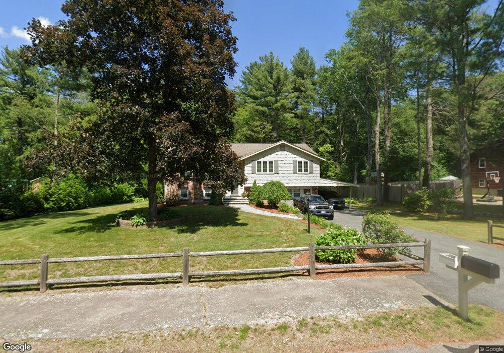
27 Clarkson Dr Walpole, MA 02081
Estimated Value: $722,000 - $818,000
3
Beds
2
Baths
1,522
Sq Ft
$505/Sq Ft
Est. Value
About This Home
This home is located at 27 Clarkson Dr, Walpole, MA 02081 and is currently estimated at $768,229, approximately $504 per square foot. 27 Clarkson Dr is a home located in Norfolk County with nearby schools including Elm Street School, Eleanor N. Johnson Middle School, and Walpole High School.
Ownership History
Date
Name
Owned For
Owner Type
Purchase Details
Closed on
Jul 23, 1993
Sold by
Eosco Joseph A and Eosco Tina M
Bought by
Lassell Stephen R and Lassell Cynthia
Current Estimated Value
Home Financials for this Owner
Home Financials are based on the most recent Mortgage that was taken out on this home.
Original Mortgage
$116,000
Interest Rate
7.43%
Mortgage Type
Purchase Money Mortgage
Purchase Details
Closed on
Jul 13, 1987
Sold by
Suchy Nicholas
Bought by
Eosco Joseph A
Create a Home Valuation Report for This Property
The Home Valuation Report is an in-depth analysis detailing your home's value as well as a comparison with similar homes in the area
Home Values in the Area
Average Home Value in this Area
Purchase History
| Date | Buyer | Sale Price | Title Company |
|---|---|---|---|
| Lassell Stephen R | $175,000 | -- | |
| Eosco Joseph A | $190,000 | -- |
Source: Public Records
Mortgage History
| Date | Status | Borrower | Loan Amount |
|---|---|---|---|
| Open | Eosco Joseph A | $100,000 | |
| Closed | Eosco Joseph A | $25,000 | |
| Closed | Eosco Joseph A | $120,000 | |
| Closed | Eosco Joseph A | $116,000 |
Source: Public Records
Tax History Compared to Growth
Tax History
| Year | Tax Paid | Tax Assessment Tax Assessment Total Assessment is a certain percentage of the fair market value that is determined by local assessors to be the total taxable value of land and additions on the property. | Land | Improvement |
|---|---|---|---|---|
| 2025 | $8,659 | $674,900 | $339,700 | $335,200 |
| 2024 | $8,456 | $639,600 | $326,500 | $313,100 |
| 2023 | $7,946 | $572,100 | $284,000 | $288,100 |
| 2022 | $7,498 | $518,500 | $263,000 | $255,500 |
| 2021 | $7,114 | $479,400 | $248,100 | $231,300 |
| 2020 | $6,937 | $462,800 | $234,000 | $228,800 |
| 2019 | $6,710 | $444,400 | $225,100 | $219,300 |
| 2018 | $6,517 | $426,800 | $217,200 | $209,600 |
| 2017 | $6,301 | $411,000 | $208,900 | $202,100 |
| 2016 | $6,131 | $394,000 | $201,000 | $193,000 |
| 2015 | $5,715 | $364,000 | $183,200 | $180,800 |
| 2014 | $5,431 | $344,600 | $183,200 | $161,400 |
Source: Public Records
Map
Nearby Homes
- 1648 Main St
- 43 Chandler Ave
- 13 Sandtrap Cir Unit 14
- 11 Sandtrap Cir Unit 15
- 20 Sandtrap Cir Unit 4
- 18 Sandtrap Cir Unit 3
- 17 Sandtrap Cir Unit 12
- 15 Sandtrap Cir Unit 13
- 10 Sandtrap Cir Unit 2
- 31 Sandtrap Cir Unit 5
- 14 Tiger Terrace Unit 29
- 1391 Main St Unit 304
- 1391 Main St Unit 208
- 1391 Main St Unit 305
- 1391 Main St Unit 308
- 16 Magpie Cir Unit 16
- 137 Clear Pond Dr
- 127 Clear Pond Dr
- 18 Teal Cir
- 66 Oak St
- 29 Clarkson Dr
- 25 Clarkson Dr
- 28 Clarkson Dr
- 31 Clarkson Dr
- 30 Clarkson Dr
- 26 Clarkson Dr
- 23 Clarkson Dr
- 32 Clarkson Dr
- 24 Clarkson Dr
- 21 Clarkson Dr
- 51 Hitching Post Dr
- 47 Hitching Post Dr
- 55 Hitching Post Dr
- 33 Clarkson Dr
- 22 Clarkson Dr
- 3 Bucket Mill Ln
- 43 Hitching Post Dr
- 34 Clarkson Dr
- 19 Clarkson Dr
- 39 Hitching Post Dr