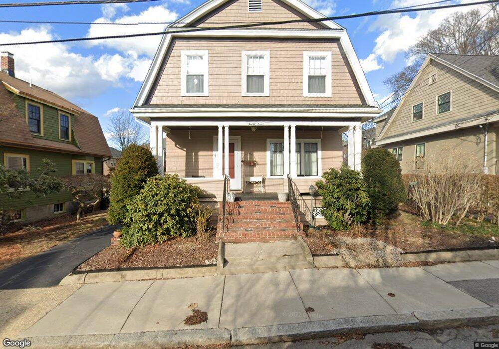
27 Curtis Ave Somerville, MA 02144
West Somerville NeighborhoodEstimated Value: $1,084,000 - $1,447,000
4
Beds
2
Baths
1,434
Sq Ft
$909/Sq Ft
Est. Value
About This Home
This home is located at 27 Curtis Ave, Somerville, MA 02144 and is currently estimated at $1,303,361, approximately $908 per square foot. 27 Curtis Ave is a home located in Middlesex County with nearby schools including Somerville High School, St. Clement Elementary School, and International School of Boston.
Ownership History
Date
Name
Owned For
Owner Type
Purchase Details
Closed on
Apr 27, 2009
Sold by
Pumpkin Patch T and Lenoir Lynne Ann
Bought by
Lenoir Lynne Ann and Dimarzo Dorothy Ann
Current Estimated Value
Home Financials for this Owner
Home Financials are based on the most recent Mortgage that was taken out on this home.
Original Mortgage
$270,000
Outstanding Balance
$171,326
Interest Rate
4.93%
Mortgage Type
Purchase Money Mortgage
Estimated Equity
$1,132,035
Purchase Details
Closed on
Mar 31, 1995
Sold by
Covino James J and Covino Ruth A
Bought by
Dimarzo Dorothy A and Lenoir Lynne A
Home Financials for this Owner
Home Financials are based on the most recent Mortgage that was taken out on this home.
Original Mortgage
$173,850
Interest Rate
8.8%
Mortgage Type
Purchase Money Mortgage
Create a Home Valuation Report for This Property
The Home Valuation Report is an in-depth analysis detailing your home's value as well as a comparison with similar homes in the area
Home Values in the Area
Average Home Value in this Area
Purchase History
| Date | Buyer | Sale Price | Title Company |
|---|---|---|---|
| Lenoir Lynne Ann | -- | -- | |
| Dimarzo Dorothy A | $183,000 | -- |
Source: Public Records
Mortgage History
| Date | Status | Borrower | Loan Amount |
|---|---|---|---|
| Open | Lenoir Lynne Ann | $270,000 | |
| Previous Owner | Dimarzo Dorothy A | $176,000 | |
| Previous Owner | Dimarzo Dorothy A | $173,850 |
Source: Public Records
Tax History
| Year | Tax Paid | Tax Assessment Tax Assessment Total Assessment is a certain percentage of the fair market value that is determined by local assessors to be the total taxable value of land and additions on the property. | Land | Improvement |
|---|---|---|---|---|
| 2025 | $12,063 | $1,105,700 | $604,300 | $501,400 |
| 2024 | $11,538 | $1,096,800 | $604,300 | $492,500 |
| 2023 | $11,208 | $1,083,900 | $604,300 | $479,600 |
| 2022 | $10,504 | $1,031,800 | $575,600 | $456,200 |
| 2021 | $10,138 | $994,900 | $571,400 | $423,500 |
| 2020 | $9,743 | $965,600 | $571,800 | $393,800 |
| 2019 | $9,586 | $890,900 | $520,500 | $370,400 |
| 2018 | $8,660 | $765,700 | $473,200 | $292,500 |
| 2017 | $8,428 | $722,200 | $446,400 | $275,800 |
| 2016 | $7,940 | $633,700 | $398,600 | $235,100 |
Source: Public Records
Map
Nearby Homes
- 123 W Adams St Unit 1
- 12 Upland Rd
- 25 Upland Rd
- 83 Conwell Ave Unit 1
- 183 Powder House Blvd
- 202 Powder House Blvd Unit 1
- 202 Powder House Blvd Unit 2
- 138 North St
- 233 Powder House Blvd
- 150 North St Unit 150
- 6 Hamilton Rd Unit 6
- 34 Belknap St
- 59A High St Unit A
- 325A Alewife Brook Pkwy Unit A
- 327 Alewife Brook Pkwy Unit A
- 327 Alewife Brook Pkwy Unit B
- 28 Quincy St
- 106 Electric Ave Unit 3
- 69 Sterling St
- 55 Packard Ave Unit 1
- 23 Curtis Ave
- 23 Curtis Ave Unit 1
- 31 Curtis Ave
- 30 Chetwynd Rd
- 32 Chetwynd Rd Unit 30-1
- 30 Chetwynd Rd
- 32 Chetwynd Rd Unit 1
- 30 Chetwynd Rd Unit 1
- 30 Chetwynd Rd Unit SF
- 32 Chetwynd Rd Unit 2
- 32 Chetwynd Rd
- 28 Chetwynd Rd Unit 24-2a
- 28 Chetwynd Rd Unit 24-1
- 28 Chetwynd Rd Unit 28
- 28 Chetwynd Rd
- 28 Chetwynd Rd Unit 2
- 26 Chetwynd Rd Unit 2
- 26 Chetwynd Rd Unit 1
- 26 Chetwynd Rd
- 35 Curtis Ave
Your Personal Tour Guide
Ask me questions while you tour the home.