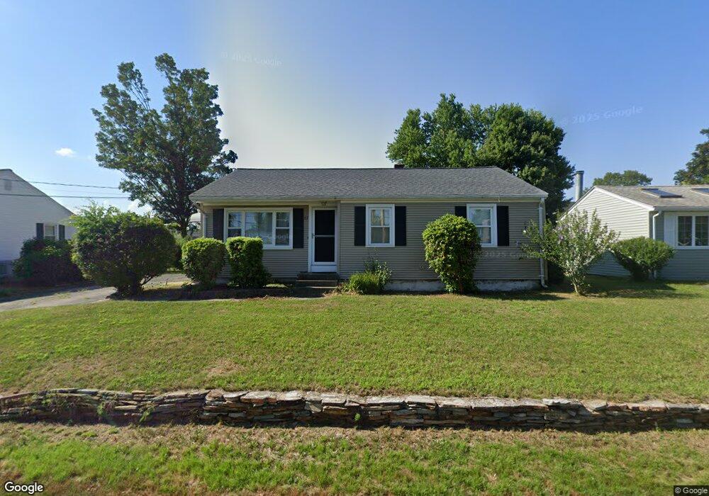
27 Dawson Ave Warwick, RI 02888
Palace Garden NeighborhoodEstimated Value: $386,636 - $454,000
3
Beds
1
Bath
1,100
Sq Ft
$379/Sq Ft
Est. Value
About This Home
This home is located at 27 Dawson Ave, Warwick, RI 02888 and is currently estimated at $417,409, approximately $379 per square foot. 27 Dawson Ave is a home located in Kent County with nearby schools including St. Peter School and Saint Paul School.
Create a Home Valuation Report for This Property
The Home Valuation Report is an in-depth analysis detailing your home's value as well as a comparison with similar homes in the area
Home Values in the Area
Average Home Value in this Area
Tax History
| Year | Tax Paid | Tax Assessment Tax Assessment Total Assessment is a certain percentage of the fair market value that is determined by local assessors to be the total taxable value of land and additions on the property. | Land | Improvement |
|---|---|---|---|---|
| 2025 | $4,437 | $349,400 | $114,700 | $234,700 |
| 2024 | $4,287 | $296,300 | $99,700 | $196,600 |
| 2023 | $4,204 | $296,300 | $99,700 | $196,600 |
| 2022 | $3,965 | $211,700 | $64,500 | $147,200 |
| 2021 | $3,965 | $211,700 | $64,500 | $147,200 |
| 2020 | $3,965 | $211,700 | $64,500 | $147,200 |
| 2019 | $3,965 | $211,700 | $64,500 | $147,200 |
| 2018 | $3,230 | $155,300 | $64,500 | $90,800 |
| 2017 | $3,143 | $155,300 | $64,500 | $90,800 |
| 2016 | $3,143 | $155,300 | $64,500 | $90,800 |
| 2015 | $2,807 | $135,300 | $57,200 | $78,100 |
| 2014 | $2,714 | $135,300 | $57,200 | $78,100 |
| 2013 | $2,678 | $135,300 | $57,200 | $78,100 |
Source: Public Records
Map
Nearby Homes
- 1020 Warwick Ave
- 63 Benbridge Ave
- 52 Dahlia St
- 56 Errol St
- 15 Christopher Rhodes Way
- 6 Christopher Rhodes Way
- 20 Commodore Ave
- 408 Fair St
- 34 N Country Club Dr
- 23 Wildrose Ct
- 39 Holiday Ave
- 821 Post Rd
- 72 W Shore Rd Unit 104
- 72 W Shore Rd Unit 3
- 25 Newfield Ave
- 1052 Post Rd
- 15 Shadbush Rd
- 200 Post Rd Unit 419
- 15 Palm Blvd N
- 80 George St
Your Personal Tour Guide
Ask me questions while you tour the home.